

Member Trip report
Au Revoir 2018
12/30/2018
Trip Report/Photos from Robert.L
I had mapped out a series of hikes through the New Year and while I intended to post Mt. Greylock as a trip, I was unsure if my schedule and energy level would permit another adventure. I was, after all, fresh the Zealand Hut trek. Turns out it did! David, David and Long were all interested so I invited them over Saturday evening and made the hike a Sunday adventure. At 3,491’ Mt. Greylock is a nice moderate to strenuous option closer to my home than the White Mountains. For those coming from greater Boston – it’s a bit more of a Journey. I thought it would make their trek easier by crashing closer to the hike and we could also car pool from my home.
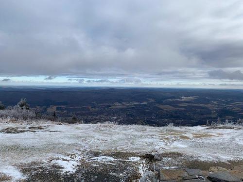
Did I say adventure? Yep – I did. The weather forecast promised bright blue skies but we only got a bit of sun with the day being mostly overcast. The cloud ceiling was high so we scored some views – but the day did not start out quite as planned.
Cruising down the highway approaching the exit for the Berkshires a snow squall ensued. It was nothing of concern on the highway – the snow wasn’t accumulating – but after taking the exit it was obvious the secondary roadways were slick and the maintenance departments for the various towns had not salted or sanded. It seems – this little weather blip caught many by surprise. It was going to be a modestly late arrival at the trail head – getting slicker as we got closer!!
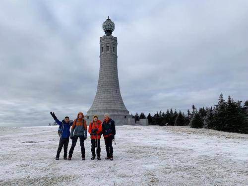
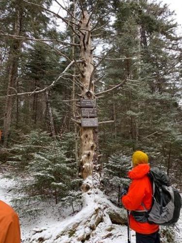
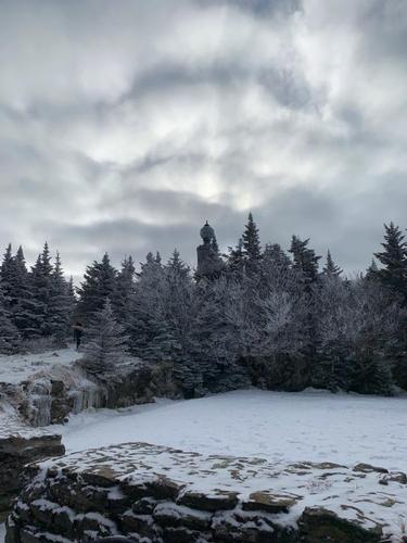
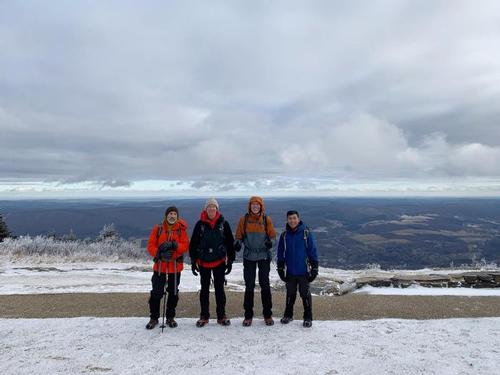
To make this trip more “strenuous” I mapped out the long way up Greylock. We departed from the trail head for the Hopper Trail but detoured west to get on the Money Brook Trail. From there we traversed through some tricky water crossings up to the Money Brook Falls. After viewing the falls we carried on to the Wilbur Clearing Shelter but not without making our way under, over & around some significant blow downs – massive pine trees shattered at their base – some quite fresh. From there we went up to Mt. Williams then onto Mt. Greylock. We didn’t take many pictures but you’ll see the highlights at the summit. We only encountered people nearing the summit of Greylock. The entire loop pre and post summit did not involve coming across other folks. There are more direct and easier ways up the summit – remember this is “moderate to strenuous”, lol.
We carried on southbound on the AT through the most awful ice flow ever! Up to that point we had hiked dry earth, muddy earth, bits of patch ice and switched to micro spikes when we hit 3,000’ and regular swaths of packed granular snow. Thankfully the ice flows were short lived – treacherous they were and our micro spikes, though helpful, were not nearly as secure as I would have liked. The Southbound trail contains many junctions and if you make the wrong turn, you’ll end up far away from the parking. Greylock has a myriad of trails with mixed signage so I often paused to confirm our location on the map before heading down another trail. We finally arrived at the Sperry Road campground to connect with the last leg of the Hopper Trail which would deliver us back to the parking lot. Long’s phone app indicated we did 12.8 miles while map mileage has us at 10.5 – I guess we walked a lot on the summit, lol. I supposed when you factor the falls detour – the shelter detour – the summit exploration – it all adds up.
We hit the trail roughly at 9:40am and were back at the car by 3:30pm – we were a robust and highly energized hiker group – LOVED IT! Thank you gentlemen for a brilliant end of year hike – I enjoyed it 1000 percent more with your energy, passion and desire to be one with the trail and I hope you did too. I look forward to many more winter adventures. Happy New Year gents and happy trails ---Rob.
There are 6 photos in Album (Note: Move mouse pointer over larger pic and click on NEXT for better viewing)


Enjoyed reading your report - good reminder on some of the challenges winter hiking can present in terms of snow and ice. Have not climbed Mt. Greylock, but your report had made me put it on my bucket list!
Great to see GO members celebrating the New Year in style! HAPPY NEW YEAR!!!
