

Trip report
Wakely Mountain Hike
Hiking/Walk DATE: 09/09/2012 - 09/09/2012
Trip/Event Location: Inlet/Indian Lake, NY
US
Trip Leader(s): shep5
Max # People: 10
Trip Guiding / Event Fee: No, I will not be asking participants for money
Difficulty Level: Moderate
Join me for this 6.4 mile hike into one of the more remote sections of the central Adirondack Mountains. Two-thirds of the hike to Wakely Mountain are on an old road trail, which is relatively flat;
...From the village of Indian Lake, proceed two miles west on Rt. 28. Turn left on the Cedar River Road. Proceed another twelve miles. The road will change from paved to dirt after eight miles. Just 0.3 miles before the Cedar River Flow, you will see a trail sign. Turn right into the parking area for the trailhead. Look for a grey Hyundai Elantra.
Trip Report/Photos
On September 9th, I arrived at the trailhead near the end of Cedar River Road by about 6:30AM. No one had signed up for this event so I decided to start early and doublehead this trip with the one up Gore Mountain (which had been scheduled for the day before, but due to lack of interest and the potential for serious late afternoon storms, I delayed this one for Sunday as well). On the way to the trailhead in the morning I saw two downed trees...one on top of a car in Warrensburg and one in the road in Indian Lake. I wasn't sure I would be able to get down Cedar River Road, but as it turned out there had been some minor tree damage, but someone had already gone down the road and cleared it...going all the way to Inlet from what I understand...the Moose River Plains area is a popular camping area.
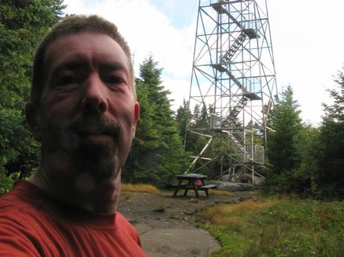
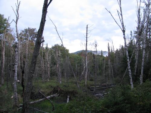
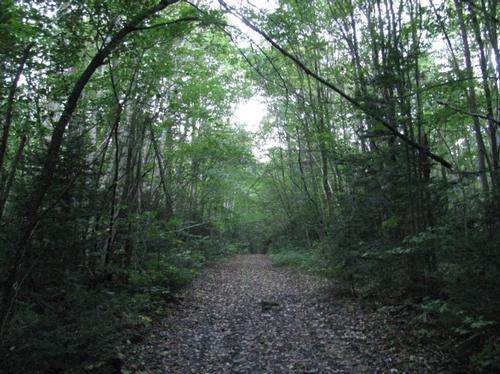
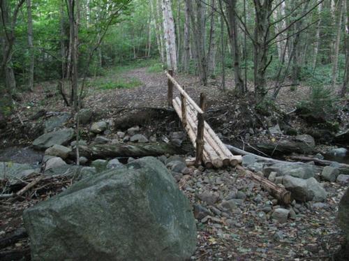
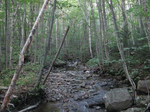
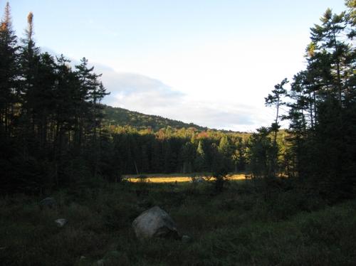
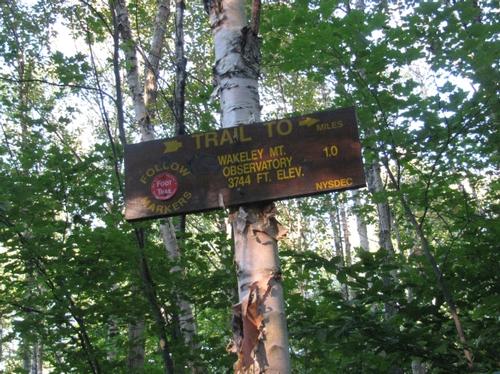
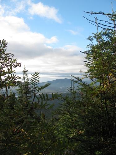
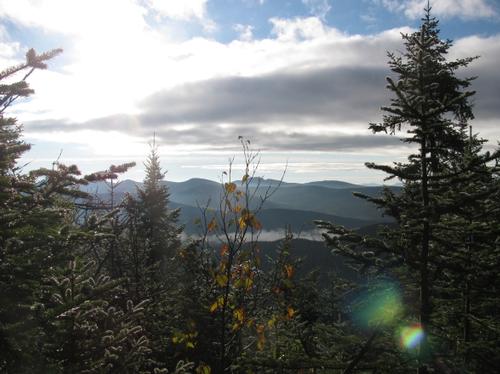
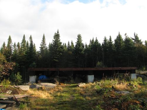
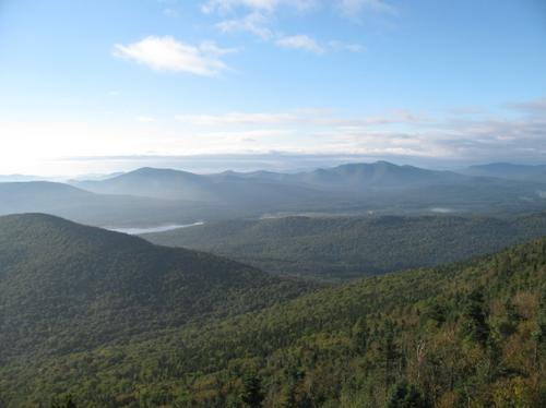
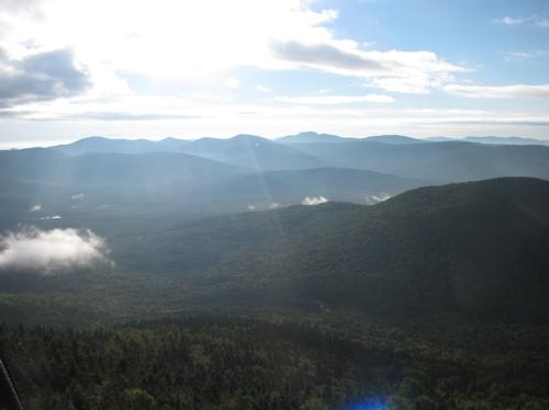
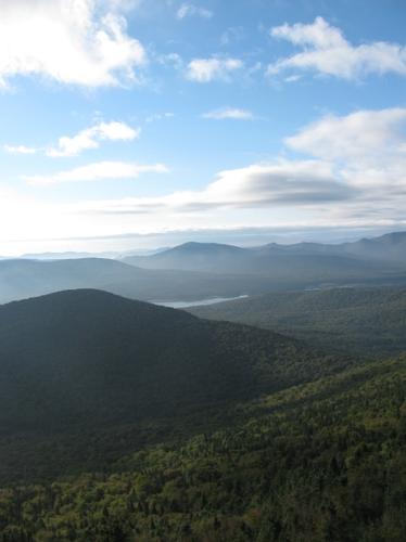
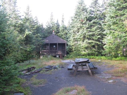
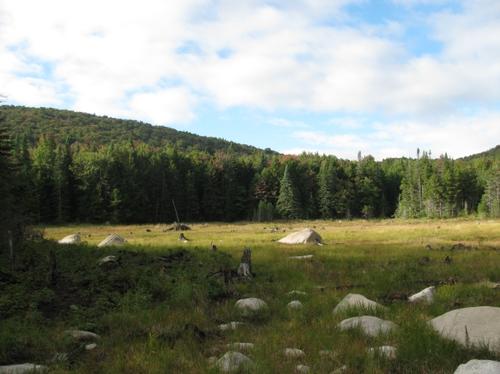
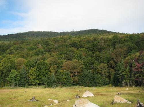
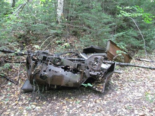
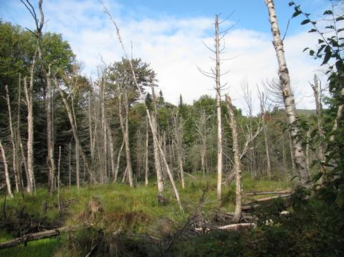
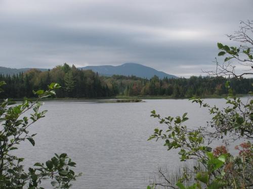
I quickly got ready and headed out. The first two miles up to a beaver pond area was along an old tote/jeep trail. It was mostly wide, but washed out in several areas. It was also an easy grade for this initial portion of the hike and it followed Wakely Brook a good part of the way. Along the way there was what appeared to be parts of an old truck in the woods. I made it to the end of the jeep trail at about 7:15AM and I went out slightly into the clearing where a beaver pond was. It was mostly dry, but didn't check it out much more until my return. The early morning fog was finally lifting and it was partly cloudy with sun showing through at times. From this point it was only another mile to the summit. The trail immediately became persistently aggressive as it climbed the mountain. Still for a mountain of 3766 feet of elevation the hike up was fairly quick with some views through the trees near the top (mostly to the south). Just prior to reachin the summit there was a large clearing with a newly constructed platform. I'm wasn't sure of its purpose, but it appeared large enough as a helipad. There was alot of junk and construction materials near by, so it appeared to be a staging area for materials for the fire tower restoration.
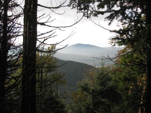
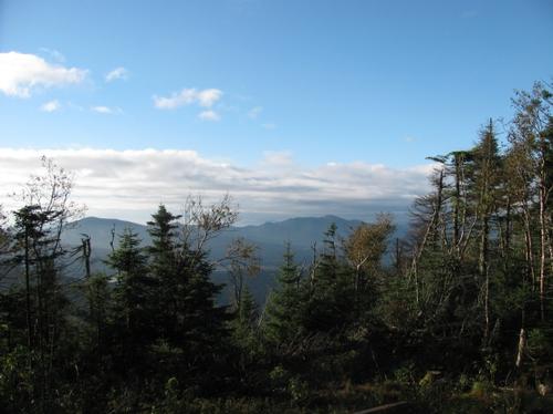
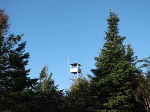
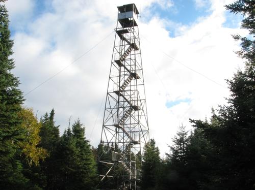
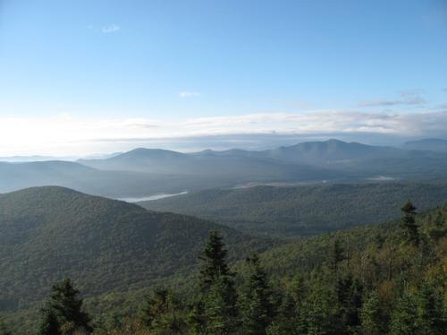
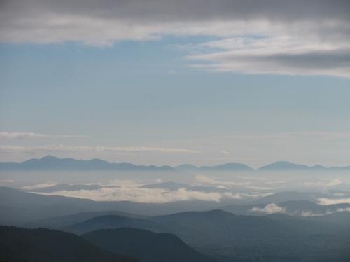
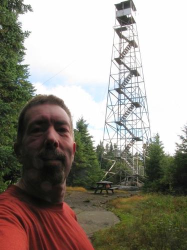
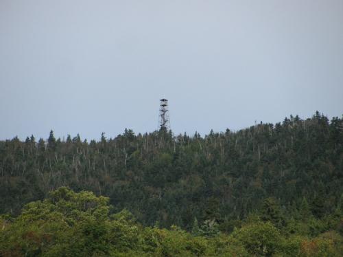
A short distance later, I emerged into another clearing where the fire tower and fire warden's cabin was located (8AM). The 82-foot tower was impressive. I climbed up to just below the cab for some incredible views...in all directions (the wire messing around the stairs stopped just below the cab). The High Peaks were evident, but the valleys were still covered in clouds. It was pretty windy and brisk and at times it was hard to stand still. Still the views were well worth it.
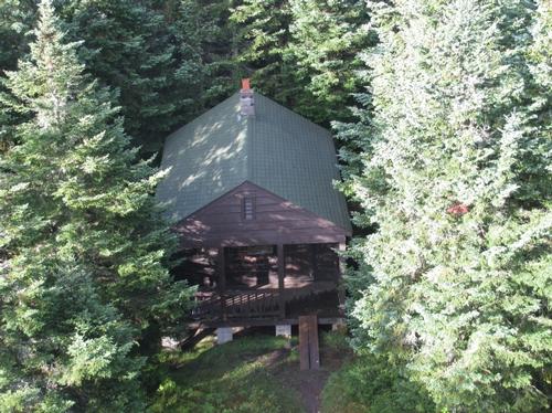
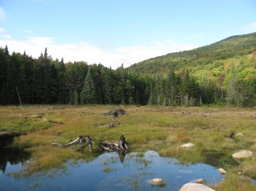
I checked out the boarded-up cabin and after a rest up at the top, I started heading back. The trip down was quick and I once again reached the clearing at the base where I had noticed the beaver pond. I headed out and to my surprise there was an incredible view back to Wakely with a clear view of the fire tower. After some time here exploring, I headed back to the main trail and started back along the jeep trail. I made it back to the parking lot by 9:30AM.
I drove the additional mile down to the Cedar River Flow to check it out. It was a beautiful area, but it was grey and overcast looking down the flow from the dam. It's an area I would definitely like to explore more next year. I started back up the road and at 10AM just made sure noone else had showed up for the hike at the last minute. I then made my way back up to Indian Lake and headed to North Creek for the hike up Gore Mountain.
There are 29 photos in Album (Note: Move mouse pointer over larger pic and click on NEXT for better viewing)

|
|
||

