

Trip report
Algonquin/Wright/Iroquois Peaks Hike
Hiking/Walk DATE: 06/19/2010 - 06/19/2010
Trip/Event Location: North Elba, NY
US
Trip Leader(s): shep5
Max # People: 10
Trip Guiding / Event Fee: No, I will not be asking participants for money
Difficulty Level: Strenuous
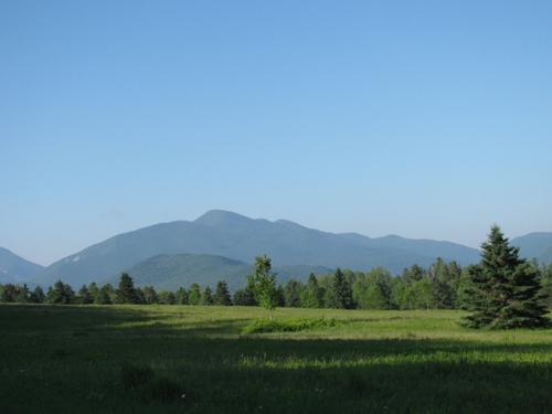
Join me for this 13.5 mile loop hike up to the summits of Algonquin (5115'), Wright (4587') and Iroquois Peaks (4843') in the High Peaks of the Adirondacks. These peaks make up a portion of the
...The trailhead (Adirondack Loj) is approximately 32 miles from Exit 30 of the Northway. Follow US-9 N for 2.2 miles and take a slight left at NY-73 W, continuing for another 24.2 miles. Turn left onto Adirondack Loj Road (may also be designated as Adirondack Lodge Road or County Road 34) and continue to the parking lot for the trailhead (approximately 5 miles). Allow about an hour drive time from the Northway exit.
Trip Report/Photos
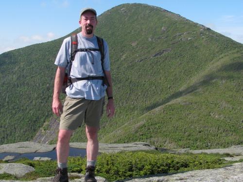
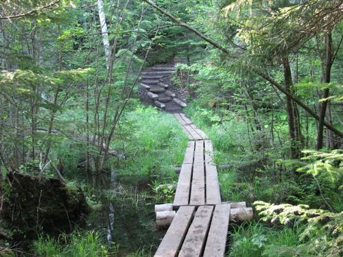
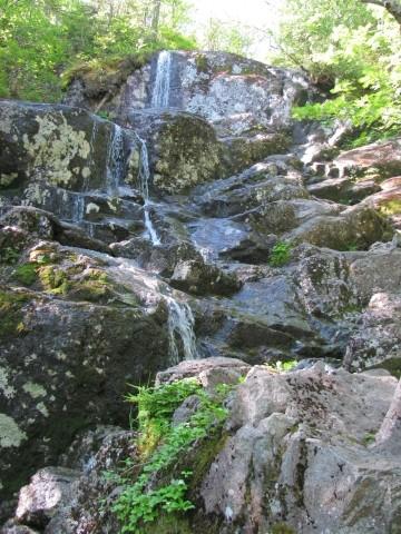
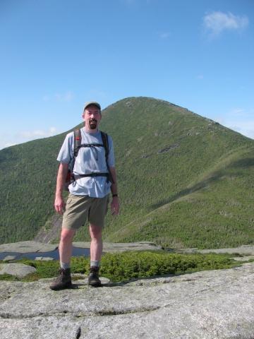
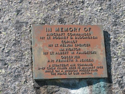
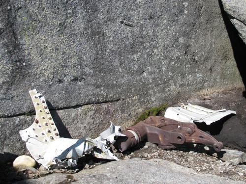
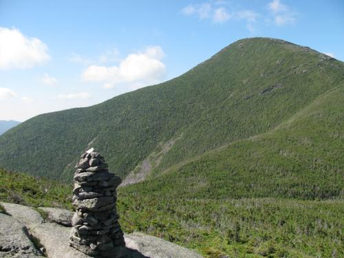
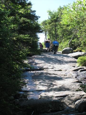
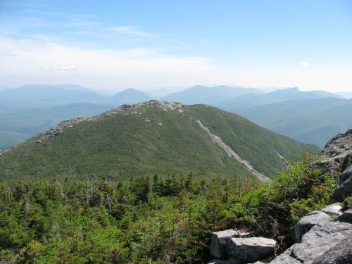
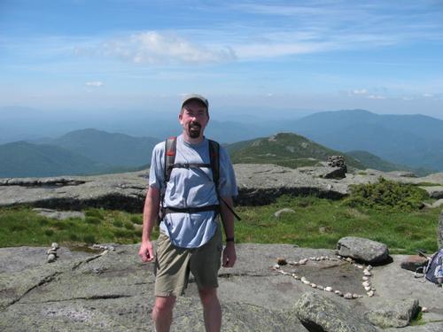
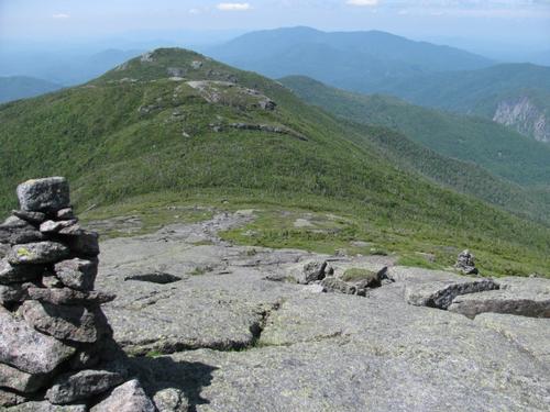
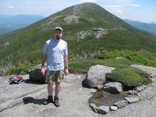
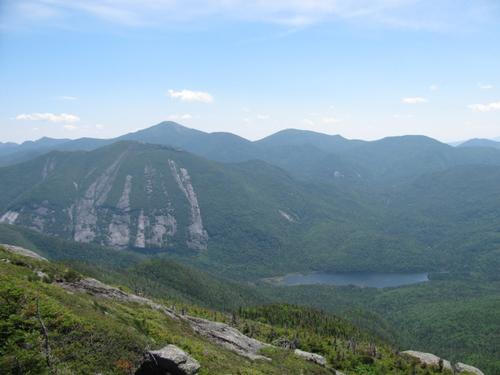
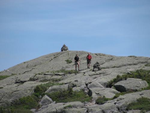
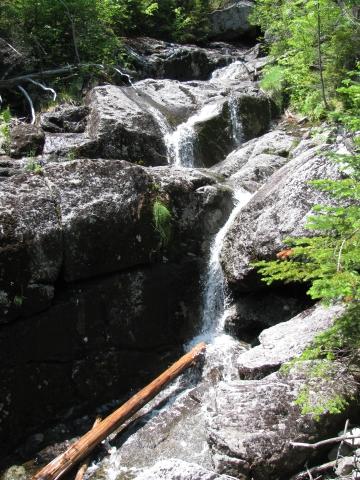
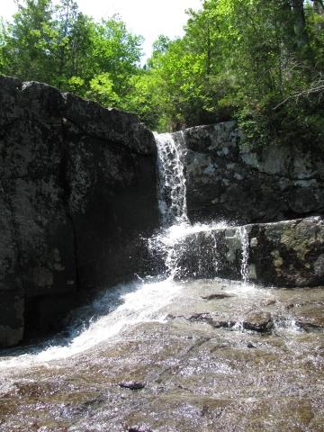
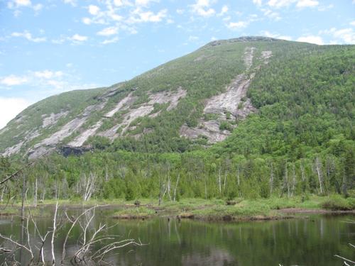
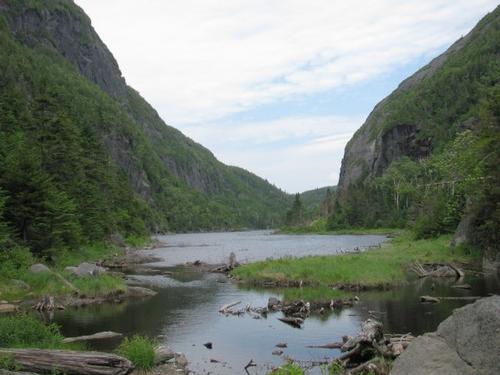
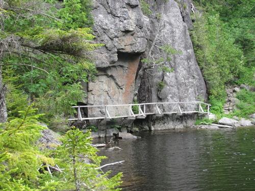
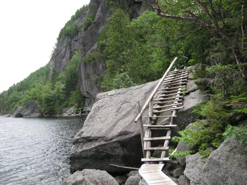
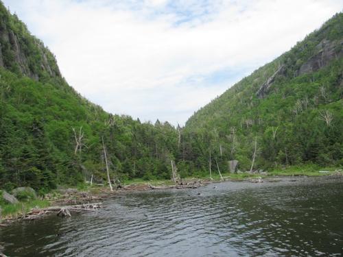
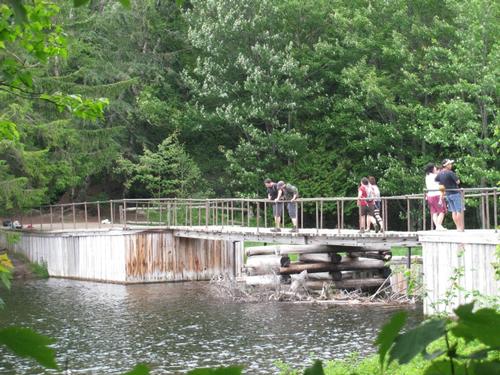
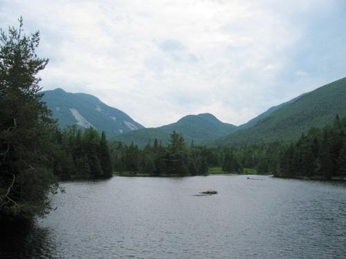
On Saturday morning (July 19), I stopped by Mark's place to see if he still was going to be able to go...unfortunately he was not up for it so I continued on to the High Peaks region and arrived at the Adirondack Loj parking lot at about 7:40AM. Noone else had signed up for this hike, so I got myself ready and headed up to the trailhead at the end of the parking lot just before 8AM. Following the Blue-marked trail in the beginning and then continuing along the Yellow-marked trail which proceeds up to the peaks and along the ridge. The grade of the trail to the junction of Wright spur was moderate with a slight break at the MacIntyre Brook Cascades (I'm sure this is much more spectactular after significant rains or during the spring run-off). I reached the Wright Peak spur trail at about 9:30 and took the 0.4 mile trail to the summit where I met a peak steward. We talked and he was kind enough to show me down to the place where the B-47 bomber had crashed on the summit. Here there still is limited debris and a plaque. After looking around and taking in the fine views of Algonquin and the surrounding High Peaks, I descended back to the trail junction and started my ascent up to the summit Algonquin. At points this was a little more steep. At about 11AM I reached the summit and found another peak steward, who was greeting hikers as they reached the summit. She was kind enough to take my picture here. Again the views here were awesome. I started to head over towards Iroquois, where I wanted to have lunch. I ran across a large cairn before the trail heading back into the woods with a sign indicating the Yellow-marked foot path. I didn't think much about this and headed down. Well, it got steeper pretty fast and I was worried I might have missed the junction with the herd path. Sure enough, back at the sign someone had written Iroquois with an arrow pointing down a very narrow path. Yippee! I would have been bummed to have missed it. Anyway the trail was obviously more overgrown and a little muddier than the other trails on the trip. I reached the summit of Iroquois at noon and enjoyed my lunch there before heading back along the herd path to the trail junction, which leads into Avalanche Pass. Again, this peak offers exceptional views of the surrounding Adirondacks. It was an especially hot day with a nice breeze occasionally. Unfortunately, I used up my water just before the descent. On the plus side, I had remembered my filter and was able to refill along this trail as it follows a cascading brook all the way down to Lake Colden. Also while this trail was steep in places it was not as bad as other hikers had warned...I could see their point if it were wet though. It was a little before 2PM when I reached the the Avalanche Pass trail junction and I continued to Avalanche Lake and Marcy Dam. The trail through the pass was nice with boulder scrambles and some unique boardwalking which was bolted to the cliff walls abover the water. After this I it was somewhat a long walk out to Marcy Dam and the trail which led back to the Adirondack Loj. There were some great views from Marcy Dam looking back towards the pass and I took a short break here. I had pushed myself pretty hard and had gone through about 4 liters of water. I headed back from here to the trailhead parking, which I reached a little before 5PM.
The hike was long and definitely strenuous, but it is a fantastic hike with many nice features...ridges, open peaks, falls, lakes, etc. Despite the heat, I couldn't have asked for a better day out in the Adirondacks.
There are 26 photos in Album (Note: Move mouse pointer over larger pic and click on NEXT for better viewing)


|
|
||

