Trip report
Black Mountain Hike
Hiking/Walk DATE: 02/22/2020 - 02/22/2020
Trip/Event Location: Benton, NH
US
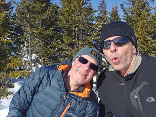
Trip Leader(s): Gandalf , JDNnh
Max # People: 15
Trip Guiding / Event Fee: No, I will not be asking participants for money
Difficulty Level: Moderate
The finest summit in the little Benton Range west of Mt. Moosilauke at 1,800 feet, offers an expanse of open ledge at the top! There are wide views of the Connecticut River valley to Vermont, south to
...Chippewa Trail parking via Rt 116;
Route 93 north to Exit 32, right at bottom of exit ramp
Route 112 west towards Woodstock (and Woodsville & "Lost River") (for about 12.5 miles)
(Stay on 112 past the junctions for 118 and 116 North)
Route 116 SOUTH towards Benton (for 7.5 miles)
(Stay on 116 through Benton)
Left on to Lyme Kiln Road (for about 1.8 miles)
(Lime Kiln Road is about half mile past Windy Ridge Orchards on 116)
We'll be driving a blue Tacoma truck.
Trip Report/Photos
Mileage: 3.8
Elevation gain: 1730'
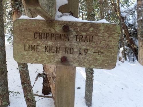
Trails used: Chippewa Trail.
We wanted to play it safe and go low key and not punish ourselves hiking this weekend. We needed something that would be broken out with views as the weather was forecasted for 30s and sunny skies.
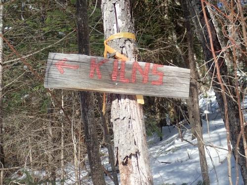
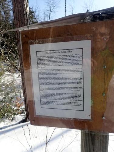
Black Mountain is located in Benton and Haverhill, New Hampshire. It is also located in the Black Mountain State Forest. We also decided to visit the Lime Kilns that are in the area on the way back down.
Black Mountain is on the New Hampshire 52 With-A-View (52 WAV) and New Hampshire Fire Tower List.
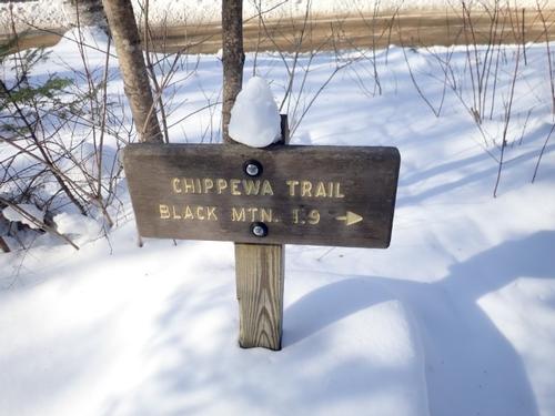
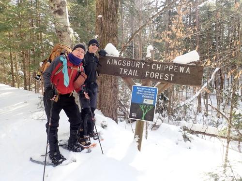
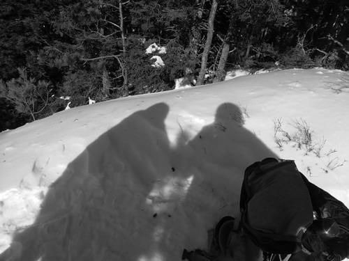
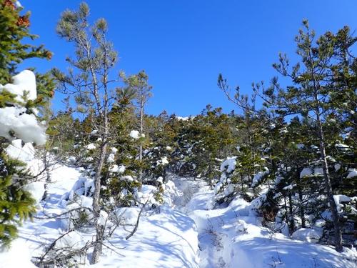
The start of the Chippewa Trail is off of Lime Kiln Road. The small trail head parking area was plowed out. The Chippewa Trail is part old logging road, part trail. We found the trail broken but were not sure how far the hikers may have gone so we put on our snowshoes. Rick switched to MicroSpikes on the steeps later on whereas Jon and I switched for the return.
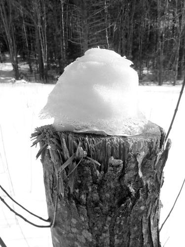
At the start we remarked how a woodpecker had gone to town on this tree.
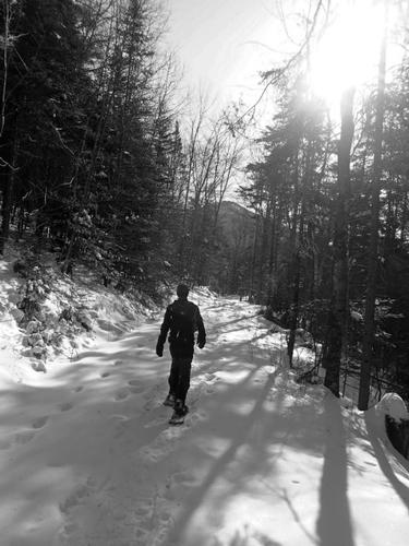
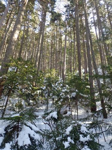
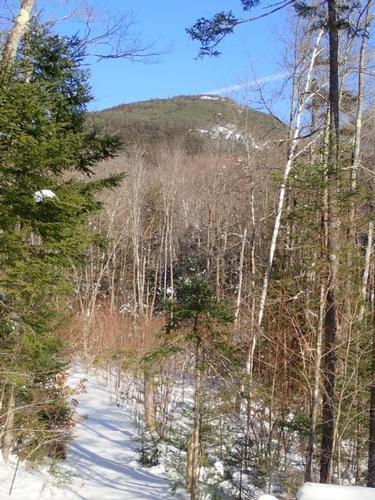
We began the ascent of Black Mountain up the Chippewa Trail, which heads up an old woods road with a steady ascent at first.
On the ascent we saw Black Mountain looming ahead. Sometimes it seemed like it was very high up and that we had lots of elevation gain left to reach the summit.
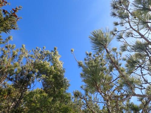
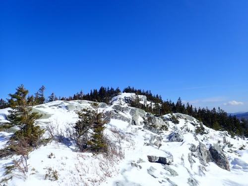
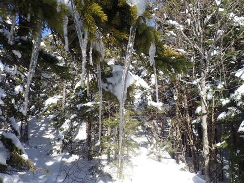
The Chippewa Trail has a good amount of yellow blazing. We then began the steep climb up the Chippewa Trail through nice woods. We walked through red pines on the way to the summit of Black Mountain.
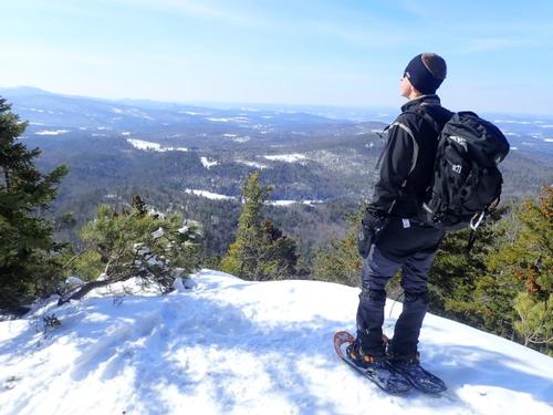
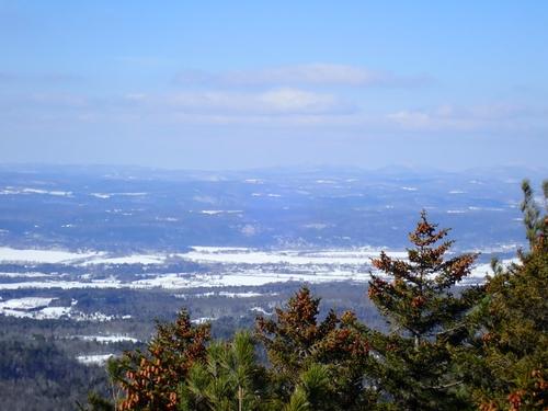
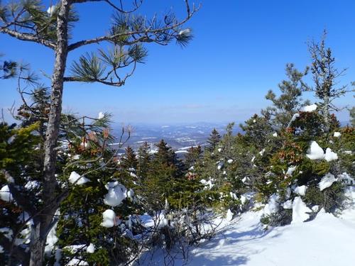
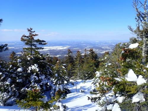
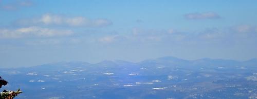
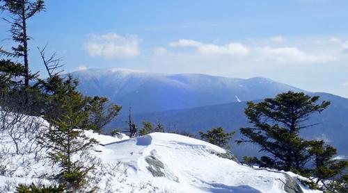
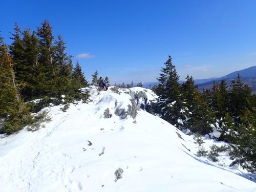
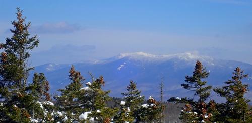
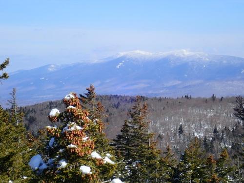
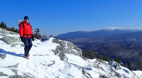
The Chippewa Trail makes its way over a ledge area with good views. NH Views included Piermont Mountain, Mount Cube and Smarts Mountain. Vermont views included Knox Mountains, Butterfield Mountain, Signal Mountain and Camels Hump barely visible in the background.
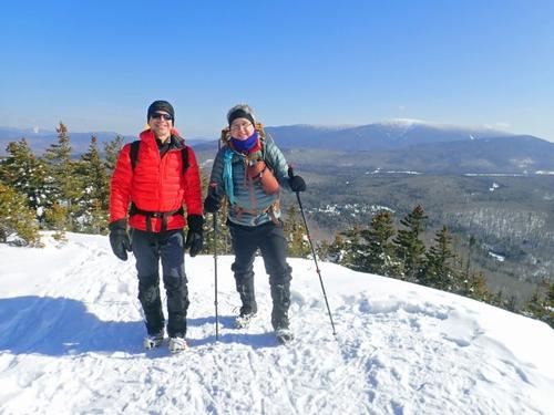
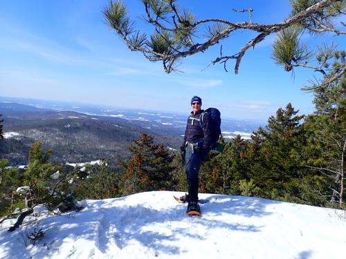
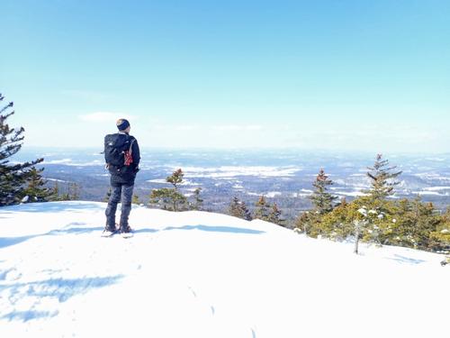
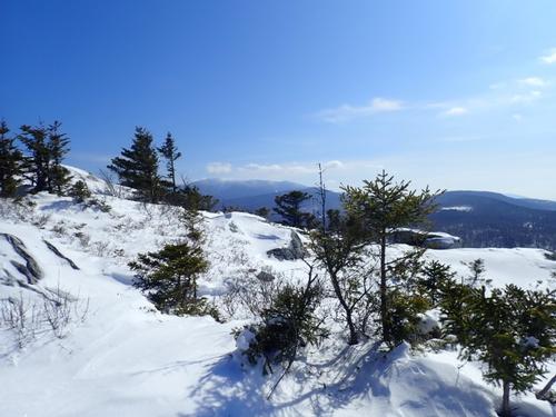
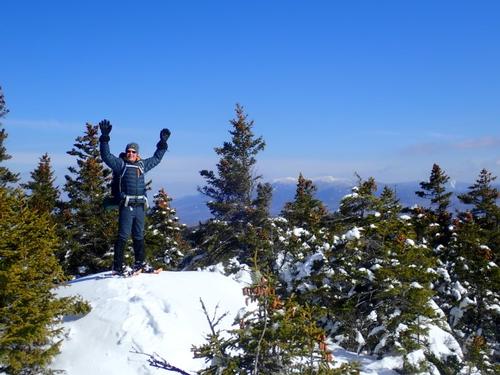
Just when we thought we were nearing the summit of Black Mountain, we still had to climb around more ledges to reach it. We then approached the summit area of Black Mountain (elevation 2830'). Views on the summit included the Kinsmans, Mount Wolf and Mount Liberty and Mount Flume. We could also see Mount Moosilauke, Sugarloaf Mountain and the Hogsback, Mount Jeffers and Smarts Mountain, Mount Cube and Piermont Mountain.
After lunch we returned the way we came coming down the ledges just below the summit of Black Mountain. We then began the steep descent of the Chippewa Trail.
Almost back to the truck, we decided to visit the remnants of lime kilns that are in the area. The bigger lime kiln has been restored over the years.
A productive day of hiking with warmer temperatures briefly teasing us with a preview of what we want to come SOON! Enough with the snow and cold temperatures already!
We managed decent views this time around although the minor elevation still manages to wipe us out for today's hike.
There are 48 photos in Album (Note: Move mouse pointer over larger pic and click on NEXT for better viewing)


|
|
||