Trip report
Mt Tremont Hike
Hiking/Walk DATE: 10/05/2014 - 10/05/2014
Trip/Event Location: Crawford Notch, NH, NH
US
Trip Leader(s): georgep , Eric.Cohen
Max # People: 12
Trip Guiding / Event Fee: No, I will not be asking participants for money
Difficulty Level: Moderate
Mt Tremont is an easy to get to, moderate hike with very nice views. The trail is fairly moderate with one water crossing and some switchbacks close to the summit. The summit has fine views over
...Meeting time is 9:30am at the Mt Tremont Trailhead. There is a small parking area right beside US 302 about 4 miles west of the town of Bartlett, NH, .5 mi west of Sawyer River picnic area.
GPS 44• 3' 12"; 71• 21' 25"
From Boston and other points south, the quickest route is Interstate 93 north to Exit 35, Rt 3 East to US 302 South through Crawford Notch. Look for my Black Hyundai Elantra with NH plates
Trip Report/Photos
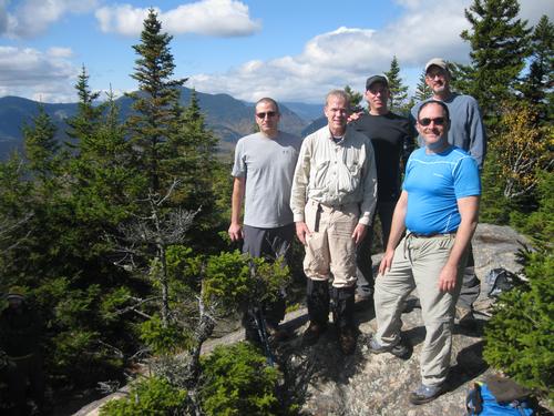
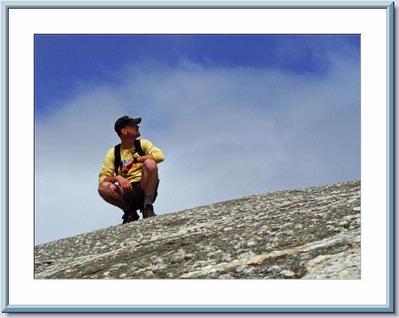
Five of us met early Sunday morning as the clouds from Saturday's rain retreated to the East leaving us with a cool, bright October day to hike Mt Tremont. Four members and one guest enjoyed a leisurely ascent on a trail strewn with Autumn leaves and various, colorful, late summer mushrooms. We had some great and often 'entertaining' conversation with friends new and old. Bright blue skies, spotted with occasional puffy white clouds lent a beautiful backdrop to dramatic views of Crawford Notch and The Presidentials in the distance draped in their fall colors. As we gained elevation and the grade steepened the views came more frequently. The many switchbacks along the top half of the trail encourage stopping to take in the vista. Only the actual summit is above the trees although the views aren't quite 360 degrees. We summited around 1:00 briefly sharing the peak with another group of hikers who were kind enought o take some pics of our group for us. After they departed we had the mountain top to ourselves. Tremont offers a bit of a different perspective to some familiar surrounding mountains and great views of Sawyer Pond, Church's Ponds, Green's Cliff, Owl's Cliff and some of the peaks of the Sandwich Range to the south-west. We all had some lunch then enjoyed the strong sun and relatively balmy temperatures for an hour before heading back down. After more lively conversation and laughs we reached the parking lot just before 4:00pm as it was a little too early for dinner and most of had long rides, we opted to skip the post hike meal and all headed home after a fun day in the mountains.
Thanks to a great group of hikers for making my first GO hike as a leader a success!
- The Trip Has No Photos -
What Members Are Saying About This Trip/Event
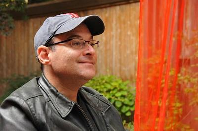
- Thanks for the fantastic photos Tim and Ken! - georgep
|
|
||