Trip report
GetWinter#3: Nancy Pond
Hiking/Walk DATE: 03/01/2014 - 03/01/2014
Trip/Event Location: Barlett, NH
US
Trip Leader(s): DaveSchumaker , HikerBiker
Max # People: 15
Trip Guiding / Event Fee: No, I will not be asking participants for money
Difficulty Level: Moderate to Strenuous
On the third hike in this series of four, we will be hiking the Nancy Pond trail.
Few trails in the Whites pack as much scenic variety into one hike as the Nancy Pond Trail from Route 302 up to
...
Two landmarks help locate the Nancy Pond Trail on the west side of US 302 between Bartlett and Crawford Notch. If you are travelling east on US 302, a mile before the trailhead you'll see on the left a large asphalt parking area for the Davis Path, then the Notchland Inn on the right and soon thereafter, the Nancy Pond trailhead on the right.
Approaching the Nancy Pond Trailhead from the west on US 302, it is 1.2 miles past from the Sawyer River Road [Mt. Carrigain trailhead] on the left. You'll see Sawyer River Road branching off to the left just north of the Sawyer River Bridge.
Trip Report/Photos
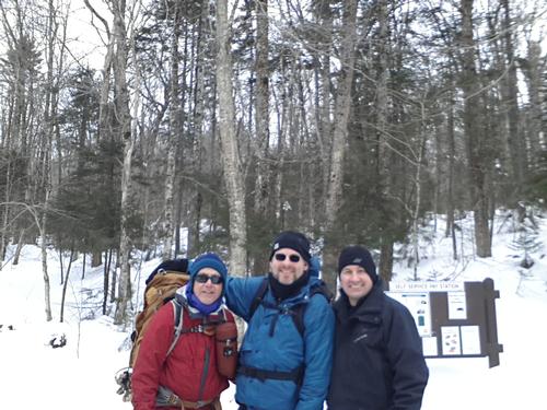
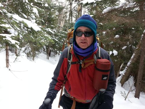
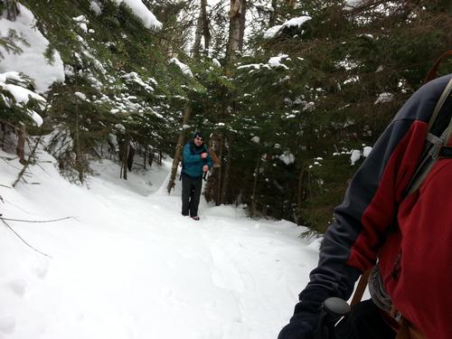
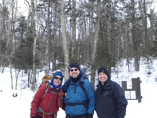
For the GetWinter #3 hike, we were set to hike Nancy Pond in Bartlett, NH. On the day before the hike, all but three people had removed themselves fromt he hike (it happens). That left Jim, Rick and myself to brave the elements. Since we were all riding in the same car and no one was meeting us at the trailhead, I proposed we 'change it up'. Rather than hiking Nancy Pond, I suggested we kick it up a notch and attempt to hike East Osceola. Not only does this cut down on the time/distance in the car, but it's a 4K peak I have yet to bag. Everyone was on board with the itinerary change, so off we went.
We headed to the Greeley Ponds trailhead, which I drove past on the 1st GetWinter hike. I did not miss it this time (or so I thought). I had not done any research on hiking East Osceloa and did not note the trail name. Before heading up the trail, I looked for the trailmap sign and did not see it. I thought there was one at the trailhead. This should have stopped me here, but we headed up the trail and eventually crossed a (familiar) ice bridge over a stream. Everything seemed ok as the three of us acended up the trail chatting about various things along the way. I was waiting to encounter a trail junction to head up to the summt of East Osceola but it never came. I don't think I would have missed the trail juntion, but we continued up the trail and the snow became softer and much less packed down. When I thought we were about to reach the top, the trail ahead started going down. This was the 'red flag' that prompted me to take out my map and check our possible location.
It was one of those WTF moments when I realized what happened. I stopped at the East Pond trailhead rather than the Greeley Ponds trailhead. They are close to each other. The East Pond trail runs parallel to the Greeley Ponds trail so the stream crossing would have seemed familiar as both trails cross it. I did not miss the trail junction because there wasn't one. We had simply followed the East Pond trail. We could see East osceloa, but we were not going to summit it. We all laughed at the mistake and decided to head down the mountain. Despite the error, it turned out to be an excellent hike with some decent elevation gain which was needed for practice before heading up Mt. Moosilauke on the fourth and final hike of the GetWinter series.
There are 4 photos in Album (Note: Move mouse pointer over larger pic and click on NEXT for better viewing)

|
|
||