Trip report
Welch-Dickey Loop
Hiking/Walk DATE: 07/02/2011 - 07/02/2011
Trip/Event Location: Thornton / Waterville Valley, NH
US
Trip Leader(s): XTERRAMAN03053
Max # People: 12
Trip Guiding / Event Fee: No, I will not be asking participants for money
Difficulty Level: Moderate to Strenuous
Please join me in hiking this very popular moderate to challenging 4.4 mile trail loop located at the gateway to the beautiful Waterville Valley area of New Hampshire. Your reward
...Take I-93 to the Campton / Waterville Valley and get off at exit 28 and follow NH 49 thru Campton toward Waterville Valley. Four and a half miles beyond 175 in Campton, turn left (northwest) onto Upper Mad River Road (second intersection with this loop road) and cross the river. Follow this road for 0.7 miles then turn right onto Orris Road. The parking area is just 0.6 miles ahead.
Note: There is a WMNF parking fee.
Trip Report/Photos
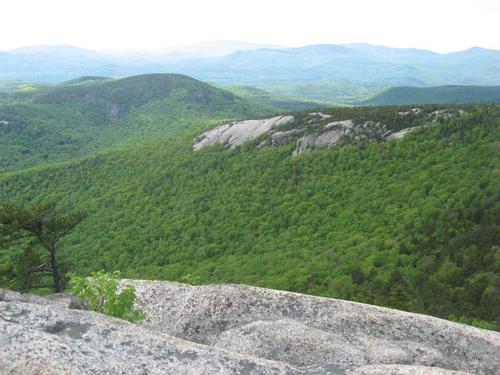
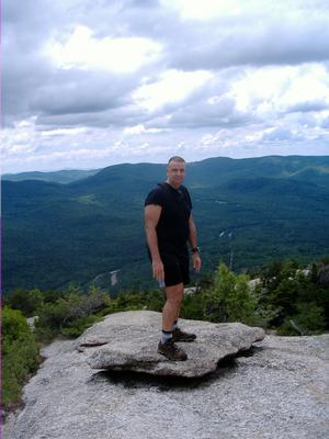
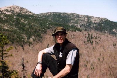
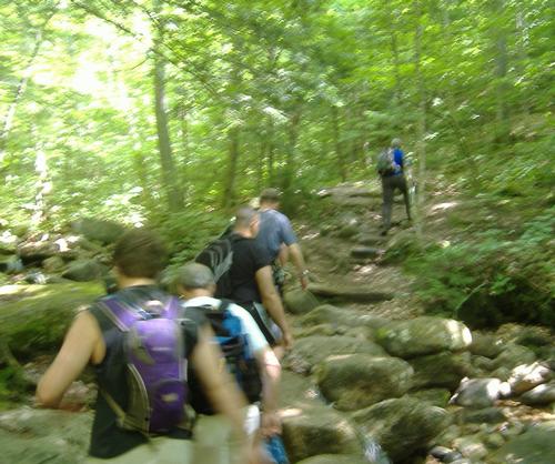
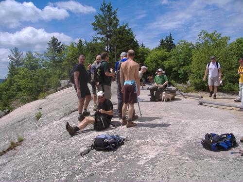
The weather on Saturday was absolutely perfect for viewing the panoramic scenery offered by this loop trail. Clear sunny skies allowed the group to absorb the breath taking views from many miles away. The hike was a good mix of moderate to strenuous inclines elevating one's heart rate without being too terribly taxing.
We had a full group in that everyone that signed up made the trip. We took a lunch break at the summit of Welch and then proceeded towards Dickey on our way back to our starting point. Back at the trail head we decided to head off to the Country Cow for some drinks and good food. This was a very fun and memorable trip. I wish to thank everyone who came along. A special thanks to those who remembered to bring a camera to record the fantastic views.
There are 3 photos in Album (Note: Move mouse pointer over larger pic and click on NEXT for better viewing)

|
|
||