Trip report
The Tripyramids Hike
Hiking/Walk DATE: 12/11/2010 - 12/11/2010
Trip/Event Location: Lincoln, NH
US
Trip Leader(s): Gandalf
Max # People: 15
Trip Guiding / Event Fee: No, I will not be asking participants for money
Difficulty Level: Strenuous
The Tripyramids have three summits, but only the North and Middle peaks count as official 4000 footers.
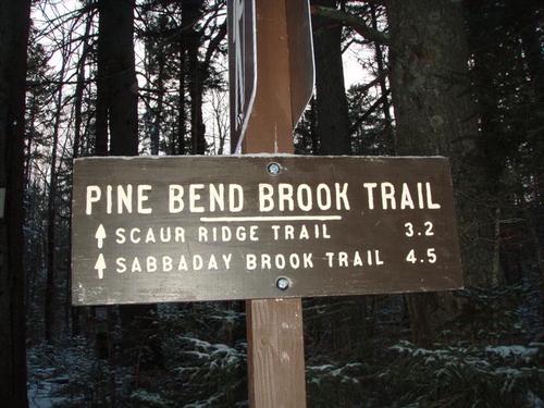
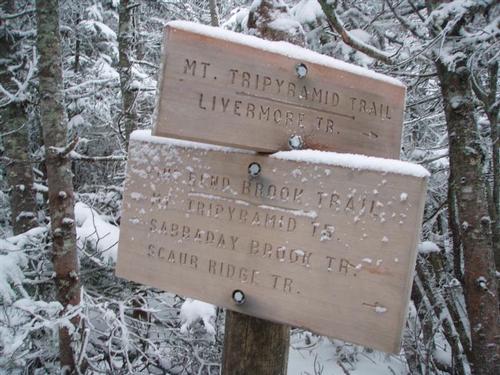
There are multiple approaches to these peaks. We will be taking the Pend Bend Brook Trail. The
...Roadside on NH Route 112 (Kancamagus Highway) one mile W of Sabbaday Falls picnic area and county line, elevation about 1380 feet
44.0016°N, 71.4130°W (WGS84)
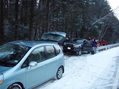
From Exit 32 of I-93, take NH Route 112 E over Kancamagus Pass about 19.5 miles (about 2.9 miles beyond Lily Pond), roadside parking on R. We will be driving a blue Toyota FJ Cruiser.
Trip Report/Photos
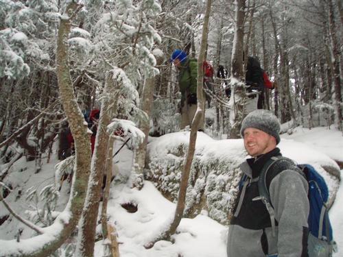
Season's Greetings! We didn't want December to get away without a hike to a 4,000 footer so North and Middle Tripyramids looked like a good choice for winter conditions. We parked on the same side of the road where the Pine Pend Brook trail sign was posted.
We were the only vehicles there. Started up the trail at 7:45am and it was 26 degrees. Minimal snow from a trace to 2" or 3" on the ridge and summits. While there were a few glimpses of sunlight, things were mostly cloudy with very little wind.
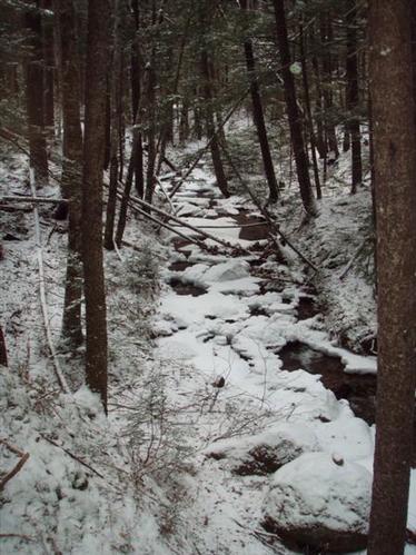
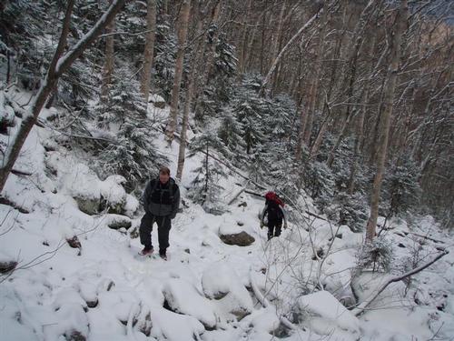
The trail was firmly packed and easy to walk. The trail was pretty gradual for quite a awhile, lollygagging its way across some brooks. After about one mile we put on our MicroSpikes as certain sections of trail had ice hidden beneath the snow.
Brook crossings were rock hoppable. The rocks were snow covered and we were concerned about ice beneath. For the most part, ice on rocks was not an issue.
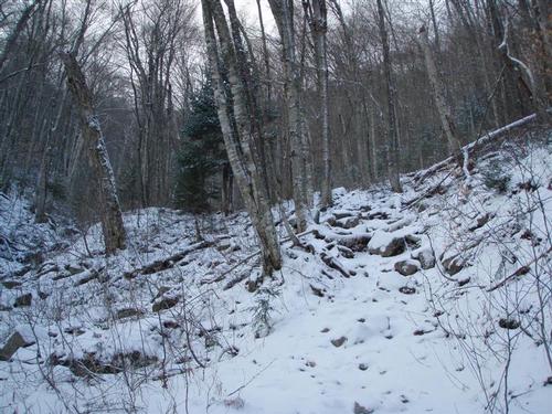
Then, shortly after crossing the wilderness boundary, things picked up quickly, as the the trail worked its way up a fairly steep ravine with rough, rocky footing, and a steady grunt up.
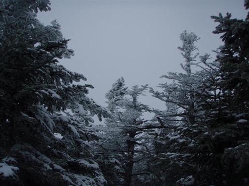
The temperature remained steady as we got on top of the ridge. The trees were covered with Hoar Frost that easily put us in the holiday spirit. The section of trail after the Scaur Ridge Trail junction is very interesting with steep slopes on both sides.
The ridge walk didn't last long before we were heading up again. Up and up we went on a steep, winding, ledgy climb with many icy ledge steps to negotiate.
We reached the summit of North Tripyramid [4180'] and took a short break in the clouds. We didn't see any point in trying to find a better view since we were in the clouds.
We then continued 0.8 miles to the Middle Tripyramid [4140'] that provided us another nice flat section of ridge walking. The hike to Middle Tripyramid was easier than we expected and we were still in the clouds.
Eating lunch at the summit we saw a brief glimpse of the Waterville Valley Ski Aea through a veil in the clouds. Time to head back. It always seems steeper on the way down than it does on the way up.
On the return, on the Scaur Ridge section, we saw glimpses of Mt. Carrigain to our right. The trail was firm enough to hold your boot in place but there was still ice. We took our time on the descent, as the trail was quity icy in the steep parts.
It seemed like a long way back to the road and the legs were feeling the 9.6 mile round trip. Back in the car at 3:45pm. Saw a few other hikers out today, two which used the same route we did.
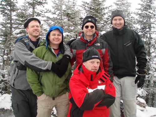
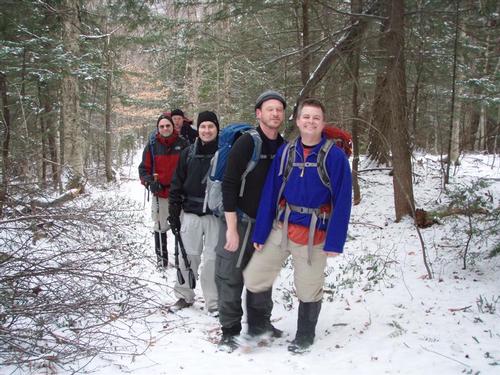
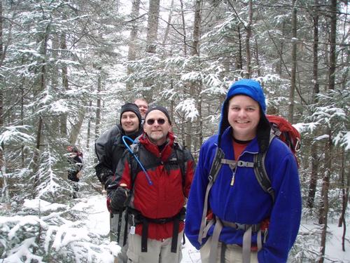
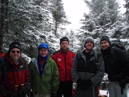
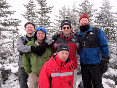
Winter has arrived! The six of us had a great day. Four of us checked off two more 4,000 footers.
There are 19 photos in Album (Note: Move mouse pointer over larger pic and click on NEXT for better viewing)


What Members Are Saying About This Trip/Event
- The day before was an ultra deep freeze, the day after a total washout. How did you pick such a great day Mike? The hike was awesome, thanks! - WalkaboutBrian
- Thanks Mike and everyone who made this a great hike. - DaveSchumaker
|
|
||