Trip report
Wonalancet Range Loop Hike
Hiking/Walk DATE: 11/20/2010 - 11/20/2010
Trip/Event Location: Wonalancet, NH
US
Trip Leader(s): shep5
Max # People: 10
Trip Guiding / Event Fee: No, I will not be asking participants for money
Difficulty Level: Moderate to Strenuous
Join me for this 7-mile hike up into the Wonalancet Range. This will take in the summits of Mt. Wonalanset (2760') as well as Hibbard Mountain (2940'). There are ample views into the
...From I-93, take Exit 24 in Ashland/Holderness. Take Rt. 25-E/3-S. Follow this for roughly 4.5 miles. Here turn left onto Rt. 113-E and follow for about 15 miles. Continue on Rt. 113A-W for 6.7-miles. You'll come to the tiny village of Wonalancet where there will be a quaint church all by itself. Rt. 113A continues on this sharp right, but you should continue straight here onto Ferncroft Road. A short distance up this road there will be a trailhead parking area on the right. It is about 27.5 miles (42 minutes) from Rt. 93. Look for a Grey Hyundai Elantra.
Trip Report/Photos
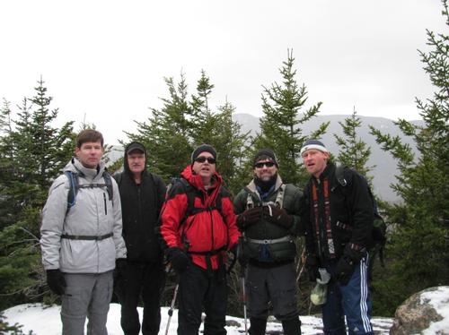
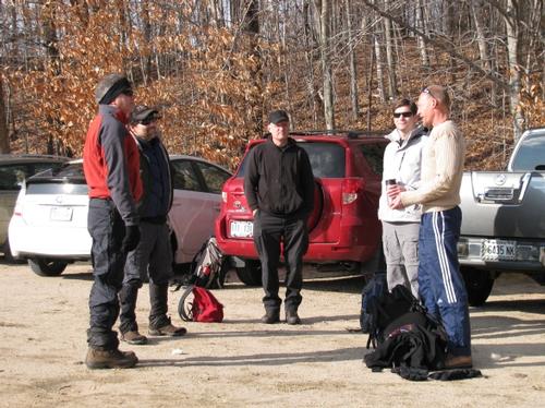
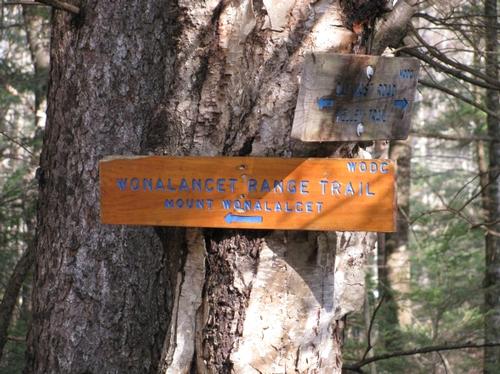
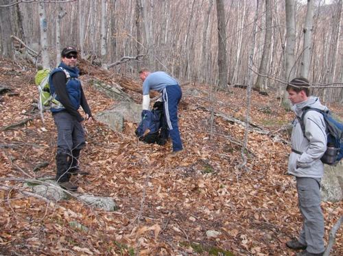
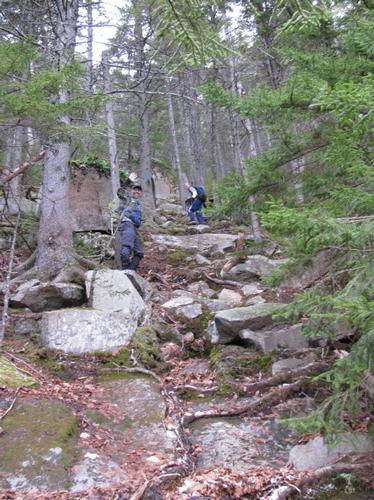
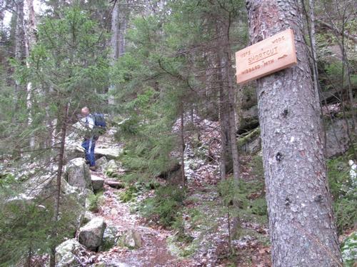
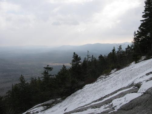
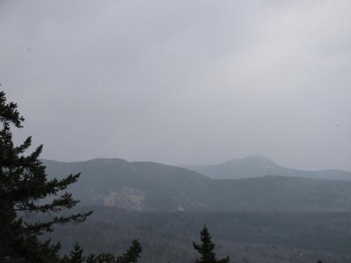
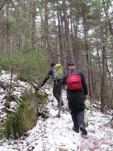
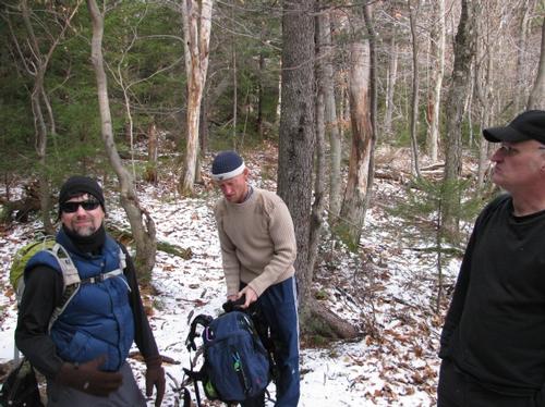
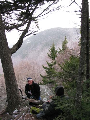
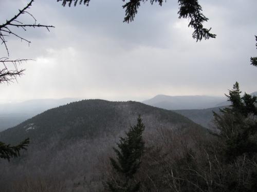
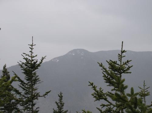
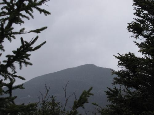
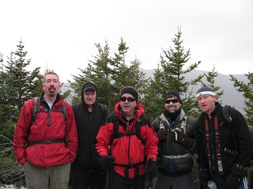
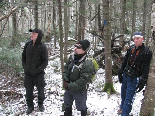
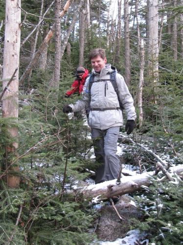
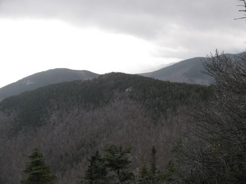
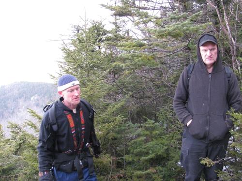
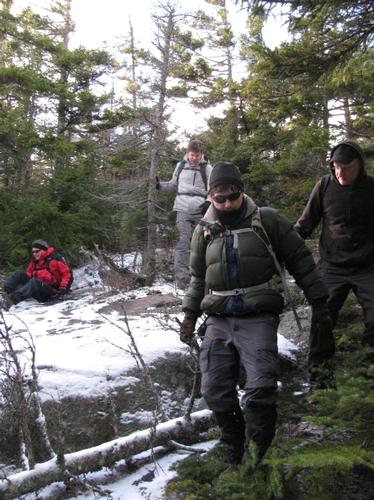
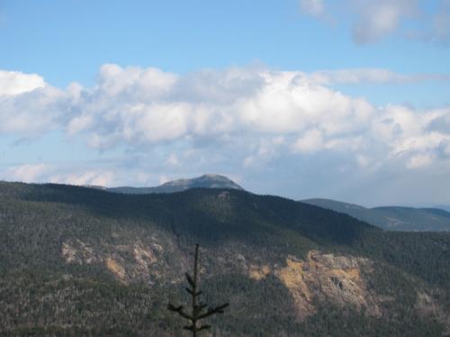
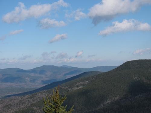
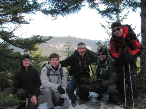
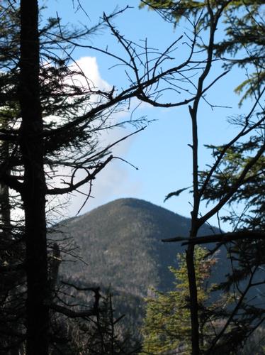
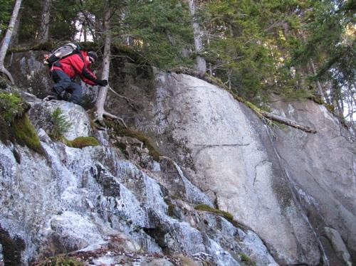
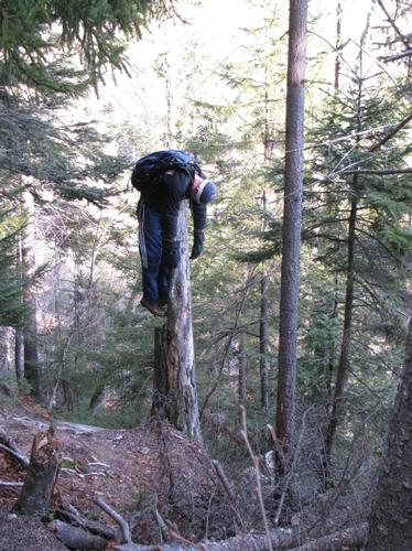
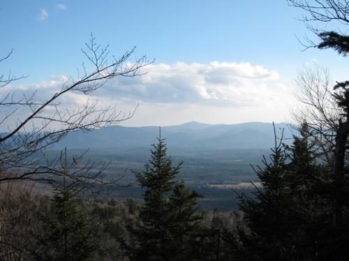
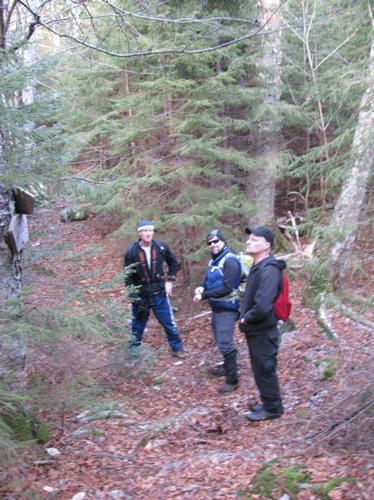
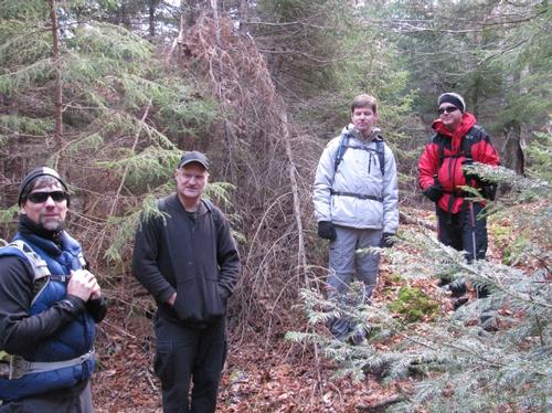
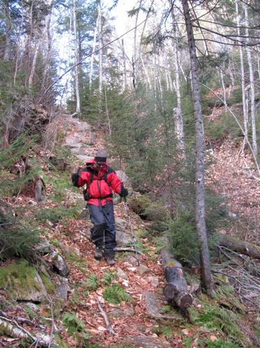
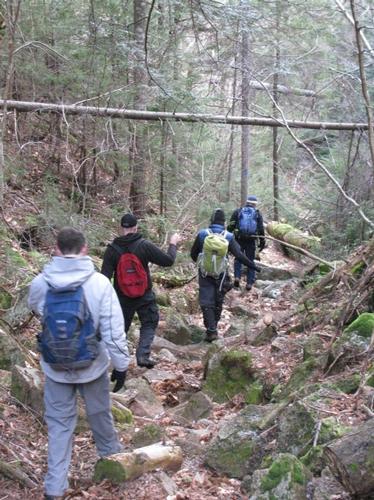
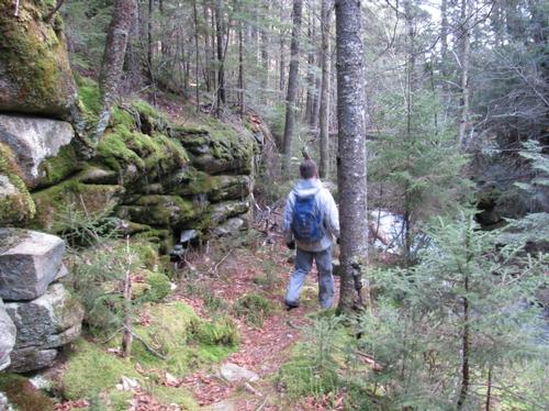
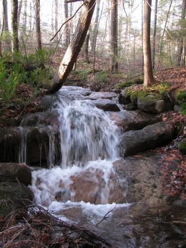
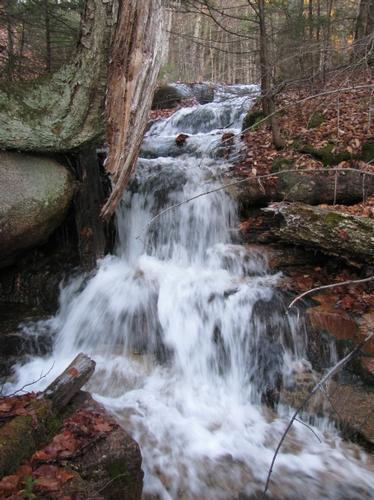
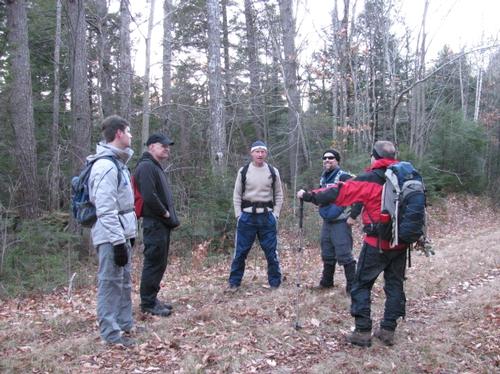
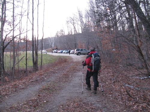
On Saturday, November 20th, six of us (Ron, Rob, Rick, Markus, Stacy and I) met up at the trailhead in Wonalancet. After waiting for about 15 minutes for a couple of no-shows, we headed into the woods to start the hike. It was a chilly overcast day at the start. From the parking lot we initially took the Kelley Trail, which very quickly reached the Wonalancet Range Trail just before a bridge and stream crossing. This meandered a bit before starting to gradually ascend up to Mt. Wonalancet. The pace was moderate and we just enjoyed spirited conversation along the way. We reached the junction with the "shortcut", which branched off for Mt. Wonalancet and for Hibbard Mtn. The trail began to steepen somewhat to Wonalancet and we were soon at an opening with good views to the south and east. It was overcast, so the views could have been better, but it was still nice to emerge from the woods with such a view. By this time there was more ice and snow on the trail and snow flurries had begun. We reached the unmarked summit of Mt. Wonalancet at about 12:15PM and decided as a group to continue on to Hibbard Mtn. About 20 minutes later we were on a ledge just below Hibbard's summit, where we enjoyed our lunches. This ledge provided nice, if not a little hazy, views back to Mt. Wonalancet. After lunch we continued the short ascend up to the summit. Again, this summit is unmarked, but there was an opening in the trees with views of Whiteface and Passaconaway. Continuing along the trail we quickly the Walden Trail. We turned east and started our descent to the Paugus Pass. Along the route there were a couple of outlooks...the first of which looks southward and the second to the east. It was still hazy at the first of these views, but the sky opened up and the sun came back out by the time we reached the second. Here we were rewarded with a beautiful view of Mt. Chocorua. After that the trail descended more steeply to the Old Mast Road (Trail) and a further 0.3-mile later we reached the Paugus Pass, where the Kelley Trail returns back to the trailhead. This route through the pass was beautiful as it descended into a narrow ravine in spots and followed a cascading brook. We continued along this trail until it finally reached what appeared to be old logging roads, which returned us to the parking area once again. It was a little after 4PM when we returned. Afterwards we all headed to Buckey's Restaurant and Tavern in Moultonborough for dinner before we called it a day.
It was a great day out despite the cloudiness and snow...thankfully we did get to enjoy some of the views that this loop has to offer. This is one that I'll look forward to doing again someday. Thanks too for the great group of guys that came along! It was alot of fun hanging out and doing this together.
There are 35 photos in Album (Note: Move mouse pointer over larger pic and click on NEXT for better viewing)
What Members Are Saying About This Trip/Event
- The scenic gorges and cliffs were something out of a novel-great choice of trails. - markmtn
|
|
||