Trip report
Mt. Ascutney Hike
Hiking/Walk DATE: 11/06/2010 - 11/06/2010
Trip/Event Location: Weathersfield, VT
US
Trip Leader(s): shep5
Max # People: 15
Trip Guiding / Event Fee: No, I will not be asking participants for money
Difficulty Level: Moderate
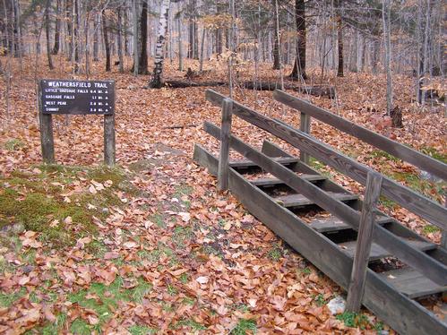
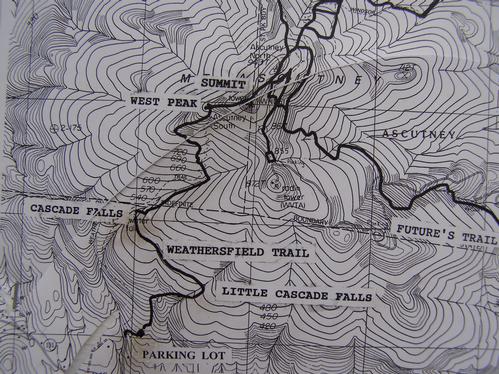
Mt. Ascutney is located in the south-eastern section of Windsor County, in the Connecticut River Valley. The Weathersfield Trail is the one trail on the south face of the mountain.
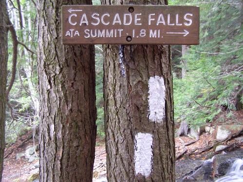
...We will be meeting at the trail head parking area, which is located off Route 131 in Weathersfield, Vt...Cascade Falls Rd veers off of Vermont Route 131 in Weathersfield. Take this to the end.
Trip Report/Photos
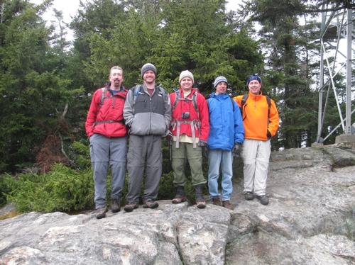
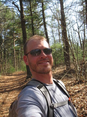
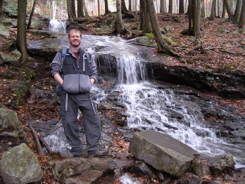
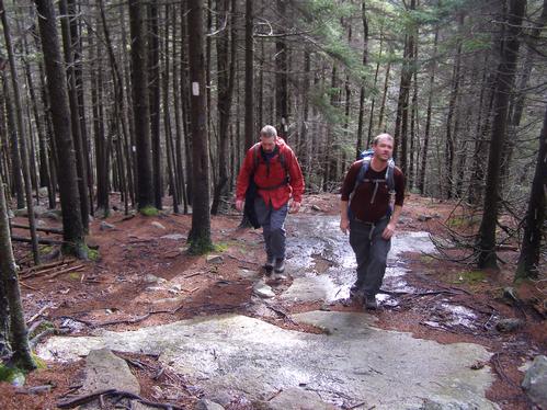
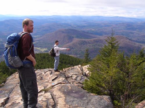
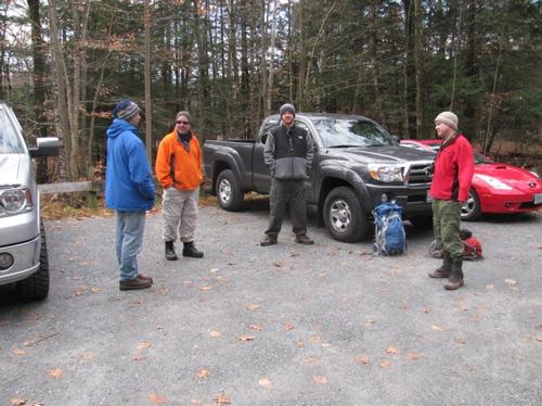
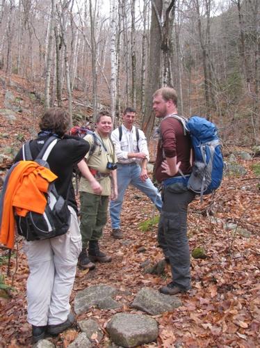
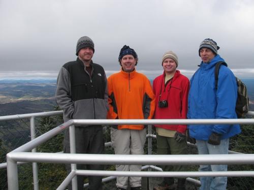
On Saturday, November 6th, five of us (Christian, Brian, Mark, Tom and myself) met up for the hike up Ascutney Mountain in Weathersfield, VT. We waited to start until about 10:25 for four "no-shows" (one had cancelled that morning, but we didn't know at the time).
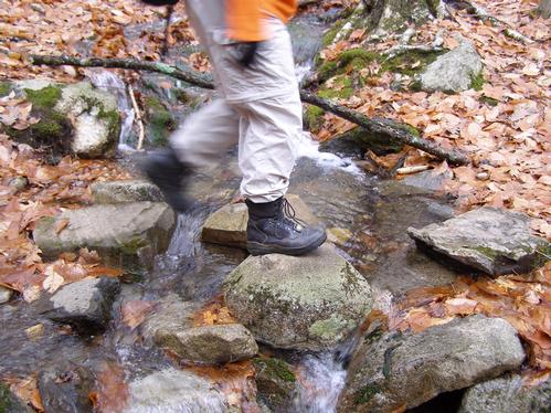
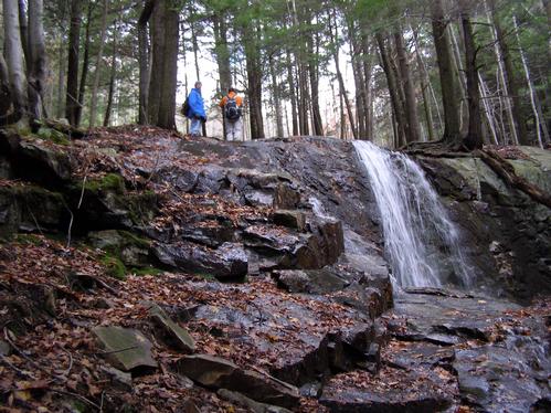
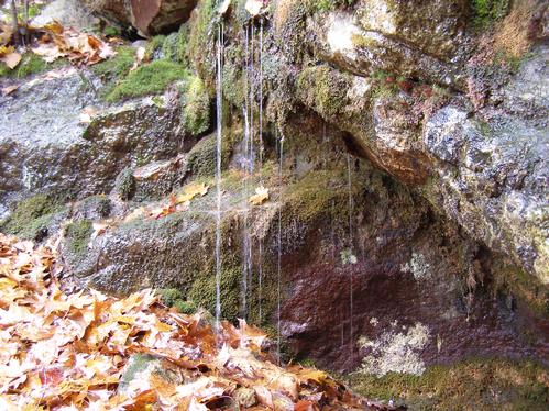
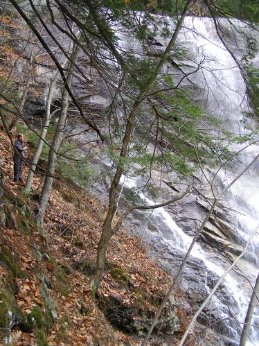
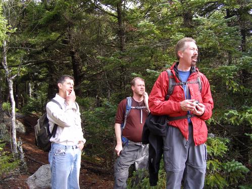
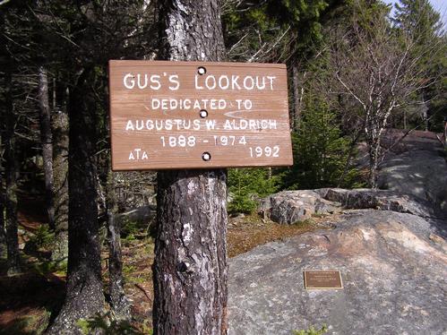
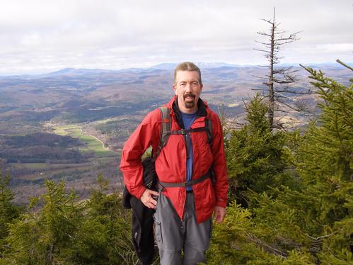
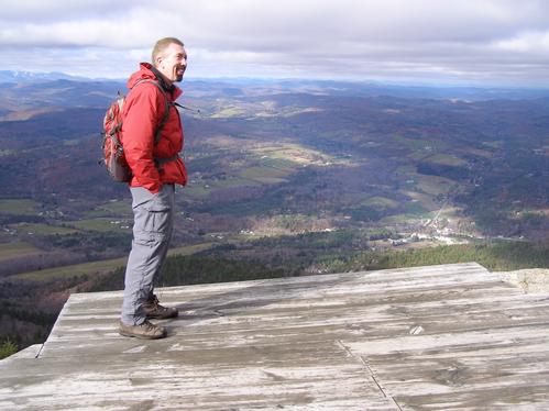
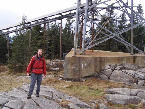
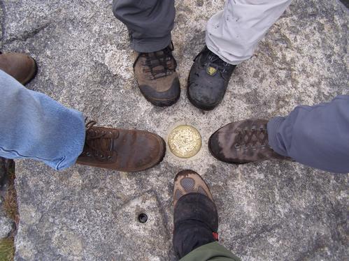
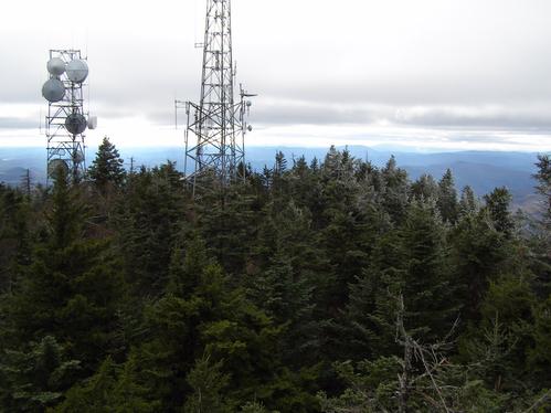
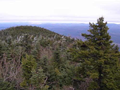
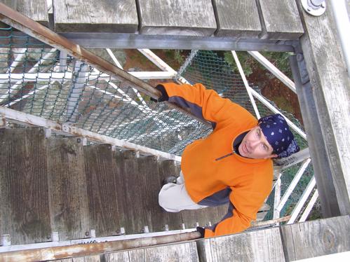
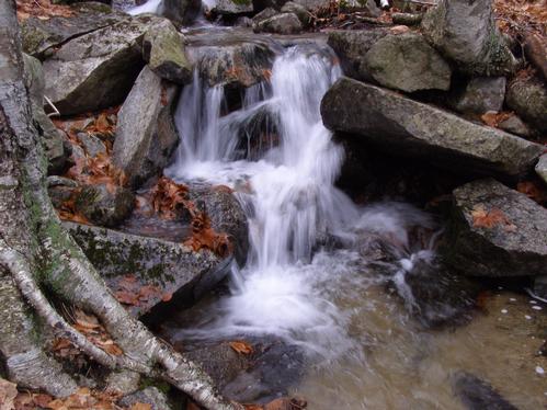
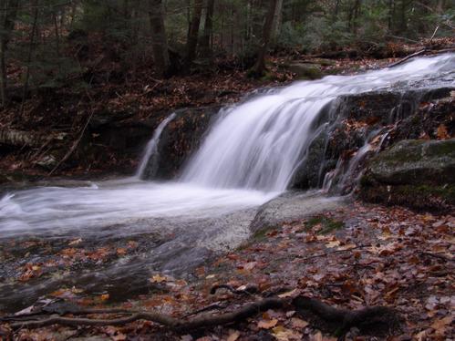
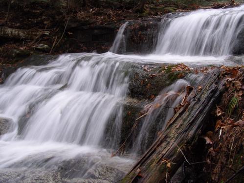
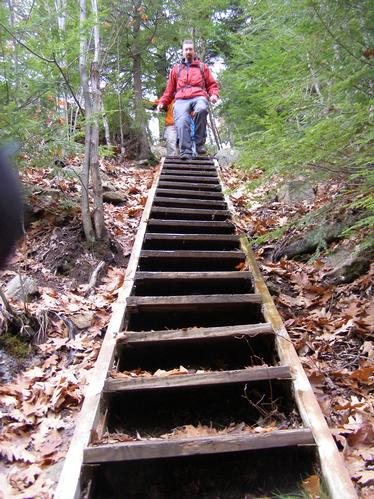
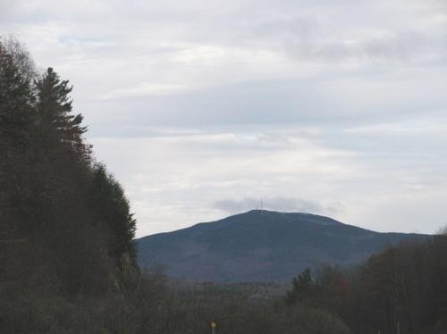
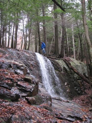
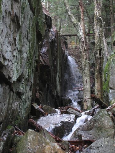
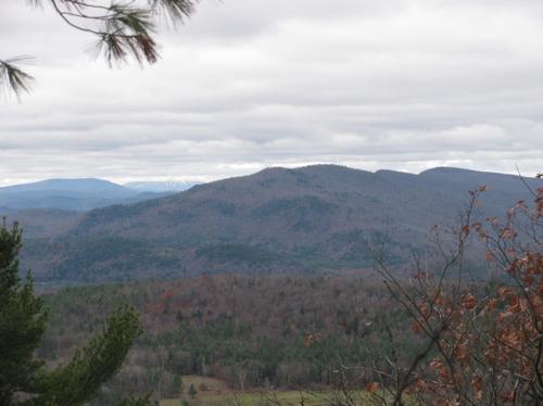
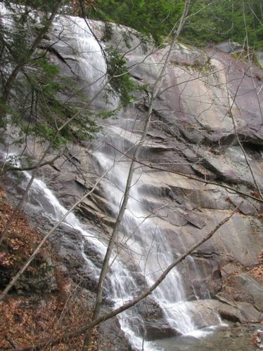
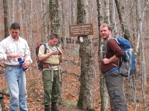
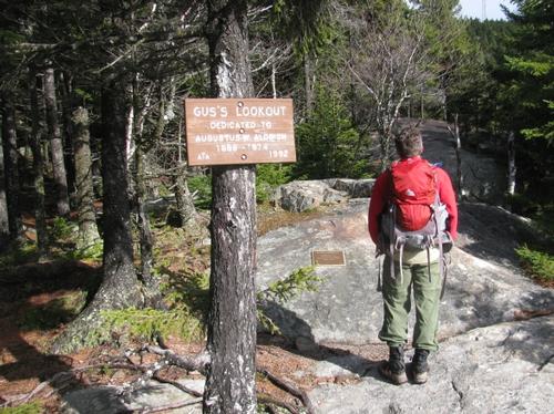
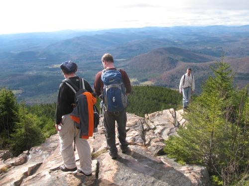
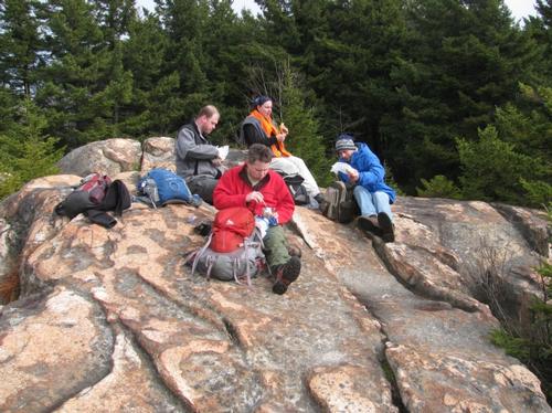
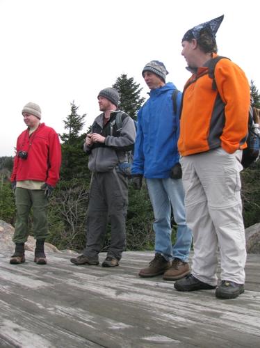
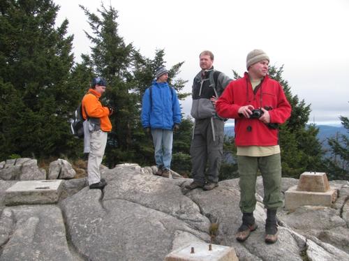
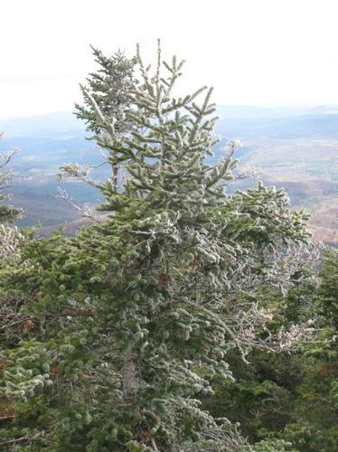
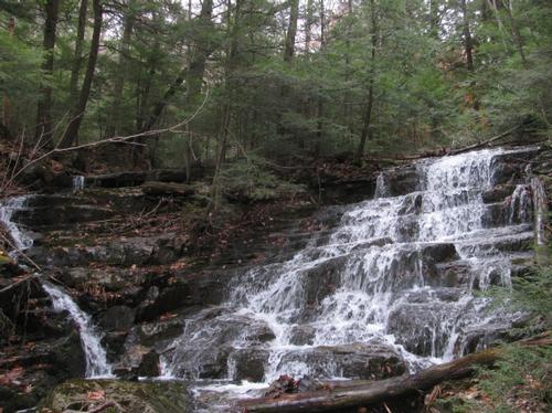
It was a brisk morning with some sun and clouds. The Weathersfield Trail was dry, but the leaf cover made for some slick areas on the trail. At first the trail mostly meandered through the woods and for the most part the trail ascended at a modest grade. We generally stayed together and just enjoyed conversation and the nice day outside. Twenty minutes into the hike we arrived at the first of many waterfalls...the first being Little Cascade Falls, which drops off of a small ledge. The total drop of this falls was 45 feet over several cascades. We continued on and found another falls nestled in a small, narrow gorge. From here there were stairs, which led to the first of many fine outlooks. After taking in the views we continued ascending the trail, where we quickly found ourselves at the dramatic ledge for Cascade Falls. This one drops a total of 84 feet and was running very well...the most spectacular that I've seen it. We bushwhacked a short distance off the trail to view the falls from below. It was pretty incredible dropping off the shear ledge. We proceeded from this point up the trail. At this point we were finally encountering others on the trail. The trail then paralleled the Ascutney/Halfway Brook until it emerged on a couple of open ledges...one of which was the Gus's Lookout dedicated to Augustus Aldrich. From here we got our first glimpses of the summit. We continued on to the West Peak summit (a very short spur trail). It was about 1PM and we decided to enjoy our lunch with a fine view to the south and west. After lunch we continued back to the main trail and quickly found the other spur trail, which headed out to a wooden platform, where hang gliders launch during the summer. From here it was a short distance with a short steep scramble up to the summit and viewing tower. We arrived at the summit at 1:45PM. The peak itself was dominated by two radio/cell towers. Just a short distance from the summit was a 2-story viewing platform, which allowed views in all directions above treeline. At this point it was totally overcast with many of the higher surrounding peaks in the clouds. Still the views were very nice. We hung out for a bit and then headed back down via the same trail. We took it pretty slow going down, taking breaks often so everyone stayed together. We returned to the parking lot at roughly 4:15PM.
After the hike we all headed down the road to Mr. G's Restaurant for a nice dinner before calling it a day. This was a pretty basic "diner" style restaurant, but there isn't much else in the area. It definitely suited the purpose.
A big thanks to Christian, Tom, Mark and Brian for joining me on this hike. I've hiked Ascutney a number of times in the past and this was by far the most spectacular trip...a great group of guys, beautiful waterfalls and open woods/ledges with many great views. It was a nice moderate hike with alot to offer.
There are 43 photos in Album (Note: Move mouse pointer over larger pic and click on NEXT for better viewing)


What Members Are Saying About This Trip/Event
- Steve, thank you for hosting a great fall hike. A must do hike for waterfall enthusiasts. As always, everyone was fun to hike with.Great group and great views. - WalkaboutBrian
|
|
||