Trip report
Tour de Mont Blanc - 2018
Hiking/Walk DATE: 08/17/2018 - 09/02/2018
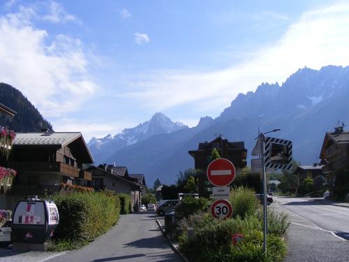
Trip/Event Location: Chamonix,
FR
Trip Leader(s): Robert.L
Max # People: 6
Trip Guiding / Event Fee: Yes, but only to cover shared expenses, and I too am paying
Difficulty Level: Strenuous
Dear Fellow Go Members…
Europe 2018! Join me for what I hope to be a brilliant self guided adventure – Le Tour de Mont Blanc
Mont Blanc is known as the Monarch of the Alps.&
...To be provided to participants directly
Trip Report/Photos
We are back!! The trip was a brilliant adventure and one I will not soon forget.
There is simply too much to share, both in experience and photos. I’ve decided to build the trip report by day and include 5-10 photos that highlight the best of the day. This will take some time – so check back often!
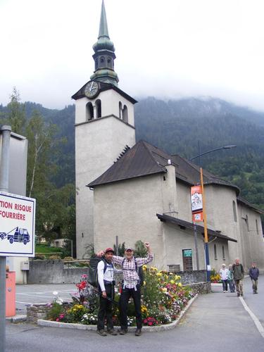
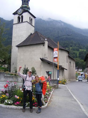
Arrival in Chamonix and Day 1 & 2
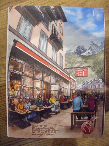
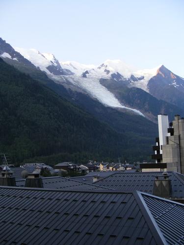
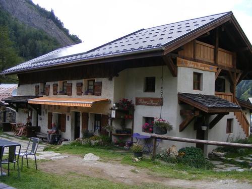
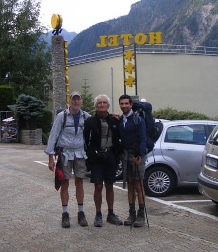
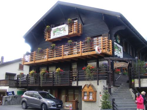
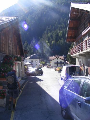
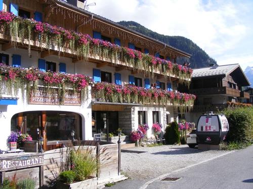
I arrived in Geneva on time to find Peter and Pavel waiting for me. In short order we collected our bags, headed over to the transport and by 1pm we were on the road to Chamonix. We arrived at l’hôtel Richmond, checked in, inquired about the bus for the morning, grocery stores and then proceeded to head into the village to find a place to eat. We settled on Elevation 1904 – a burger and beer joint. We finished eating sometime near 4pm at which time I was beginning to fade. Soon I’d have been awake for a full 24 hours and I needed to be awake until 7pm to ensure a good night’s uninterrupted sleep. Peter headed back to the hotel to nap and Pavel and I walked around Chamonix. I found a medium weight puff coat on clearance with a stuff sack – sweet! I’d been wanting one and it seemed that it might be useful on this trek. By 7pm we made our way back to the hotel. Peter and Pavel decided they were hungry for another meal and I decided to kick back, shower and go to bed. I was out before 8pm. Peter and Pavel returned to the hotel around 10pm but I never heard a thing. I awoke the next morning at 6:30am quite refreshed and ready to hit the trail.
The early forecast for this trip looked dismal. Pavel had joked he felt his investment in rain gear would not be lost. Thankfully – that proved to be wrong – the morning presented a clear blue sky – we couldn’t have been happier. We suited up, had breakfast and by 8:30am were on the bus to the Tourist Information Center (TIC) in Les Houches – the start of our journey. We pit stopped to grab snacks at the nearby market and began the hike.
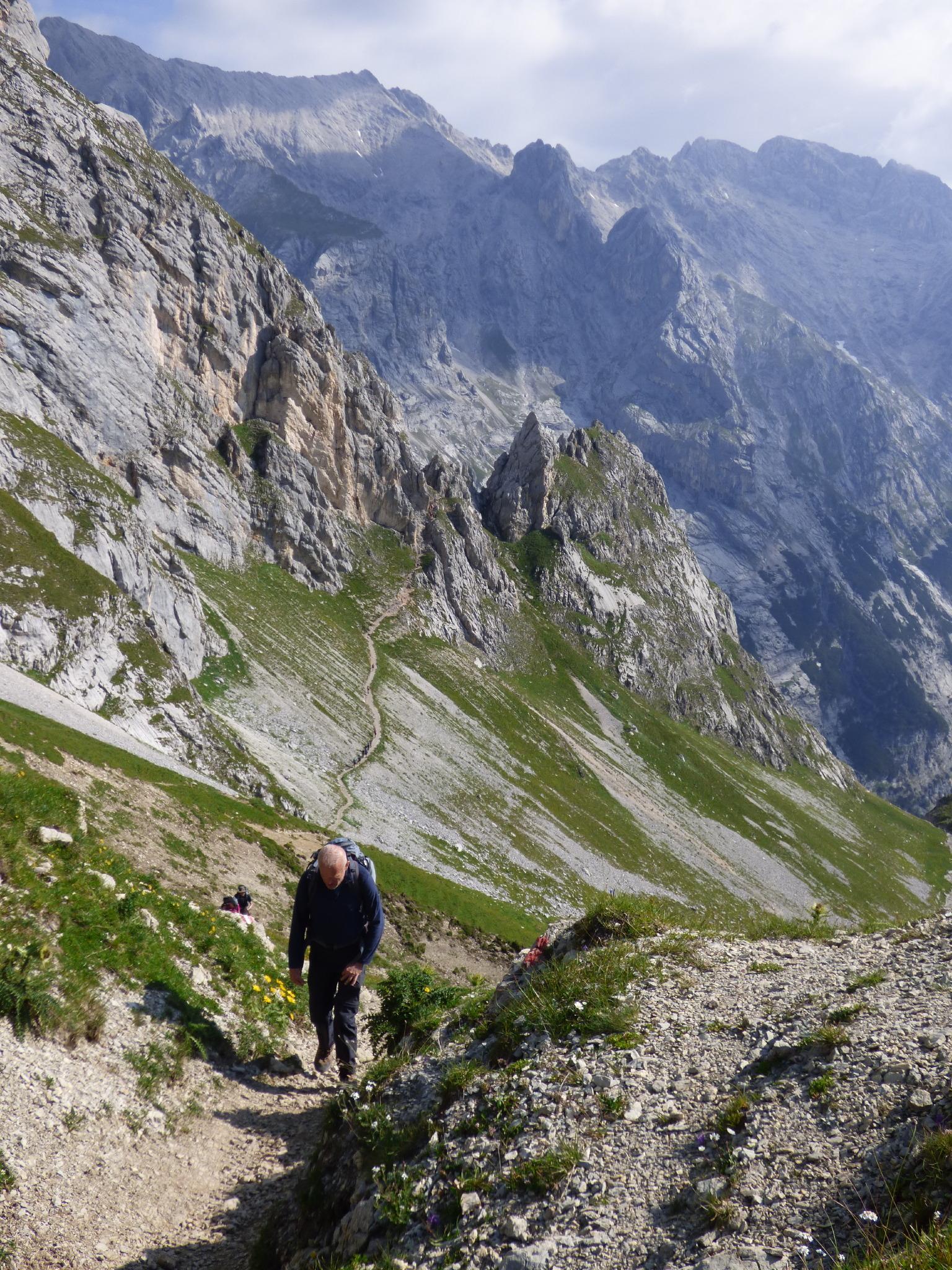
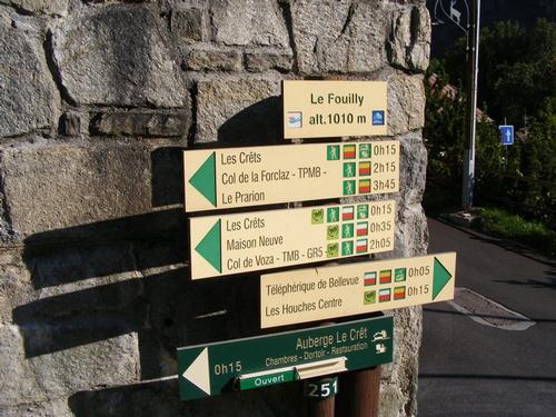
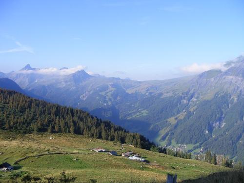
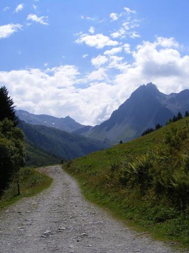
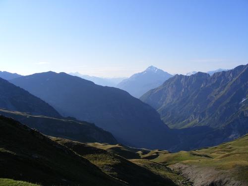
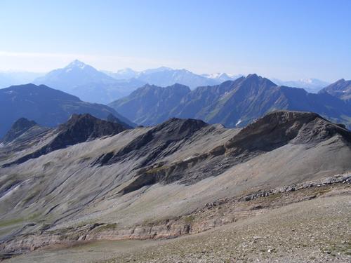
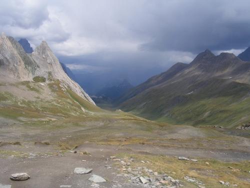
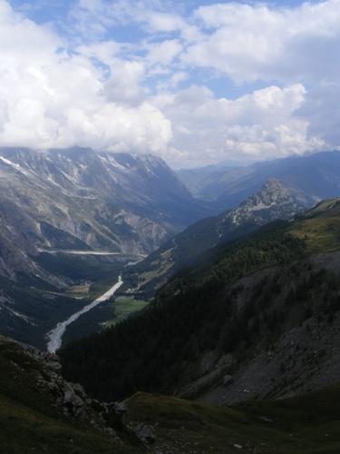
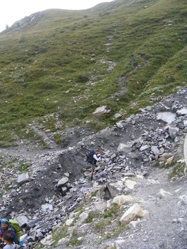
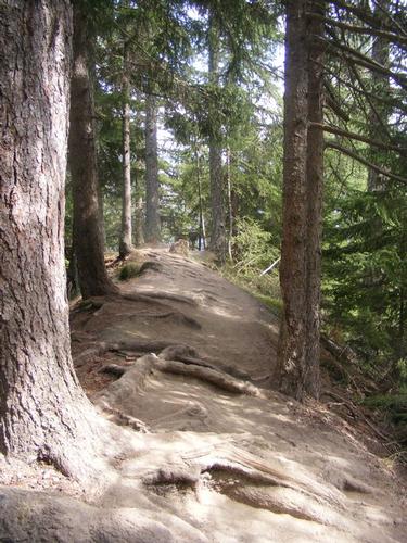
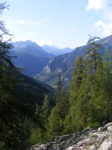
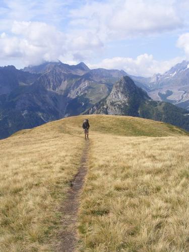
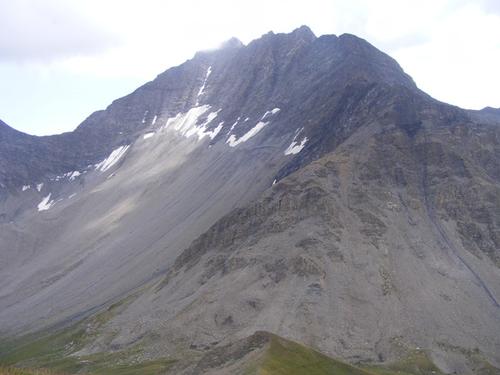
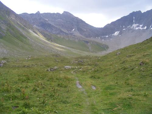
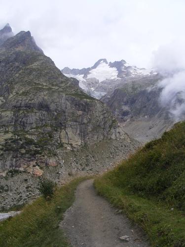
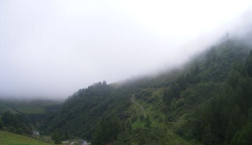
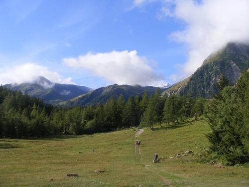
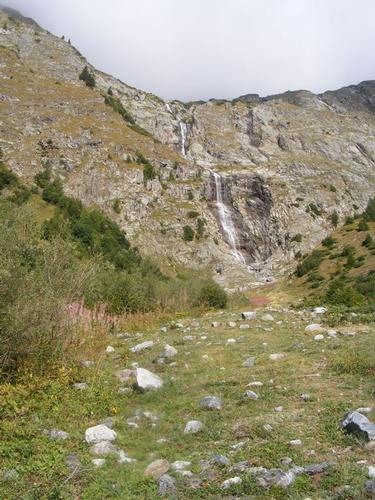
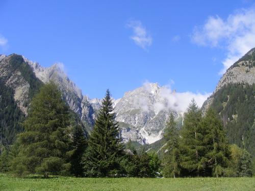
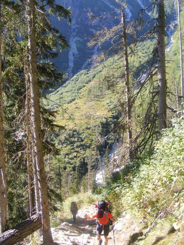
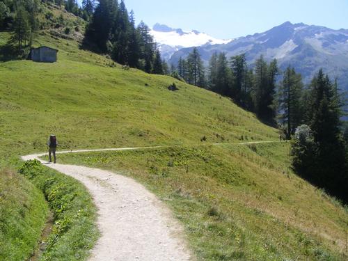
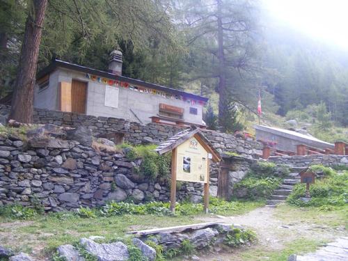
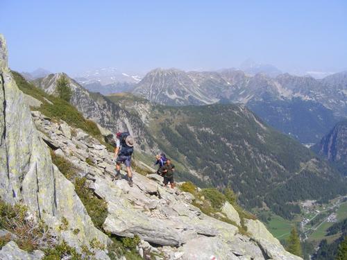
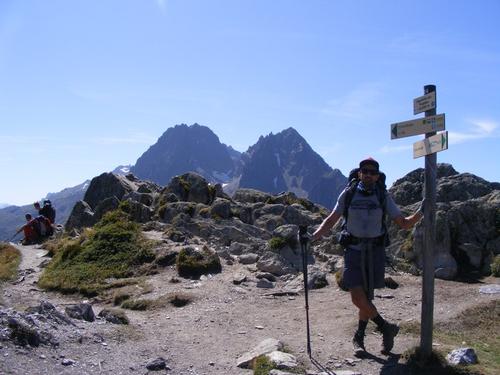
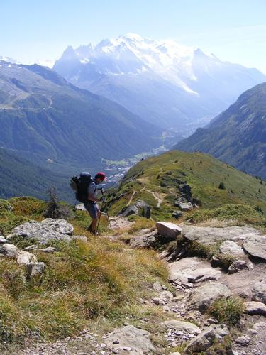
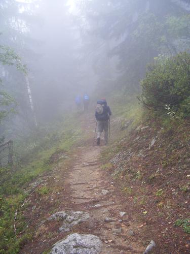
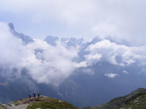
From the TIC we walked a short distance away from Les Houches to a small church where the trail sign for Col de Voza pointed us upward – and up we went! I had predetermined our trail selections well ahead of arrival. I had highlighted the traditional route, the recommended high routes for views and a more challenging hike, and the low routes for easy passage if the weather was simply not good. My goal was to walk every footprint of trail, take the high routes and spur paths to surrounding peaks in addition to the traditional TMB route. On this day the weather permitted us the high route.
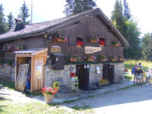
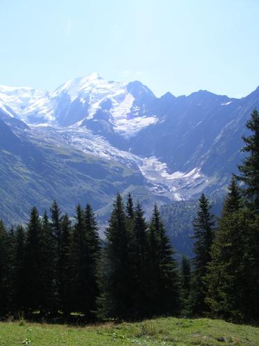
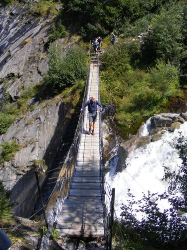
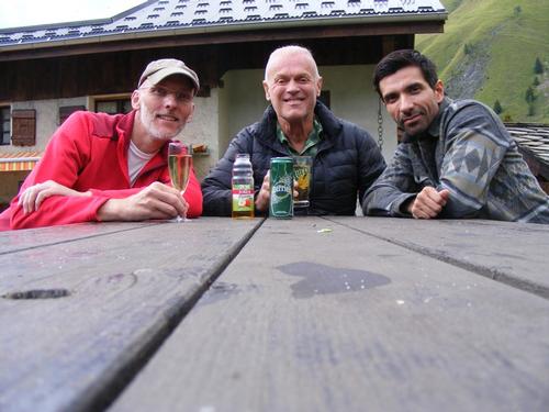
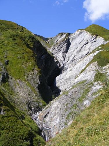
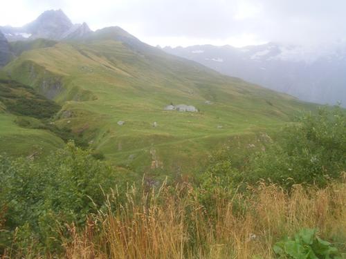
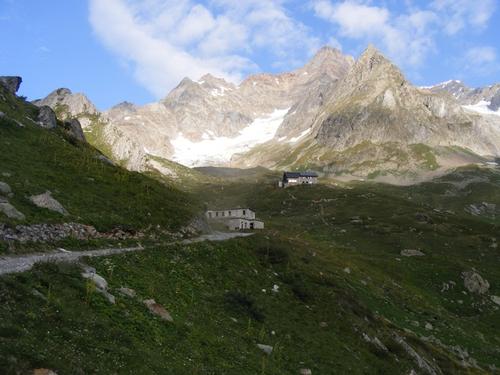
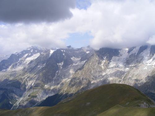
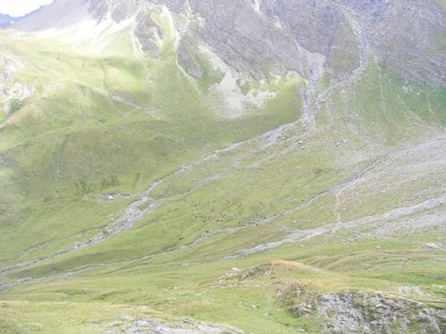
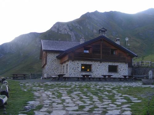
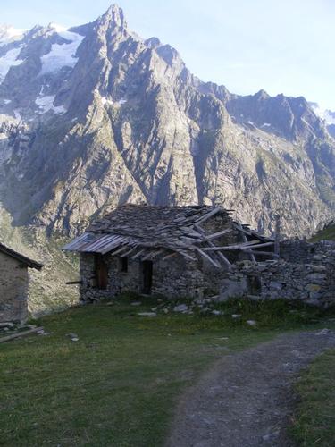
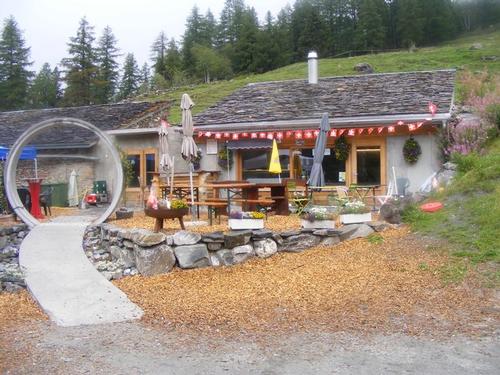
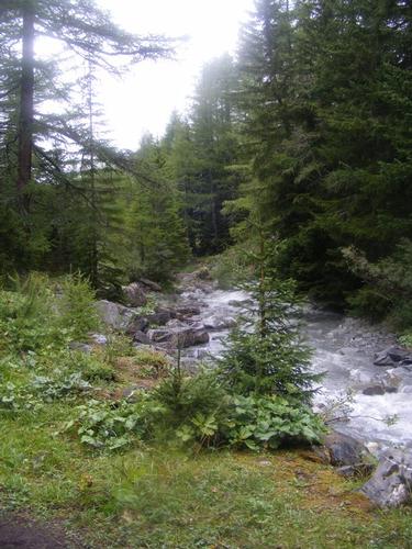
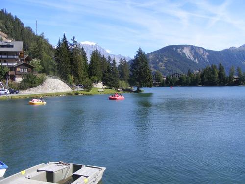
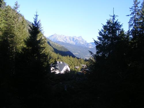
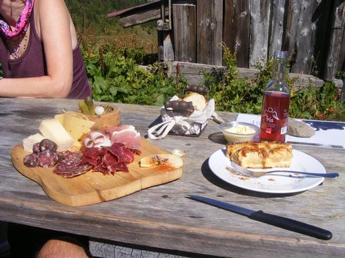
The hike up to Col de Voza was uneventful. The scenery was just beginning. The best views were looking back over the village of Les Houches. At Col de Voza we took a break and all had refreshments and a snack at the café. At Col de Voza we left the traditional TMB route for the higher route via Col de Tricot. This route afforded us beautiful, if not up close, views of Glacier de Bionnassay as well as taking us through valleys, forested trail, over a Himalayan style bridge and rugged terrain similar to that of the White Mountains. By 3:15pmish we were at Col de Tricot overlooking Chalet de Miage and the Beaufortain region. By 4:30pm we were at the Chalet settling in for the night. Dinner was salad, potato and cheese omelet, a modest cheese plate and desert – Tarte de Myrtilles
I’m going to quote mileage and elevations from the trail notes provided. The actual may vary slightly due to adding distance when taking the high routes or summiting a point of interest off a spur path. This day was 15 Kilometers and 980 meters of ascent – BRILLIANT – and it was just beginning!!
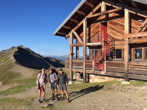
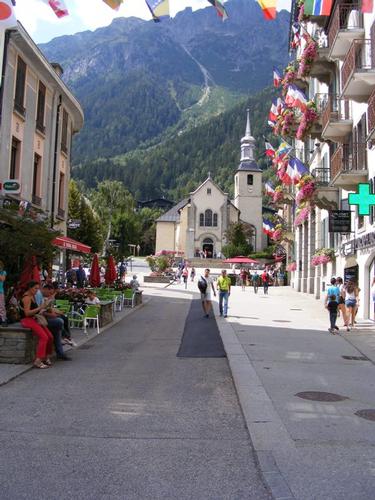
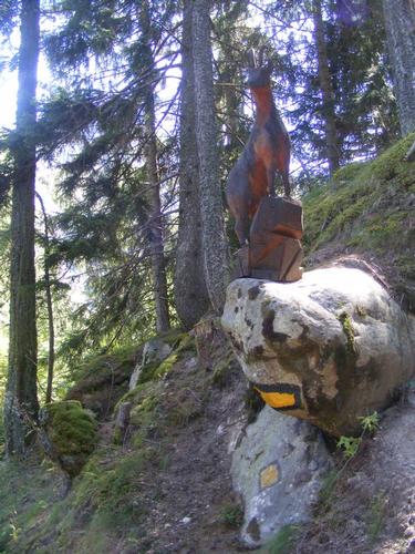
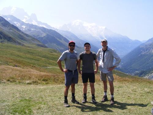
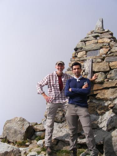
The photos, in order of appearance are: Church in the heart of Chamonix; Artistic photo of Elevation 1904; Glacier views from the l’hôtel Richmond; First TMB trail sign – destination Col de Voza; Looking back over the village of Les Houches; Café at Col de Voza; Glacier de Bionnassay; Peter on the Himalayan style bridge; Lunch in front of the Glacier de Bionnassay; Atop Col de Tricot overlooking Chalet de Miage; Chalet de Miage; The three of us celebrating day 1 with drinks!
Day 3
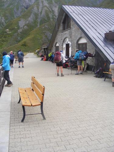
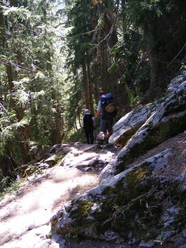
Morning comes early in the hut. Breakfast is usually served by 7am and hikers are up and packed before they eat. We, of course, were to be the last ones to leave the hut. We are hearty hikers and packing up after others have left is more pleasant as we aren’t working around everyone else.
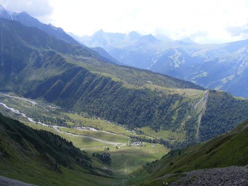
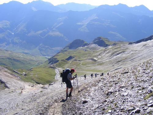
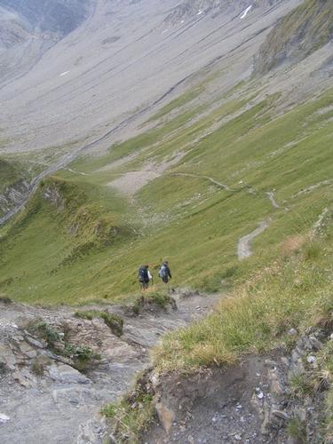
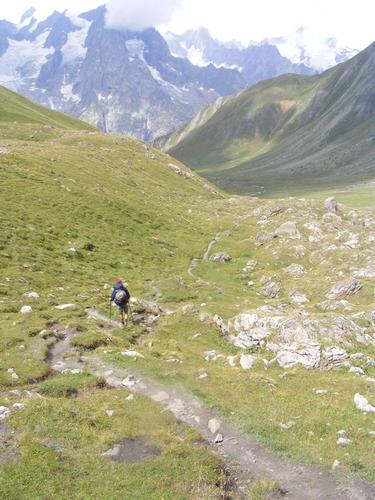
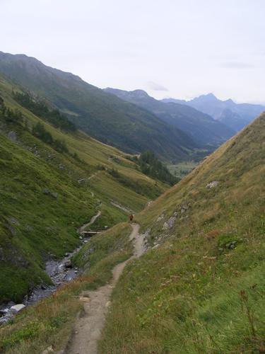
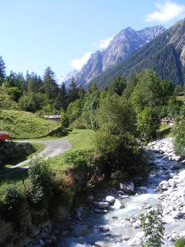
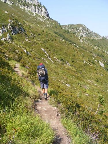
This day – as it turned out – was to be the toughest of them all. Descending to Chalet de Miage we lost over 560 meters. Departing from the Chalet we gained a small 200 meters to jaunt over Mont Truc which stands at 1,811 meters. Pavel and I took the spur path to the summit which gave us views mostly of the Beaufortain Region which is south of Mont Blanc. After Mont Truc, we descended into the village of Les Contamines where we replenished snacks at the local market. The descent brought us straight to the valley floor – having lost 650+ more meters. The only place to go from here was, gulp, up!
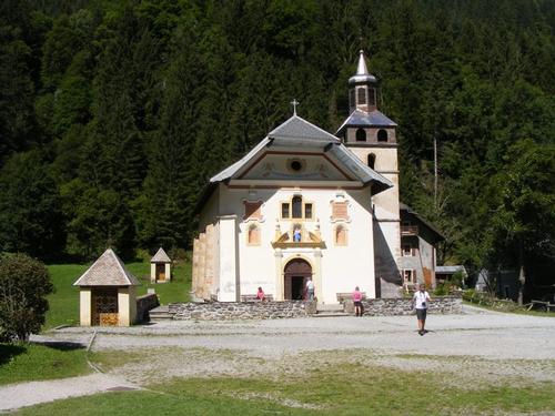
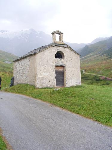
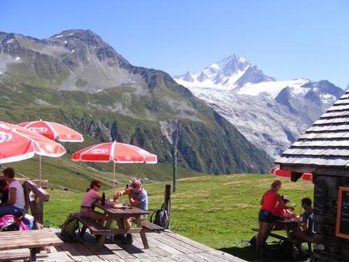
We left town and made our way along a flat stretch of the valley passing parks and recreational areas to soon arrive at the Chapel Notre Dame de la Gorge. Leaving Notre Dame is when the climb really begins. This section of trail is unique in that it was laid by the Romans – pretty cool. We make our way to Relais le Sollié where we indulge in a phenomenal lunch.
We left Relais le Sollié at 2pm which was really a bit later than we should have. We had plenty far to go. We passed Refuge du Nant Borrant and made our up and through Val Montjoie. We took a brief break at Chalet la Balm. In the distance, l’Aiguille de la Pennaz was perpetually visible. We could see our climb up to Col du Bonhomme to the left of the l’Aiguille. The day was stunning but dark clouds were forming and I knew we would not be arriving at the hut at 4pm! In the distance we also saw snow patches which we had to cross. Winter in August – how sweet!
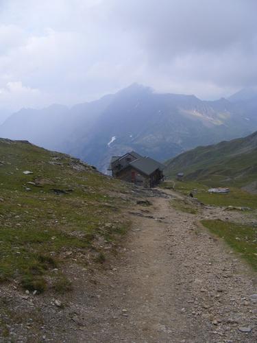
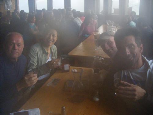
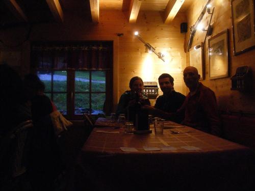
We finally reached the Col du Bonhomme around 5:30pm after a steady but strenuous climb. A few times we heard the rumbling of thunder and we still had about an hour’s hike to the hut. The temperatures were cooling so we put on some extra layers and steadily carried on. Within the hour we arrived at Refuge de la Croix du Bonhomme – a welcome sight indeed on this day. We checked in just in time for dinner – 6:30pm. Here we met a fellow hiker named Julie. We dined and shared drinks together until we called it a night.
This day was 20 kilometers and a whopping 1,590 meters of climbing – well done gents! No wonder we were tired - but I LOVED IT!!
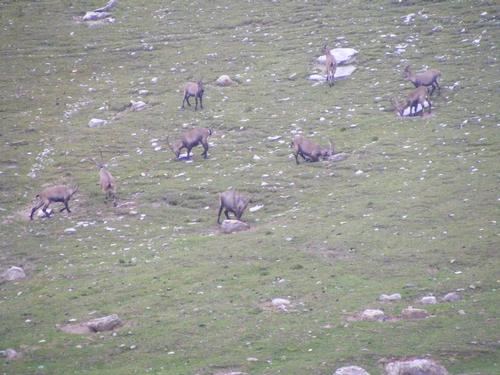
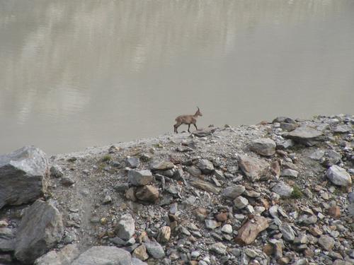
I inserted a blank page in the photos to make day two more identifiable. Photos, in order of appearance: Sunrise over the peaks from Mont Truc; Overlooking the valley descending to Les Contamines; Chapel de Notre Dame de la Gorge; The gorge itself; Lunch at Relais le Sollié; Upper Val Montjoie and l’Aiguille de La Pennaz; Climbing up to Col du Bonhomme; Looking back upon Val Montjoie; Pavel atop Col du Bonhomme; Herd of Ibex; Refuge de la Croix du Bonhomme; Enjoying drinks at day’s end!
Day 4
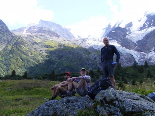
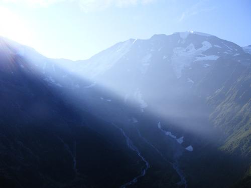
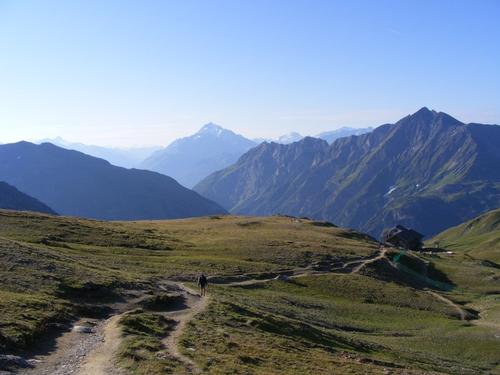
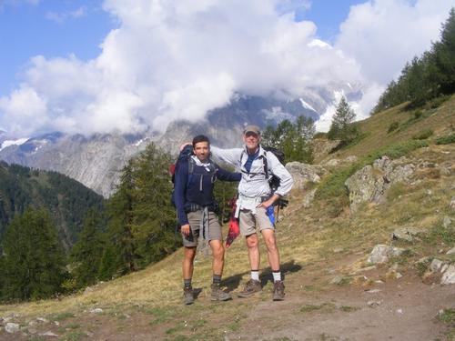
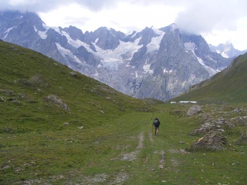
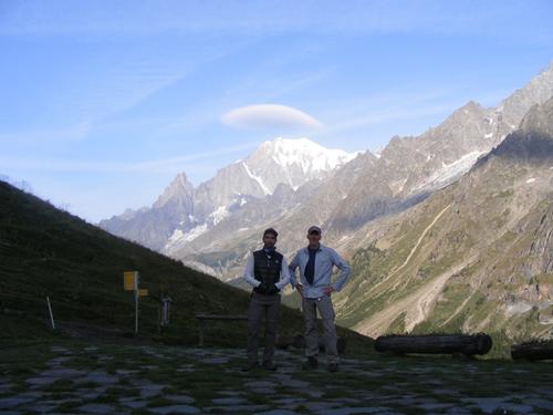
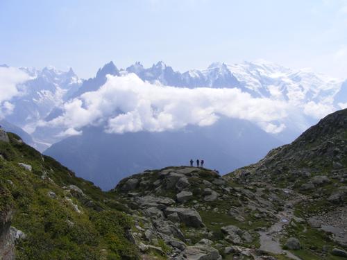
After concluding our second day just a bit tired and on the heels of dark clouds we awoke to the most crystal blue sky one could ask for. The main trip photo captures the morning beauty as the three of us set off onto the trail – simply stunning.
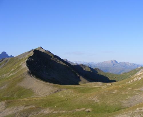
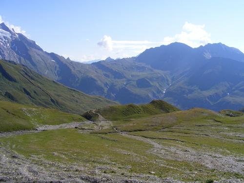
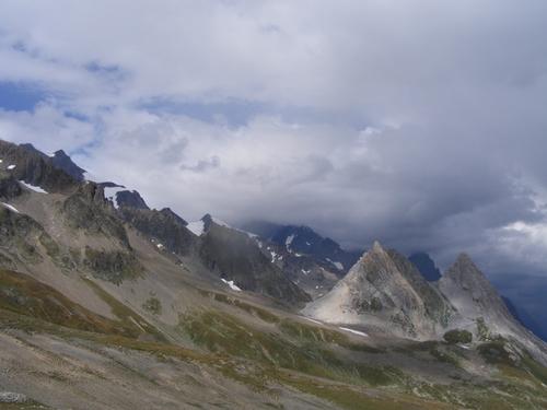
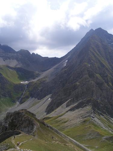
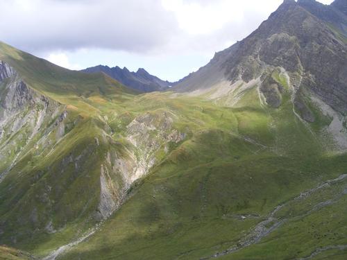
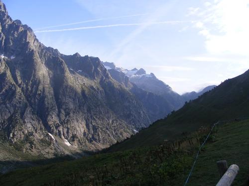
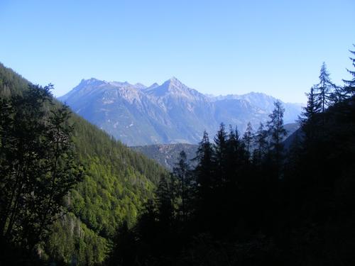
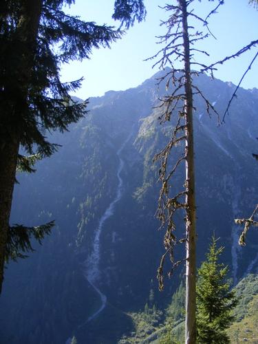
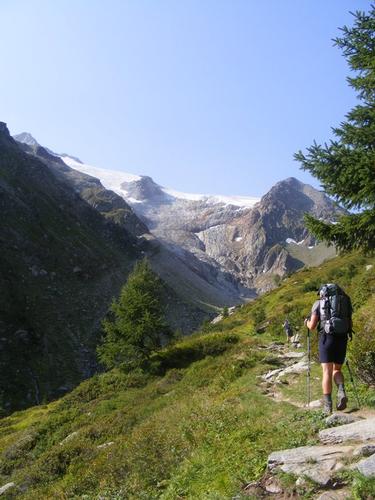
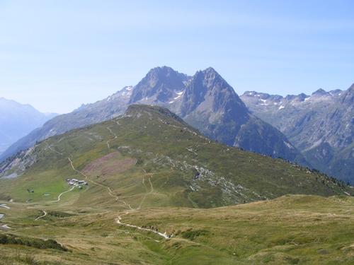
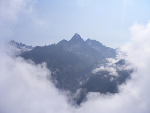
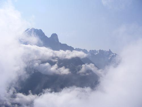
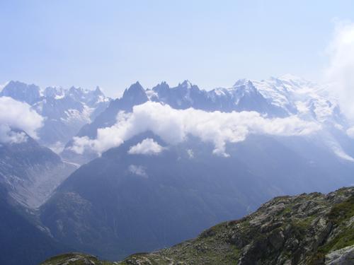
Another day – another variant – another high and rugged route – sweet! The trek starts by a short ascent up to Col des Fours. After a short bit of guessing – I realize the peak of Tête Nord des Fours is a spur path that peaks at 2,756 meters and offers stunning 360 degree views with the most amazing looking northward towards Glacier de Tré la Tête and its smaller counterparts Glacier de Mont Tondu and Glacier des Lanchettes. Notice also the stunning ridge path that sits behind us from the hut. This trail leads you into the Beaufortain region – I hungered for that ridge walk – it was an awesome sight. While waiting for a shower the night before, I chatted up two gents that were on that trajectory and they certainly left me wanting to do that trek but our time and direction did not allow. Maybe next year!!
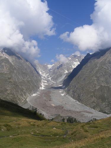
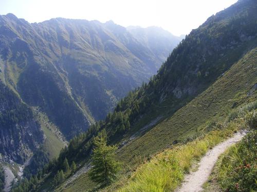
After summiting Tête Nord des Fours it was a quick descent back to Col de Fours where we begin the day’s journey into the Vallée des Glaciers. Glaciers are no longer the most prominent feature of the valley, but the scenery is stunning all the same. Plenty of icy patches remained but nothing that would encumber us in any way.
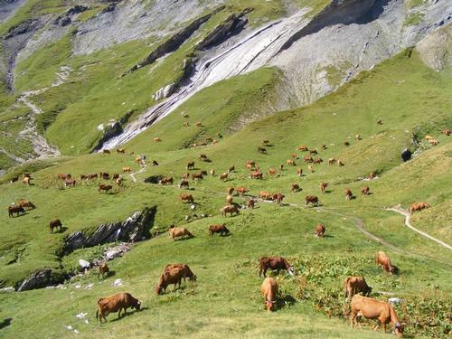
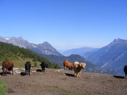
This day offered classic European hiking, a high start in rocky treeless terrain, a descent into greener pastures, passing herds of cattle and eventually settling into the tiny village of Ville des Glaciers. From what I could see the little hamlet was really a singular farmhouse with outbuildings and possible an additional home or two. Not much else.
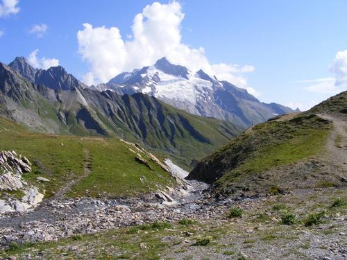
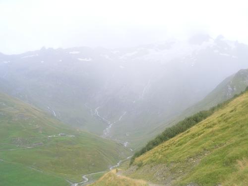
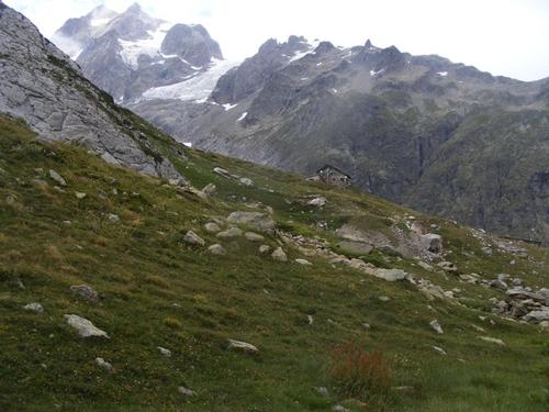
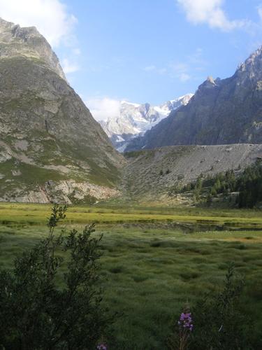
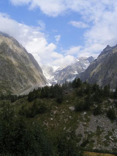
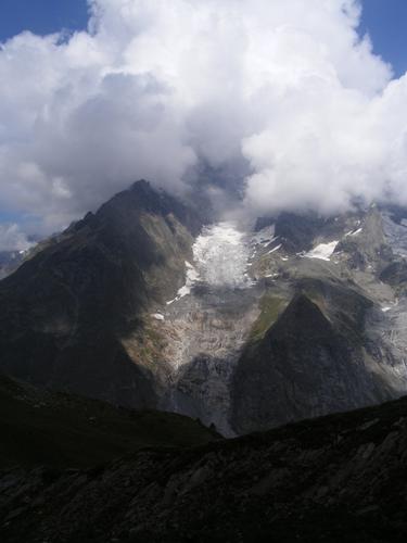
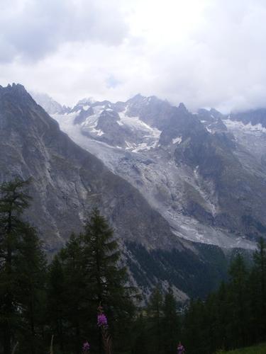
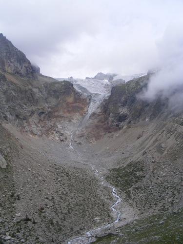
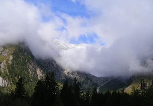
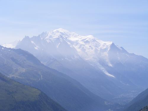
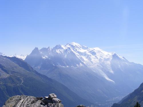
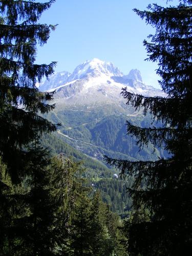
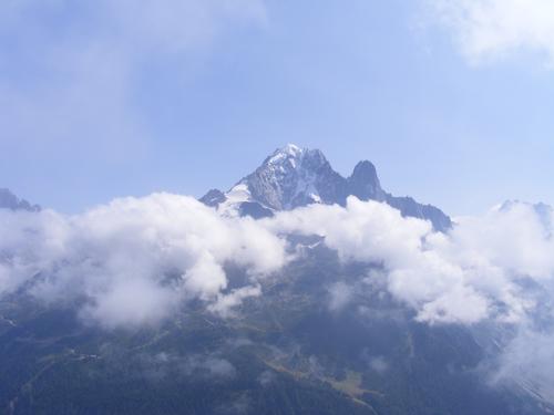
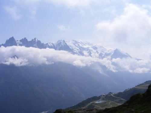
While the morning started bright and clear by the time we reached Ville des Glaciers the clouds were forming, grey skies settled in and a light sprinkle began. We opted to hangout in a covered area for about a half hour hoping it would pass – alas – it did not. We suited up in our rain gear and began the ascent up to Col de la Seigne. Col de la Seigne is notable because we were supposed to get our first “reveal” of Mont Blanc/Monte Bianco in addition to leaving France and crossing into Italy. The good news is the rain did stop by the time we reached the Col but the skies were still pretty thick with clouds. Views of Mont Blanc were non-existent so we’d have to wait another day before the centerpiece of the hike revealed itself.
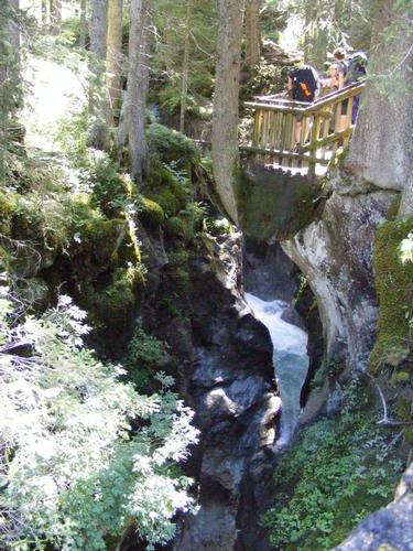
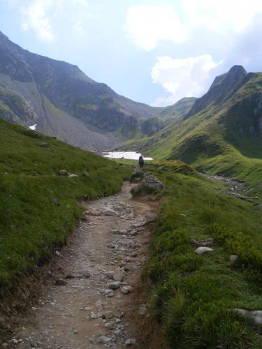
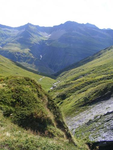
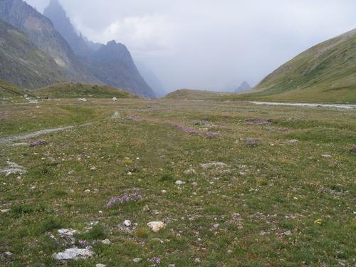
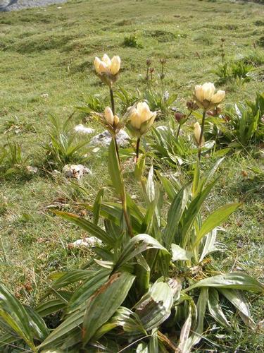
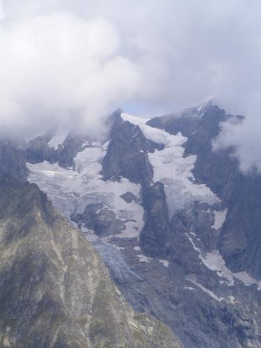
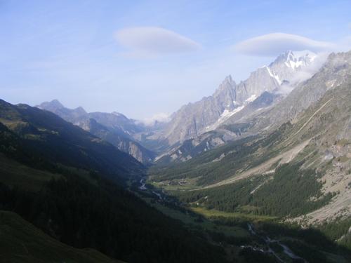
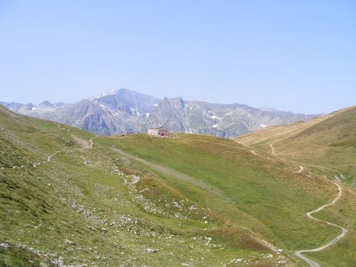
We began the descent into the Vallon de la Lée Blanche. Just beautiful. Although dark clouds rounded out the afternoon theme, the wild flowers were in abundance. Too many to show but I uploaded a favorite. We saw many marmots along this stretch as well. We also pit stopped at La Casermetta, a sort of tourist information center at the heart of the descent from the Col – both interesting and odd - but informative. It offered a history of the TMB as well as serving as a welcome to Italy center. They also had a huge 3-D map of the TMB and it was pretty cool to see the whole hike we had chosen to undertake. We carried on from here to arrive at Refugio Elisabetta – stunningly located directly beneath the Glacier de la Lée Blanche and its much smaller counterpart, Glacier d’Estelette. We concluded the day – you guessed it – with drinks. We all arrived at the hut by 5pm. Mileage was 16 Kilomters with total elevation gain on this day a more modest, yet robust 1,026 meters with the high point being 2,756 meters.
Photos in order of appearance: The morning looking into Vallée des Glaciers; View of the ridge path into Beaufortain region; Looking back at Refuge de la Croix du Bonhomme; Glaciers de Tré la Téte from Tête Nord de Fours; Looking westward from Tête Nord de Fours; Descending into Vallée des Glaciers; The next five are views in the Vallée des Glaciers; Chapel in Ville de Glaciers; Grey skies and ascending up to Col de la Seigne; Grey skies looking back into the Vallée de Glaciers; Clearer skies overlooking the Vallée des Glaciers; General scenery ascending Col de la Seigne; View into Italy/Vallon de la Lée Blanche from Col de la Seigne; Pavel and Rob at Col de la Seigne; View into Vallon de la Lée Blanche; View of the Vallon de la Lée Blanche; Vallon Flora; Refugio Elisabetta below Galcier de la Lée Blanche; Drinks!
Day 5
As has been the cycle of weather – our 4th day on the trail was to start sunny and bright but it would seen become a day of mixed clouds, low on the horizon and seemingly always threatening to open up and drench us. It never rained, but the clouds were periodically heavy. Sadly, Mont Blanc/Monte Bianco did not reveal herself and yet – this is the highlight of Val Veni. Regardless – the views were stunning and we took in what we got.
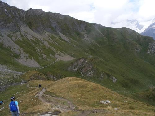
We left the hut well rested and in good spirits. Today was going to be a light day by comparison of the last three. With minor exception of taking the high route – all our time was going to be descending into the valley to Courmayeur. Naturally I opted for the high route for good views – but it’s also a hike – so we have to work it a bit, lol.
Rifugio Elisabetta was a highlight. The setting beneath a glacier, an amazing meal of Risotto, Pork and side dishes and panna cotta for desert was perfect. Peter and Pavel preferred red wine – I always went Rosé when available.
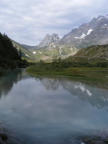
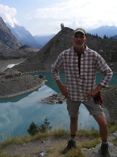
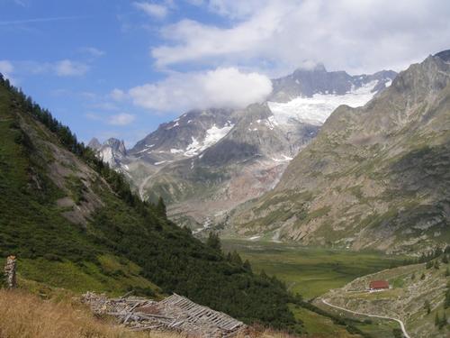
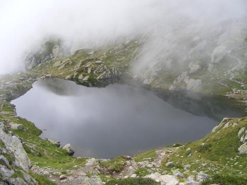
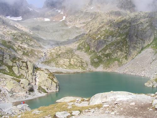
We made our final descent over the lip of Vallon de la Lée Blanche and into Val Veni. In doing so we passed the beautiful Lac de Combal where we delighted in grand views of the valley behind and in front of us, and of course, the jagged mountain peaks and glaciers. Our first and only detour of the day was to Lac du Miage – a glacial fed turquoise colored lake. Gosh I wanted to skinny dip in those waters – I could just taste the moment. The weather was always pleasant (with minor exception) it just wasn’t super hot – I passed – perhaps I slightly regret it!
From Lac du Miage we began the modest 350 meter ascent via L’Arp Vielle Supérieure. The trail was a mixture of open fields, glacial moraines, crossing some land slide remnants and passing through a few forested areas. This trail was amazing for its depth, beauty and overall moderate nature of ups and downs – just beautiful. We had perpetual views of Val Veni and across the valley glaciers were ever present. The dominant glacier of the day was Glacier du Miage but on this day I did not track which glaciers I was photographing – it was a long stretch of beautiful sights so I just too it in.
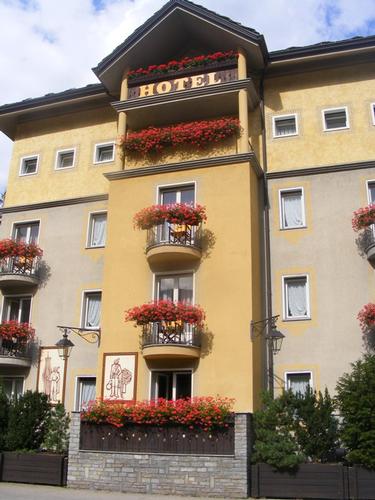
By 1pm or so we had reached Refuge Maison Vielle where we stopped for lunch. The hut sits smack in the middle of a ski area which was very much under construction. Our trail notes warned us to expect a lot of development as we approached the descent into Courmayeur and right they were! From here it was downhill into Courmayeur. The TMB path is adjacent to a ski lift, but in trees, and descended steeply and quickly. Not to worry – the next day would be our rest day so we had no place to go and we could take SHOWERS and do LAUNDRY while in town. And of course – finish the day with drinks! Our time in Courmayeur held a surprise though….. check back soon for Day 5 updates!!
Overall elevation gain for the day was 500 meters and 17 kilometers of trail time – sweet!
Pictures in order of appearance: Sunrise from the hut over Vallon de la Lée Blanche; Looking back at Rifugio Elisabetta; Entering Val Veni; View of Val Veni over Lac Combal; Rob at Lac du Miage; Ibex at Lac du Miage; the next 7 photos are glaciers and views into and across Val Veni; Pavel crossing a landslip; the next two photos are more glaciers; lunch at Refuge Maison Vielle; Path into Courmayeur; Emerging on the edge of Courmayeur; Hotel Boutin D’Or.
Day 6
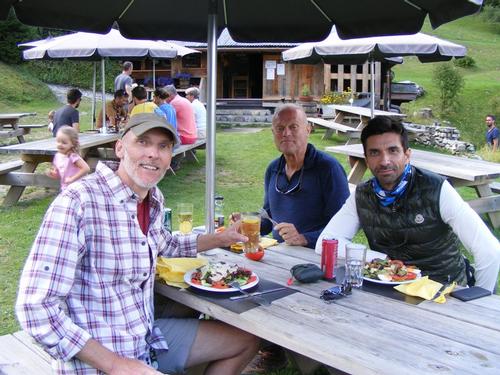
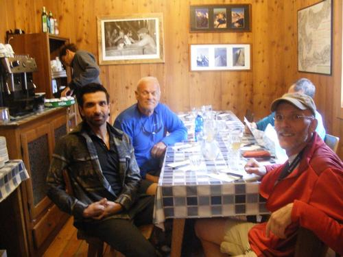
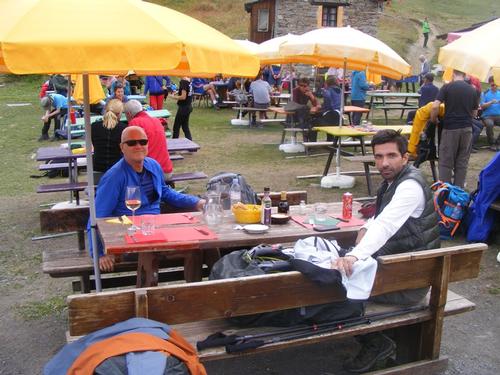
At the end of day five as we were meandering the streets of Courmayeur in search of the hotel it was to my great delight that we bumped into Luciano – hiker extraordinaire – from Boston – A sweet surprise! To be fair, I had arranged to meet Luciano in Courmayeur but did not anticipate crossing paths with him in such a serendipitous way – big hugs were had!! We set a time to meet at the hotel where we’d all go out to dinner.
Dinner that night was a feast. It was wine, pizza, pasta and a treat arranged by Luciano - a generous round of Génépi – yum! After much conversation and many laughs… we retired to our hotel for a solid night’s sleep – our first night in beds after four consecutive nights in bunkhouses.
Morning comes early – after being on the trail our bodies were trained to rise with the sun. The hotel had an amazing breakfast spread of jams, quiche’s, cookies, tarts, breads, croissants, fruit salad, coffee, teas, cheese and more – a welcome change from the standard bread and jam in the huts. We indulged.
It was in Courmayeur we had to bid adieu to Peter. Peter has been on the trekking circuit a lot over the summer and he was also scheduled to start another trek the very day this one ended so a little R&R between the two was needed. A total bummer because we would miss him.
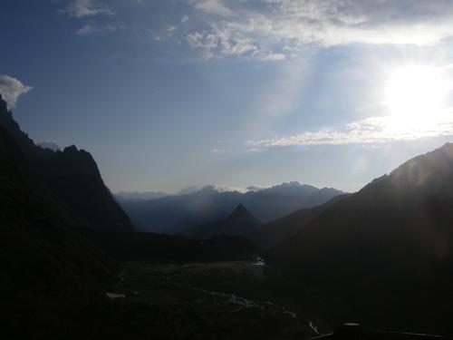
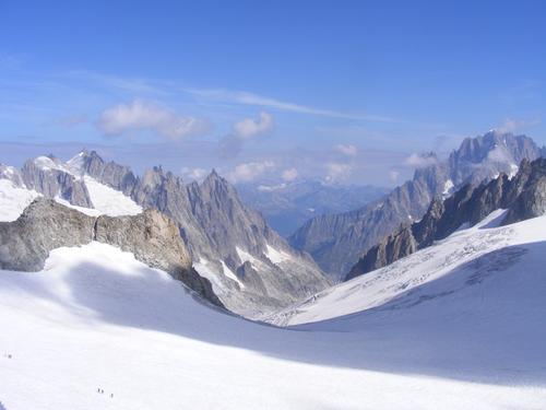
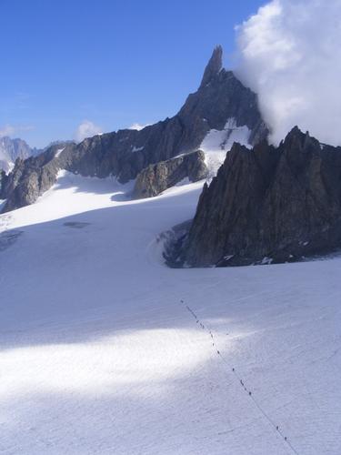
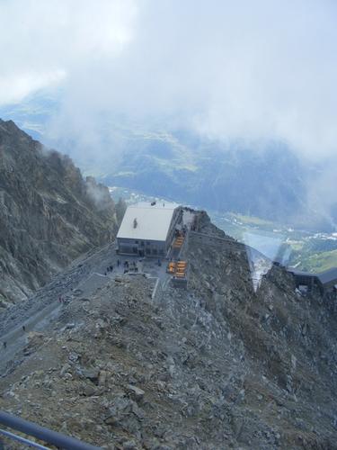
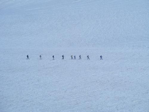
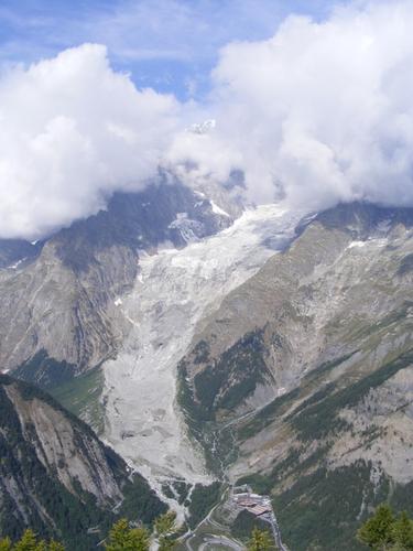
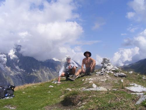
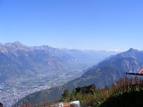
With clear skies, and not knowing how long they’d last, Pavel and I set off for the Helbronner Skyway to Monte Bianco. The skyway was supposed to take us up and over the Monte Bianco massif and over to the Aiguille du Midi. From there we’d take the tram down to Chamonix and the bus back to Courmayeur via the tunnel that connects the two towns. A journey highly recommended by our outfitters. Unfortunately the skyway was disabled between Helbronner and Aiguille de Midi so we didn’t get to experience the full traverse but being up at 3,466 meters atop the Monte Bianco glacier was still sweet.
I’m only uploading a few photos – I took hundreds – but showing the best of the portfolio. Make note of the hikers – the tiny little dots – traversing the glacier. Envy is not a desirable trait in people but I will admit – I wanted to be there with them. It gives me pause and has got me thinking – I can do that, maybe. There is also a hut that sits below the lift perched right on the edge just next to the glacier. It was just amazing.
The remainder of the day was light shopping, lunch, some sleeping, then dinner. Luciano graciously got reservations to a delightful restaurant where once again we feasted. I went a bit lighter this evening because I was feeling mighty full. It was very good FOOD, and WINE, and GÉNÉPI. We said our goodnights and retired to the hotel. The next morning Luciano saw Pavel and I off as we began day 6 on our trek to Rifugio Bonnati!! The last photo is a preview of the hike – we would be climbing up and over Mont de la Saxe – weather permitting – stay tuned!
Photos in order of appearance: Summit of Mont Blanc/Monte Bianco looking towards Chamonix; Hikers and view of Dente Del Gigante; Mont Blanc/Monte Bianco Summit; The Hut; Hikers on the Glacier; View of Mont de la Saxe & next day’s high route hike; Saying goodbye to Luciano!
Day 7
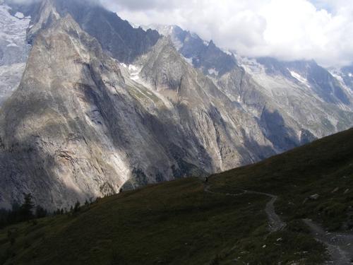
After a well deserved rest day we meandered our way to the church and said our goodbyes to Luciano. The morning was overcast but promised to clear. This was going to be a brilliant day because thanks to the initial weather forecast – the high route of Monte de la Saxe was the path of choice – rock on!
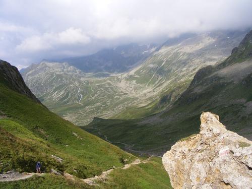
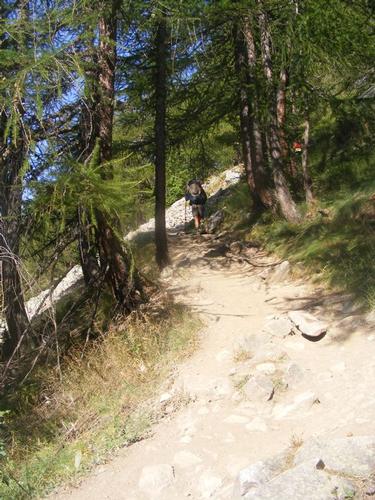
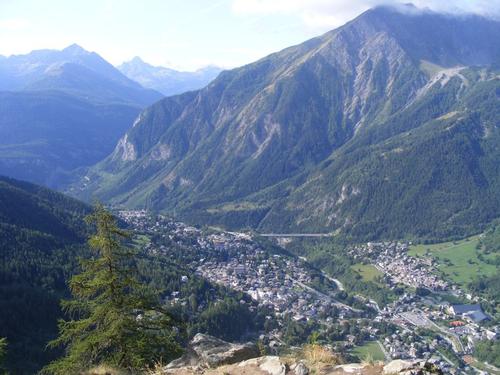
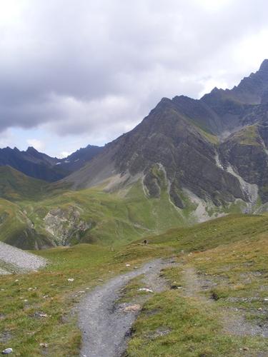
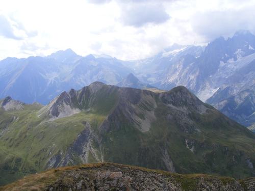
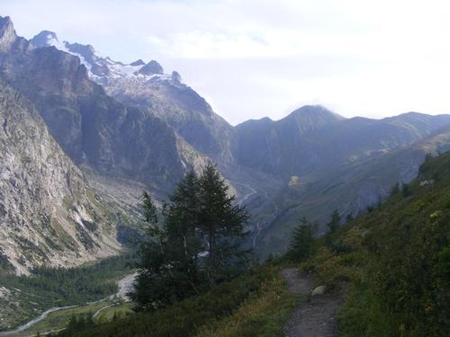
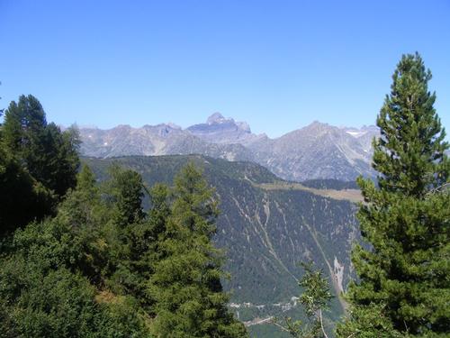
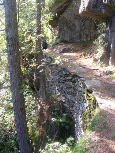
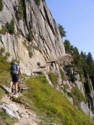
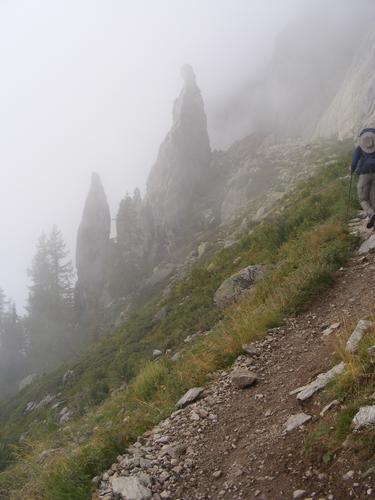
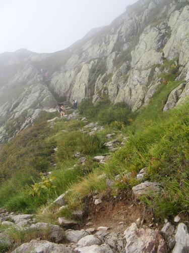
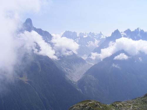
The trail was up hill from the church. The first section of trail enters the forest after about a 1 km walk leaving Courmayeur through Villair. It quickly steepens but thanks to switchbacks – a very pleasant ascent giving views of Courmayeur below. By mid morning we reach Rifugio Bertone and emerge from tree line. Throughout most of this adventure we seemed to pass huts too soon for lunch – they were in high gear cleaning up from the morning guests departure and gearing up for the lunch crowds to come. Pavel and I were surprised at how quickly we ascended the 640 meters but we also had an early start. At this juncture in the trip – we were trail fit and we felt good. We bought lunch at the hut and did a quick weather check. The morning overcast cleared while hiking up to the hut but in the distance you could see a variable mix of white, gray and black clouds – it left me a bit uncertain. This was no day to get caught in a thunderstorm – once atop Mont de la Saxe there was no protection and no easy way off. A short discussion and up we went. To our delight – the clouds swirled in high fashion creating dramatic views of the glaciers and surrounding peaks and casting shadows deep in the valley – but it never rained - suhweet!! We were very much alone on this route most of the day. We encountered a few folks at the summit while lunching and only a few hikers afterwards – this was perhaps the quietest stretch of hiking we had thus far.
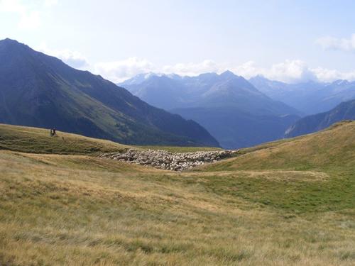
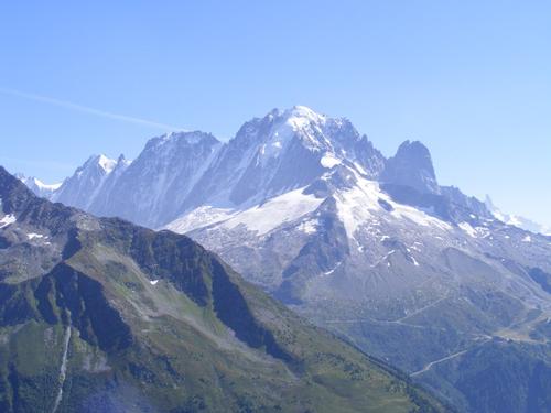
Mont de la Saxe tops out at 2,584 meters at Tête de la Tronche. I have a special place in my heart for ridge walks and I dare say – Pavel fell in love with Ridge walks on this day – he got it! To our north were views of Val Ferret and to our south were views of Val Sapin – all the while having distance views of Val Veni from where we came a few days earlier and stunning views of the Mont Blanc massif. Our pace slowed tremendously as we soaked in the traverse along an open grassy field. We even passed shepherds tending their flock of sheep.
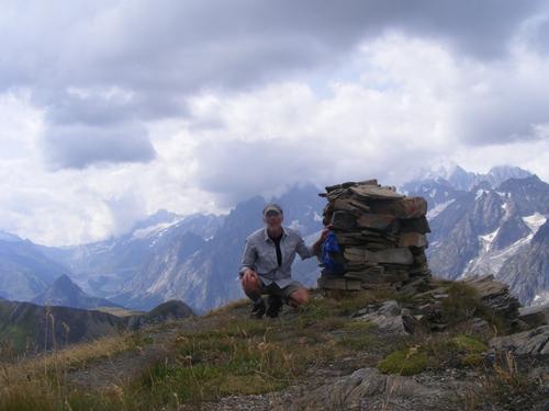
After eating lunch atop Tête de la Tronche we began to make our way down to Col Sapin. From Col Sapin we descend into the valley, crossing Torrent d’Armina and began to ascend towards the col at Pas entre duex Sauts. It is here we have a spur path to Tête entre deux Sauts. The beginning of the path is not well defined. This peak, topping out at 2,728 meters is not well traversed – the path was a mere 12 to 15 inches in width, at times, no wider than a single boot print. Pavel opted to stay put and I chose to summit. The views were dramatic and breath taking – my two favorites being the one of Mont Blanc, though slightly in the clouds, and the view looking back to where we had lunch atop Tête de la Tronche – the vastness of the region was amazing. The summit was tiny and I dared not venture to close to the edge – but I managed a selfie crouched down by the cairn.
I rejoined Pavel and we began the descent into Vallon de Malatra. It was all downhill from here. Vallon de Malatra was amazing and throughout this hike Glacier de Leschaux was prominent as were many of its smaller counterparts – utterly breathtaking.
It was getting dark, gloomy and cold on arrival at Rifugio Bonnati. We quickly settled in for the evening and were glad to see the hut. We nailed 1,924 meters (with spur path peaks) and 14 kilometers this day – we earned it and we loved it!
Pictures in order of appearance: The first three are the climb up to Rifugio Bertone, the third looking down onto Courmayeur; the next two are Pavel and I below Rifugio Bertone and the hut itself; View of Glacier de la Brenva; View of the Mont Blanc Massif; The next three are the open grassy fields of Mont de la Saxe; Pavel and I on the summit of Tête de la Tronche; Another view of the Mont Blanc Massif; Looking down to Col de Sapin; Glacier views; the next three are valley views heading to the col Pas Entre deux Sauts; the next four are views from the top of Tete entre Deux Sauts; the next four are views with Vallon de Malatra concluding at Refugio Bonnati.
Day 8
Rifugio Bonnati was a bit special. The hut looked new – certainly it had been renovated in the last few years. It was, of all the huts, the most contemporary with spacious showers and bunk rooms – there was room to spread out here. Dinner was fabulous and we got to catch up with Julie, John and Annalisa from Manhattan, our friends from Ireland and Vivian and her German husband who reside in Florida. (Sadly I don’t remember everyone’s names!!). This seemed to be a central stopping point.
The morning was BEAUTIFUL – a blue sky with light whispers of clouds – score – another gorgeous day on tap!
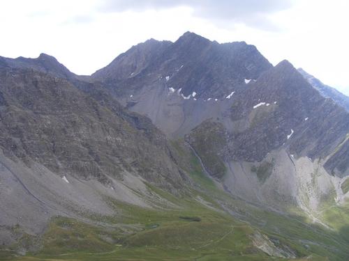
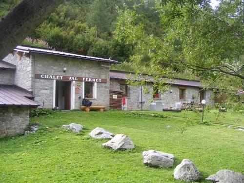
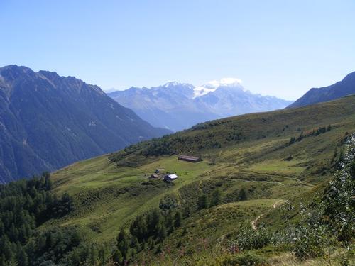
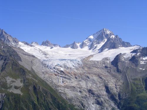
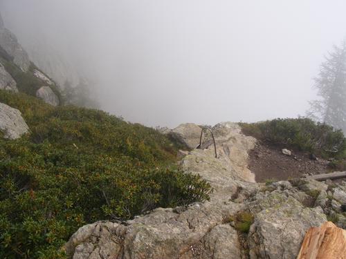
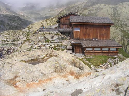
Today was another trip milestone – our time in Italy would come to an end and we would arrive in Switzerland! We departed Bonnati and hiked along a beautiful path that kept us at a relatively constant elevation as we traversed towards Arnuva taking in views of the glaciers and valley. Interestingly the trail took us down into valley to Arnuva for a 253 meter drop. By this point 253 meters was not a big deal but we didn’t really need to pit stop at the café as a short 320 meter ascent would bring us back up to Rifugio Elena. The map did not indicate a trail keeping us at level elevation but I did notice evidence of a herd path that connected to the main TMB route on the other side of a small ravine. Regardless, we arrived at Chalet Val Ferret where Pavel and I bought desert (they were rocking scrumptious). We began the ascent and a short bit later arrived at Refugio Elena. We marveled at this huts placement as well. It sits across from the Glacier de Pré de Bard and Glacier de Triolet – just stunning. The hut also looked recently renovated and was equally as beautiful on the inside. We took a short break here and also bought lunch for the trail.
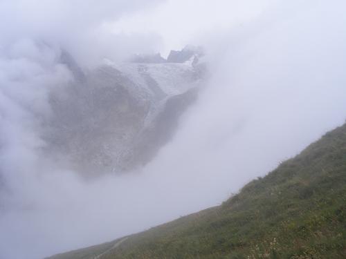
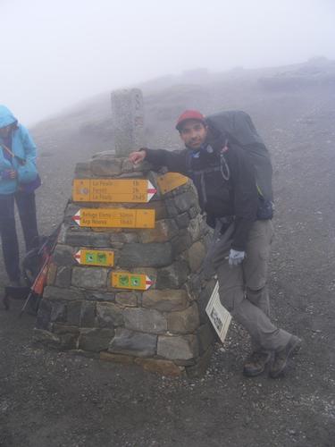
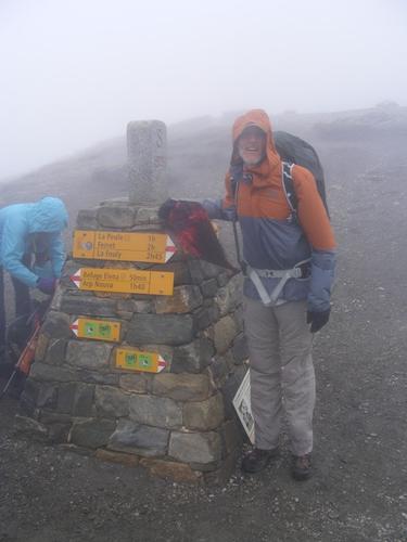
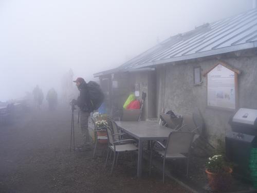
Interestingly – we had to gear up. The weather was taking a fast turn and we began to get fogged in. We were slightly disappointed because we would not be getting the views from Col Grand Ferret. It wasn’t long during the ascent from Rifugio Elena to Col Grand Ferret that the wind, rain and colder temps settled in. We reached the Col, snapped a few photos, celebrated our arrival to Switzerland and quickly shuffled over to get out of the wind. We found a spot for lunch and quickly gobbled it down – it was cold and we needed to keep moving to stay warm. The dense fog had me pulling out my map a few times to confirm our location. Spur paths to Tête de Ferret, Petit Col Ferret and a Balcony path to Ferret via le Plampro that offered high views of the valley were on the agenda but because of the weather had to be bypassed – no need for extra kilometers if weren’t getting the views. We soon arrived at La Peule (a café) where the weather was still drizzling and fog super dense. We carried on finally emerging from the dense fog at a café above the village of Ferret. We pit stopped for hot drinks while enjoying our previously purchased deserts. We made our way to Ferret and picked up the TMB off the main road onto a forested path which emerged just above La Fouly. A short few minutes later we found ourselves at Auberge des Glacier enjoying drinks with Skyler!
At 19 kilometers this was a longer day than the previous but made faster and shorter due to the weather and a modest 800 meters of ascent. Great views in the morning and tough weather for the afternoon but an enjoyable adventure!! Here we met Skyler from the US, David from Belgium and a group from Spain. We’d see David a few more times before trips end – and that my friends – was a good thing – for he was very easy on the eyes!
Photos in order of appearance: Mont Blanc from Rifugio Bonnati; Looking North over Val Ferret; Old farm house along the path; Looking southward from where we came; Hiking down to Arnuva; Chalet at Arnuva; View of Glacier Pré de Bard hiking up to Rifugio Elena; Looking back towards Arnuva; Rifugio Elena; Glacier de Pré de Bard; Getting fogged in; Rob and Pavel at Grand Col Ferret; Pavel at La Peule; Looking back at the trail from which we emerged; The café we rested at; cottage in Ferret; Wooded Path; Auberge des Glacier; Skyler, Pavel & Rob – Drinks!
Day 9
After concluding the previous day on a very wet and foggy note we awoke to clearing skies. We’d been fortunate on this trek with weather and we were once again to be treated to one of the most beautiful days one could have. Moderate temps in the high 60’s, a cool breeze and clear skies. To our surprise it had snowed at the higher elevations and in one of the photos I uploaded – the snow capped Grand Col Ferret can be seen. By day’s end it was gone – but it spoke to how quickly conditions can change at these elevations and the importance of getting over mountain passes if the weather is foul sooner than later if it is safe to do so.
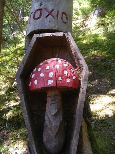
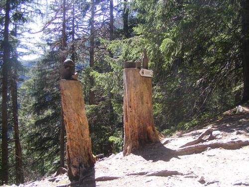
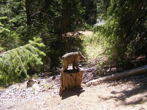
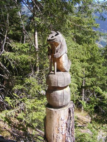
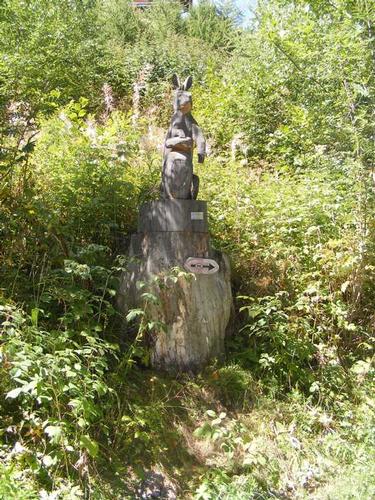
This day was anything but demanding. We adopted a very moderate pace, enjoying the valley, the views, a long lunch in Issert and arriving in Lac Champex with a little time to spare. Along the way a section of trail was dedicated to displaying various pieces of sculpture which really made this day a super sweet and charming walk through the valley and woods.
Our trajectory took us from La Fouly to Prayon to Praz de Fort to Issert concluding in Lac Champex. Photos are views along this route with no specific geographic point of interest other than being nestled in the region of Val Ferret always looking up to and sourrounded by peaks and glaciers.
In Champex Pavel took a tour of the town and found a café to relax in while I headed to The “Champex” Artillery Fortress. Known as Artillery Fortress A46 – it was classified as a military secret until 1999. The fortress was built during the second world war to defend Grand St-Bernard Pass. Invisible to the ordinary public, it is built under the Mont-Blanc and Grand-Combin ranges. A46 was an active military installation until 1998 and has a network of 600 meters of galleries, airlocks, anti-blast doors, mechanical, artillery, sleeping and eating quarters. Much of its contents are original to the 1940’s with some technological modernization dated to the 1990’s.
Of all the huts we had on this trek, Pension de Plein Air was my least favorite as it functioned more like a hostel. Lac Champex is a tourist destination coupled with it being one of the key check points for the UTMB which was slated to start the day we finished hiking – every available room was booked. Dinner was spaghetti with apple sauce for desert – a far cry from the elaborate dinners of soup, salad, main entre, cheese course and desert we’d been experiencing. No complaints though – we reconnected with Skyler and met a contingent of four mates, one from the US, one from Australia and two from Canada who were doing the Chamonix to Zermatt trek. I tried, but it remained unclear to me how they all knew each other. By day’s end we booked 16 kilometers and a jaunt over a knoll – a whole of 450 meters – it was a true valley walk.
Photos in order of appearance: Glacier de la Neuve from La Fouly; View up to Grand Col Ferret from the Val Ferret; The next 7 photos are views from the valley along the path; Water fountain in Praz de la Fort; Café in Issert; The next 8 photos are sculptures and views along the trek; Lac Champex.
Day 10
Lac Champex was cute and the tour of A46 was sweet but we were ready to move on from Pension en Plein Air. Yet – this day would start with a bit of uncertainty. With a brilliant blue bird day on tap – the question of the high route or the lower elevation route was looming large.
When I received my trail notes the high route was closed due to landslides from the spring melts. Up through departure, the outfitter had not updated me on the trail status. Turns out the trail had reopened roughly when we began our trek. I had chatted up a handful of folks who did the high route the day before, known as le Fenêtre D’Arpette, and it promised stunning views of the Mont Blanc massif. This day – by either route – would bring us to Trient rounding the northern section of the TMB. We had to choose. Follow the trail notes or the updates from those who did the actual route. I hunger for a good challenge and high elevation but it was decided that we’d follow the guidance of our outfitter. The lower elevation route, known as the Bovine, we would take. Post trip I followed up with the outfitter who stood firm on trail closure. The trail repairs – by their standards – were subpar and unsafe - they were advising their clients to avoid it altogether. I felt good about our decision.
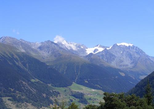
My camera was a little less active this day as much of the route was in the trees. The trail reminded me a great deal of typical hiking in the White Mountains of New Hampshire. The best views were at the café. From the café we looked over and into the Rhône Valley, the city of Martigny – quite stunning and typical of the views we’d experienced thus far. Views of the peaks were those opposite Mont Blanc and so we experienced a little variety on this day.
The trajectory was Lac Champex to Alp Bovine to Col de la Forclaz to Trient. It was at Col de la Forclaz that Glacier de Trient became visible and marked the return to views of the Mont Blanc massif. In Trient we stayed at Auberge de Mont Blanc. It was no surprise that we met up with our friends from Ireland, John and Annalisa from Manhattan, all while making new friends, Martin from Belgium (who had hiked a portion of the trail with David from Belgium) as well as a few new buds from the US. Interestingly, the folks Pavel and I met also were seated with us at dinner – it was a blast. Afterwards four of us departed for the bar across from the Auberge and Pavel graciously treated us to a round of Génépi.
This day booked in at 18.5 kilometers and a modest 690 meters of ascent. The last few days were easy on the feet, heart and lungs but that was about to change – tomorrow – new heights awaits and I was eager for it to start!
Photos in order of appearance: Leaving Champex; Looking back, the edge of Champex; the next three photos are views from the trail; Chalet de Bovine; the Chalet’s herd; Plate of Charcuterie; Rhone Valley and city of Martigny; The next two photos are views from the trail; Glacier de Trient; Church in Trient below the Glacier de Trient; Auberge de Mont Blanc.
Day 11 & 12
A blue bird day for a high route adventure – nice! We had to bypass the Fenêtre d’Arpette but I had studied the map and there was an alternative route that took us by Glacier du Trient and Glacier des Grands. For the day it would add approximately 150 meters of climbing and 5 kilometers of trekking – suhweet – more trail time!
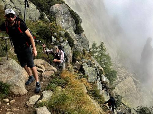
At the hut the night before our bunkmate, Martin from Belgium decided to hike with us along this route. It was nice to have the company. Turns out – Martin knew David and when we reached Col de la Balme, we reconnected with David – so much fun!!
To start the variant we had to double back a bit on yesterday’s trajectory. The final descent into Trient was 240 meters from a flat track – a fork in the trail – down to Trient or straight ahead into a wooded forest. We went up the same track but this time carried on into the forest to Chalet des Glacier. It is here you can go left up to Fenêtre d’Arpette or right, cross the ravine, and up towards Chalets les Grands which sits beneath Glacier des Grands – we went right. This trail was fun. It had a few chain holds and cliff side walking in addition to forever being cut into the side of a massive mountain. The trail basically traverses the curve of a huge summit at 2,000 +(-) meters, undulating along, until the big reveal – Col de Balme. From Chalet les Grands we got a perfect view of the trail up to Fenêtre d’Arpette. The Fenêtre is the low point in the peaks in the center of the picture. We could see the obvious landslides from the chalet but they are hard to make out in the picture. My gut is they were navigable but regardless – we had not taken that route but it was nice to see it!
It was really hard to pare down these photos – all around us the views were amazing. On arrival at Col de Balme the reveal of the Mont Blanc Massif and Glacier de Geant was breathtaking. It is here that our time in Switzerland ends and we are back in France! There was a slight haze to the atmosphere but it did not deter! From this point forward it was views of the many glaciers. I took a stab at naming them based on their size and location – know there are many associated smaller glaciers that are part of the landscape.
We made our way down to Chalets de Balme for a late lunch – boy did we indulge! From there it was a hike up to Aiguillette des Posettes – all with the glaciers front and center. It was one of the more strenuous days and a welcome relief to the easier hiking of the preceding days – it’s good to feel the burn!! Leaving Aiguillette des Posettes was all downhill –a steep 980 meter descent – which I knew, had to be climbed up after our rest day – wahoo! It was a long day – but rewarding – and we arrived in Argentiere sometime after 5pm. There are no photos of the rest day in Argentiere – I took some – not sure what happened – they are not to be found. I ventured out after breakfast but by early afternoon the skies were dropping buckets of rain – a perfectly timed rest day!
The days trek booked 20 kilometers and 1,275 meters of ascent!
Photos in order of appearance: Trail into the forest from Trient; Chalet des Glacier; The next two are climbing to Chalet les Grands; Helicopter pick up at Chalet les Grands; Chalet sign; View of Fenêtre d’Arpette; The next four are views from the trail, note Trient in the lower left in one of the photos; Col de Balme; Pavel, Martin and Rob in front of Mont Blanc; Mont Blanc from the French Side; Aiguillette des Posettes; Lunch at Chalet des Balme; Pavel – summit Aiguillette des Posettes; Mont Blanc; Mer de Glacier; Glacier d’Argentiere; Heading down to Argentiere; Into the tree line; Mer de Glacier; Argentiere.
Day 13
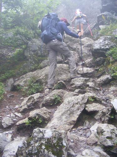
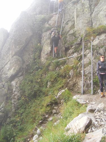
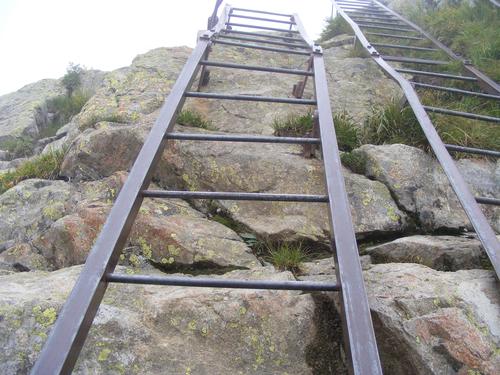
A nice rest day in Argentière made for a well rested body ready to tackle the ascent. Today – however – we had a new challenge, The Ladders. There are multiple routes up to Lac Blanc – none as direct as the route we were to take. The alternative high route that avoids the ladders was closed due to a landslide and the valley route was unappealing because we would have to spend the day in the valley only to summit at day’s end only to come back down – not an option. So we would face the challenge with authority and conviction!
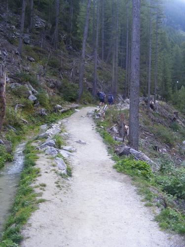
To my dismay the morning was very foggy and wet as it had rained through most of the evening. Departing Argentière was a quiet affair as the trails were empty. We encountered four hikers along the early part of the trail of which only two would go up alongside us. The ascent, 950 meters total to Lac Blanc, was a hearty one. In no time at all we arrived at the ladders – again – Pavel and I were dumbstruck at the ease with which we ascended – having scuttled up the mountain side with no effort at all. There was a bit of a traffic jam at the ladders but a short 10 minutes later we took our place in line as others, who were not far behind us, had caught up.
In no time at all we were getting photographed at the l'Aiguillettes d'Argentiere – two happy hikers! The clouds were starting to break up but you will see from the photos they were ever present creating beautiful drama and a variety of scenery quite unique and unlike the day we passed by Col de Balme.
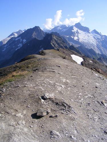
We soon finished the climb to Lac Blanc – a beautiful glacial fed lake. The hut, Refuge du Lac Blanc, was closed for the season but we made ourselves at home and had and early lunch. Despite it being August, there remained snow in the corners of the mountainside. We spent several hours here exploring around the lake and allowing the clouds and sun to pierce through – taking in the views and snapping all too many photos to try and capture the best one.
Soon it was time to go. We had plenty of time – it was only 1:30pm. La Flégère was all downhill and not very far. To my delight I parked myself about 1/3 of the way down and just took in the scenes the clouds created. I took hundreds of photos – I kid you not – and pared them down to the few you see. It was breathtaking.
After I felt I took in what I could it was time to continue along the path to the hut. We arrived at the hut sometime between 3 and 4pm – plenty early. It was here we bumped into Measa, one of our bunkmates from way back in Croix de la Bonhomme who was also staying at La Flégère. She originates from South America but currently lives in Canada. In addition, Vivian and her husband as well as our Irish friends who turned out to be our bunkmates – so sweet! The hut was large and spacious and there was room to spread out a bit. We also met more solo hikers from Belgium.
The day turned out brilliant and we had a nice crew to round out our last night on the trail. The views of the glaciers were phenomenal and we enjoyed decent wine, good food and good conversation. Simply the best. The day was one of our shorter ones, booking in at 10.5 Kilometers and 1,120 meters of ascent. Kind of nice because we needed to spend some time on the trails to let the skies clear.
Photos in order of appearance: The first three are on the trail up to the ladders; The next three are of the ladders, the 3rd being the top of the first set; A view across the valley through the clouds; The second set of ladders; Rob and Pavel at l’Aiguillette d’ Argentière; The next two more photos across the valley through clouds; Lac Chersey; More ladders; Wooden steps; Chalet du Lac Blanc; Lac Blanc; the last set all views of the glaciers through the moving clouds.
Day 14 & 15
Sigh……….. this was to be our LAST day on the trail. Breakfast was typical bread and jam but with the added bonus of cereal and a freshly made CROISSANT – SO HAPPY!
Sadly, the weather was anything but nice. We were socked in by the clouds and a light drizzle – not enough to soak you – but enough to keep you wet. Maesa asked if she could tag along – she was slated to stay at Refuge de Bel Lachat but decided this would be her last day on the trail as well. I was happy to oblige. I packed away the camera – no photos for the start of the day anyway - much too wet.
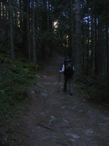
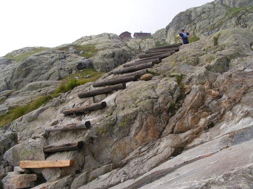
We decided to spare ourselves the fog and take the valley route but as luck would have it – we could not find the trail head! What was obvious was the high route. We saw one unmarked path leading downhill but this was no time to trek downhill with no visibility so like it or not – we were going high! Despite the poor visibility the trail was easily identifiable and we took our time to ensure we made no wrong turns. We arrived at Planpraz where we wanted to take a break at the hut but it was closed – another closed hut! We weren’t too cold so we had no option but to trudge along and make our way to Le Brévent but not before passing through Col du Brévent. The higher we went, the colder it got and the wind picked up – it was just a tad – shall we say - shitty. Visibility was - well - two feet in front of you!
We arrived at Le Brévent which is a cable car station and a café. The café was open but the kitchen was closed. Measa – resourceful hiker she is – had packed a fresh tomato and sandwiches – from where I shall never know – but the café owner was fine with us eating our own food while ordering hot drinks.
Amid a hearty discussion it was decided we would gear up and head back out into the elements. I had not hiked all this distance only to shortcut the journey by stealing down the cable car. We had 8 kilometers left and it was all downhill – I may have neglected to mention the 1,545 meter descent– oops. Yeah, it was going to be L-O-N-G.
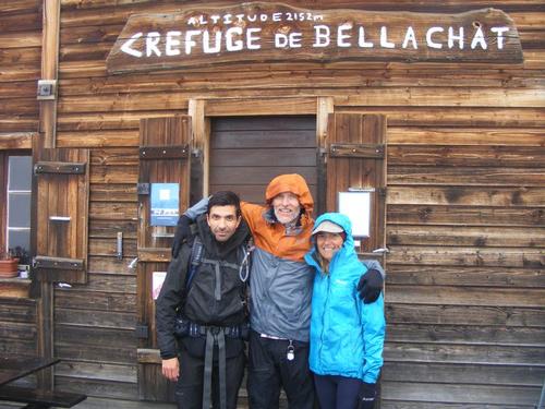
Soon after leaving Brévent we found ourselves hiking alongside a German couple who were headed to Refuge de Bel Lachat – it was fun – we all sucked up the bad weather together. This section of trail was stunning – it was near perfection in my book – a series of stone steps seemingly laid out for our ease of descending – truly quite amazing. I loved it. We soon arrived at the hut where Measa had one final moment of reflection – nope – she was coming down. It was here we took a group photo, the first of the day, see how happy we are!!
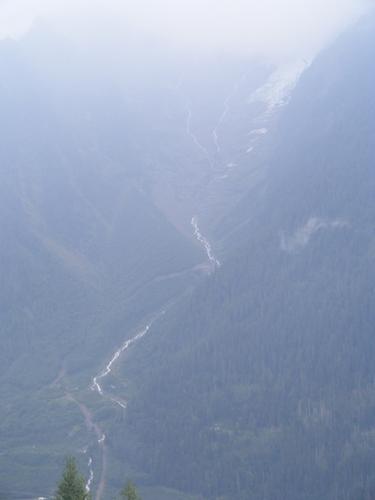
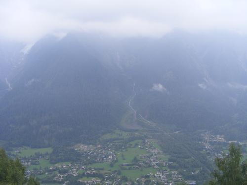
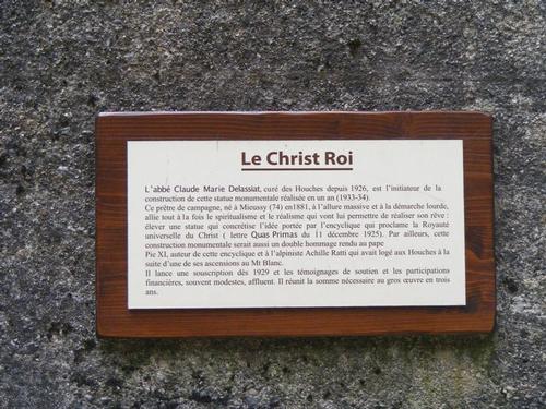
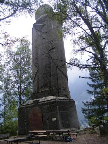
Leaving Refuge de Bel Lachat the trail quickly went from the stone laiden path to mud which was a bit trickier than rock. The trail became steep with very short and narrow switchbacks. The trail notes said not to fall off a cliff, they were not joking. At every turn the trail dropped into a ravine. Some sections required chain holds and careful navigation as the path was narrow – these final kilometers would be earned. A few hours later we finally emerged beneath the cloud line. Still drizzling, but with better visibility as Les Houches was below us. Through many twists and turns and past a huge statue of Christ we finally emerged onto tarmac. From there we meandered our way to the church into the heart of Les Houches for the photos – Journey complete – every footstep of the TMB having been done – from the heart of Les Houches to the heart of Les Houches – SUHWEET.
The next morning the skies were once again clear and we spent the day in Chamonix shopping, eating and celebrating alongside the fans of the UTMB – sometime around 3pm the winner crossed the finish line – the energy was palpable. What a great way to wrap an incredible journey – Thank you Peter, Pavel & all our TMB friends we made along the way – Cheers!
Photos in order of appearance: Group shot at Refuge Bel Lachat; Waterfall beneath a glacier; Les Houches; The wet trail; Statue description; The Statue; Emerging onto Tarmac; Pavel & Rob; Rob & Measa; Rest day skies; Hotel Saint Antoine.
There are 222 photos in Album (Note: Move mouse pointer over larger pic and click on NEXT for better viewing)


What Members Are Saying About This Trip/Event
- Hi Rob -- Stunning - Amazing - Fantastic - The TMB ranks up there as one of the best alpine treks in the world. You captured the beauty, spirit and boundless discovery of the adventure! Bravo!!! Many thanks for sharing - J - JDNnh
|
|
||