

Trip report
Carter Mountains Hike
Hiking/Walk DATE: 08/26/2017 - 08/26/2017
Trip/Event Location: Pinkham Notch, NH
US
Trip Leader(s): shep5
Max # People: 12
Trip Guiding / Event Fee: No, I will not be asking participants for money
Difficulty Level: Strenuous
Join me for a hike over the Carter Mountains, which make up part of the Carter Moriah Range. These peaks lie between Pinkham Notch and the Wild River Valley. We will traverse this set of
...FROM THE NORTH: The trailhead is approximately 5.4 miles south of Gorham, NH along Route 16.
FROM THE SOUTH: The trailhead is approximately 17.1 miles north of Glen, NH along Route 16. The trailhead is well signed and is on the east side of the road.
NOTE: There are 2 trailheads for the Imp Trail. Make certain to watch for the northern leg of the trail. These trailheads are approximately 0.2-0.3 miles apart and are both along the east side of the road.
Look for a grey Hyundai Elantra. This hike requires car spotting...Once we've all met up, we'll drive to the other trailhead for the Nineteen Mile Brook Trail.
For GPS Users: Route 16 (White Mountain Road); Gorham, NH 03581 (44.323412, -71.216897).
Trip Report/Photos

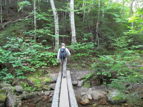
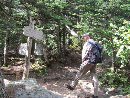
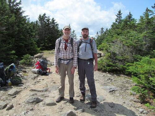
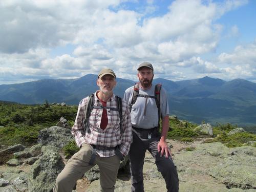
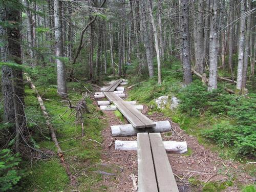
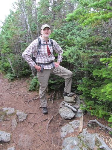
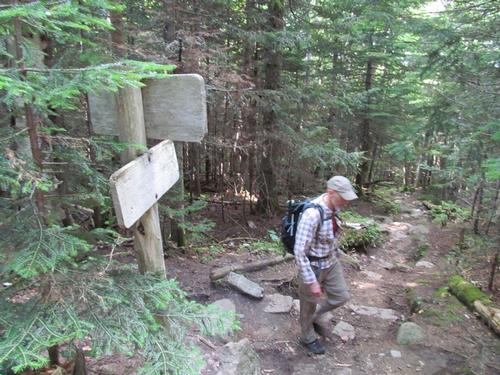
On Saturday, August 26th, Robert and myself met up at the northen leg of the Imp Trail trailhead at a little after 9AM. We got ready and then carpooled down to the Nineteen Mile Brook Trailhead to begin the traverse across the ridge.
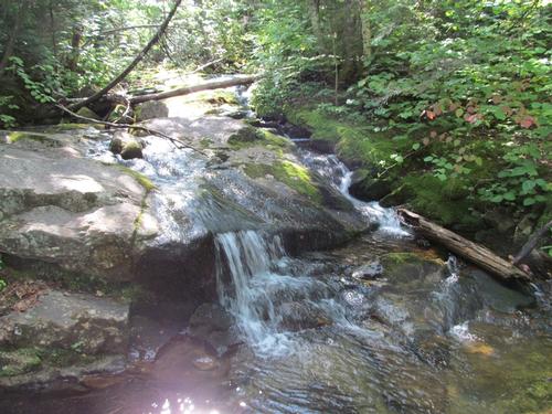
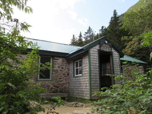
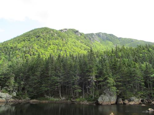
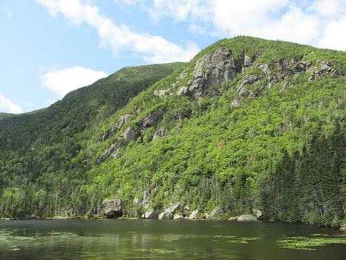
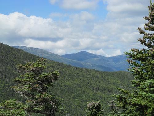
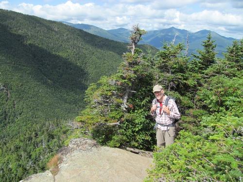
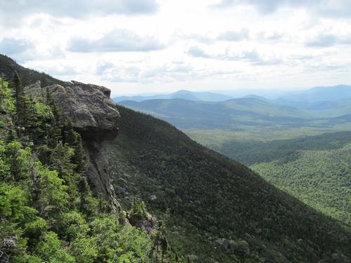
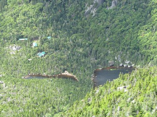
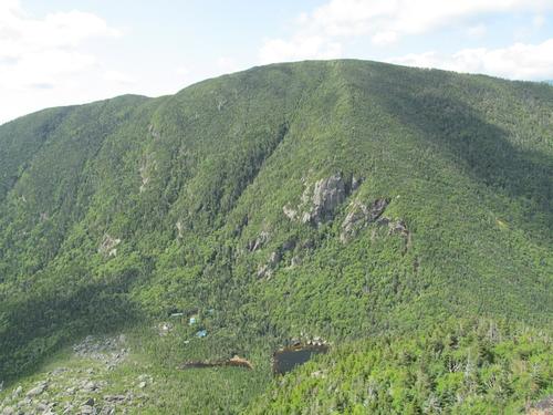
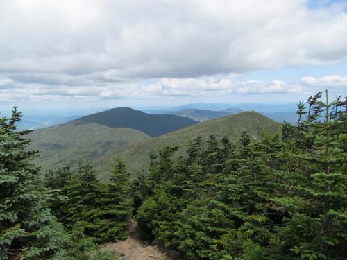
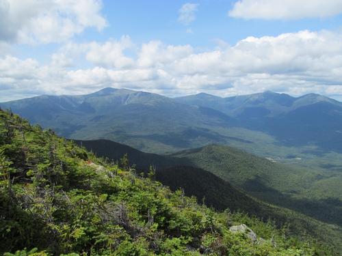
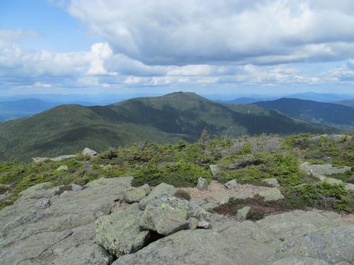
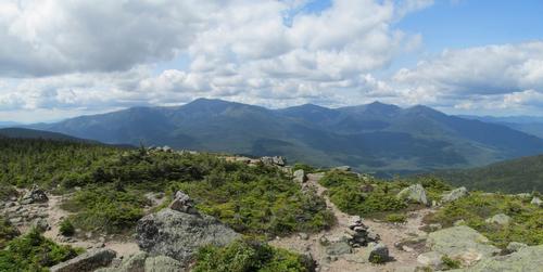
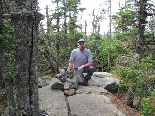
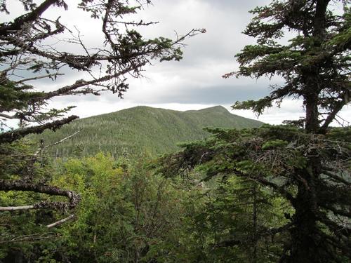
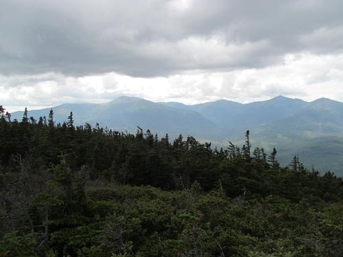
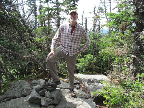
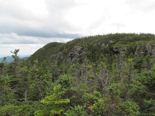
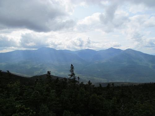
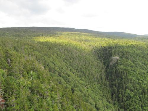
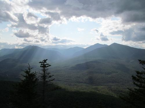
It was a mostly sunny start to the day with a slight chill in the air, as we started up the trail at 9:15AM. We made good time up this trail and made it to the junction with the Carter Dome Trail by 10. The trail was mostly modest in grade up to this point, but began to steepen slightly on our way up to the Carter Lakes. We reached the junction with the Wildcat Ridge Trail at 10:50 and continued on to the lake and then the AMC hut. The views of the Wildcat Mountain and Carter Dome ledges from Carter Lake were spectacular. We took a 20-minute break at the hut and then retraced our steps back to the Carter-Moriah Trail. This was very steep for a good portion of the ascent! There was a ledge with views back towards Wildcat Mtn. along the trail and by 11:45, we reached a short spur trail out to a dramatic ledge...again with views over to Wildcat Mtn., the hut below, the rocky ledges and boulder field on Carter Dome, the northern portion of the Presidential Range and some of the smaller peaks along the NH/ME border. We forged ahead and summited Carter Dome (4832') at 12:20PM. We took a light lunch break here as we spoke with a few other hikers. There was a view of the Carters from the northern side of the summit; however, the rest of the summit is mostly treed.
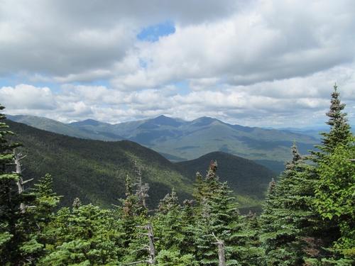
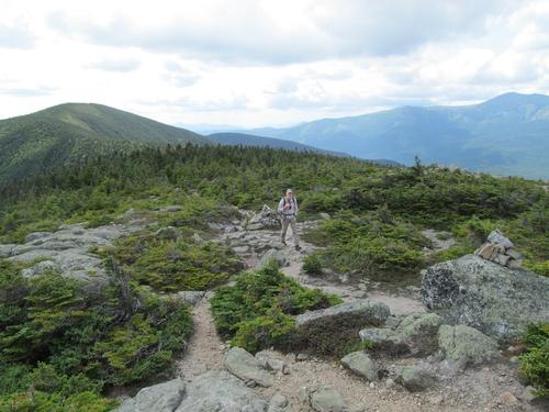
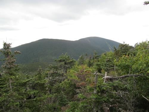
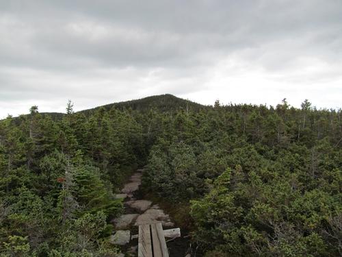
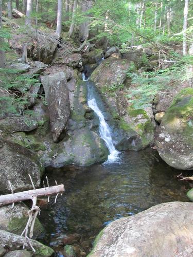
By 12:50 we were heading over to Mt. Hight. Along the way there was a great view of the Presidential Range and at 1PM we turned onto the trail for Mt. Hight. This was easy going and in only 15 minutes we were standing atop of the open summit of Mt. Hight (4675'). The views in all directions were magnificient with the Presidential Range, Carters, Moriah and Carter Dome all prominent! We took another short break. The winds were chilly and after about 15 minutes we started our descent off of the peak. The descent was quick and we reached Zeta Pass at 1:45. After chatting with a couple of hikers here, we began our climb of South Carter Mountain. This was moderately steep for portons of the trail and we summited South Carter (4430') at 2:20. Just before the summit, there was a ledge with views back towards Hight and Carter Dome. There we also ran into a Canadian couple, who we had met last year up in the Nash Stream Wilderness (of course, Robert recognized them as he spoke French with them)...very cool though. On the actual summit we took another short break. Initially we were there by ourselves, but it didn't take long before there were another half-dozen hikers. Since it's a very small area around the wooded summit, we decided to continue on. After only 10 minutes of hiking between the Carters, there is a view of Middle Carter. By this time the clouds had increased and the skies darkened. Luckily, the views of the Presidentials were still out of the clouds as we passed through an open area on the ridge. It was 3:15PM, when we came along the non-descript summit of Middle Carter (4610')...noted by only a small pile of rocks along the trail. As there was nothing to see here, we just pressed on by descending off of the peak to the North Carter Trail in the col. Along the way there were open areas with views over to the Presidential Range and the ledges off of the eastern side of Middle Carter. After re-entering the woods it took only another 10 minutes to reach the trail junction with the North Carter Trail. Here we spoke to a German couple, who were doing the AT and then we began our return. We followed the North Carter Trail and at 4:20 we encountered the Imp Trail. We turned onto the northern leg of the trail, which went over the Imp Face. This trail began to climb again for a bit before descending to the a couple of open ledges with great views of the Presidential Range. It was just before 5PM and after taking in the views we continued our descent back to our car, which we reached at 6PM. We immediately went and picked up the other car and headed for Moose Brook State Park to camp for the evening. We cleaned up and then had dinner by the campfire. Robert turned in by 10PM and I turned in after the fire was mostly out by 10:30PM.
What a great day hiking the Carter Ridge from Carter Dome to Middle Carter! The views through most of the day were spectacular even though the skies darkened through the day. Thanks to Robert for joining me on the adventure and for suggesting the camping.
There are 35 photos in Album (Note: Move mouse pointer over larger pic and click on NEXT for better viewing)

|
|
||


