

Trip report
4116' Saddleback Mt
Hiking/Walk DATE: 10/20/2018 - 10/20/2018
Trip/Event Location: Rangeley, ME
US
Trip Leader(s):
Max # People: 8
Trip Guiding / Event Fee: No, I will not be asking participants for money
Difficulty Level: Moderate to Strenuous
11.2 miles. Follow the AT north to expansive above treeline summit of Saddleback Mt. Perhaps my favorite Maine mt South of Katahdin. The trail and summit are quintessential Maine, 3 isolated ponds, ...
Driving directions to the location and spot to meet at:
Take rt 4 north out of Farmington for 32 miles to the well marked AT parking area on left. Trail begins on right of road. To gauge your distance, this is 9 miles south of Rangeley. A marked Maine rest area is several miles before the parking area. Alternate bad weather day is 10/21/18. Summit is expansive and very exposed.
Trip Report/Photos
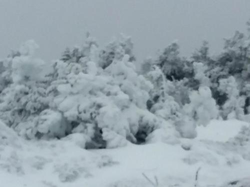 No one signed up for my Sept Saddleback hike though a couple of guys expressed interest and I always meant to get back to the mt for a fall hike, so Monday Nov 12 it was. 12° when I left home Monday morning and a recent snowstorm had left 6"-12" across much of the region, including home, but the drop in temps made the snow a nice texture for walking and the snow clinging to the trees was nicely frozen on so I didn't have loose snow falling down my back as I walked the trail, and Sunday hiker traffic left a nicely marked trail to follow. Exceptionally beautiful day of walking! Ponds were beginning to freeze over. Because of the snow anything that would have been icy had a non slick layer of crusty snow. Saddleback has a fairly broad and extensive above treeline walk as one approaches the summit. The wind was quite strong but I was snugly warm and totally stoked by the buffeting wind and complete arctic appearance of the treeless shoulder and summit. Cairns across the mt are small and as they were covered in snow I had to use extra care on the route. Interestingly going up was pretty obvious but coming down not so much even though I has just passed that way, but the wind easily covered my tracks w/blowing snow. No view on top except the tip of my nose since the very summit was in the clouds, but I didn't care I was so exhilarated by it all. After leaving treeline the trail is quite steep for a mile w/many rock steps and slabs, but due to the snow cover they didn't exist so all I had to do was shuffle my feet and slide down. A very quick and effortless descent. This trip reinforced that Saddleback is my favorite Maine mt South of Katahdin. Anyone who hasn't hiked it, keep this beautiful mt in mind.
- The Trip Has No Photos -
|
|
||
