Trip report
Goose Eye Mountain (3870' - NE100)
Hiking/Walk DATE: 08/13/2017 - 08/13/2017
Trip/Event Location: Newry, ME
US
Trip Leader(s): alex4mts , HikerSinger
Max # People: 8
Trip Guiding / Event Fee: No, I will not be asking participants for money
Difficulty Level: Moderate to Strenuous
Goose Eye is one of the most stunningly beautiful peaks in all the north country. Its wide and verdant double summit provides gorgeous, long-range views in all directions. And, being in
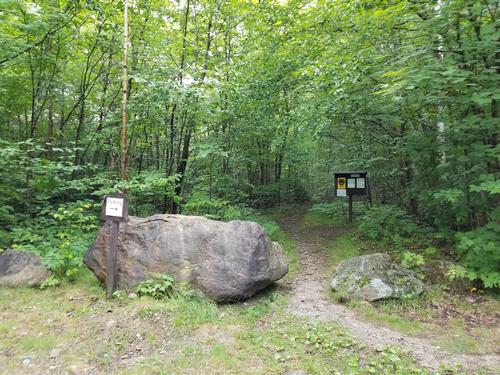
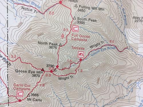
...We will meet at the Wright Trailhead in Newry, ME, approximately 2:40 from Concord, NH not counting stops and breaks. For directions, Google or click on "Wright Trail (Trailhead), Bull Branch Rd, Newry, ME 04261?", which is at GPS coordinates [44.5185269,-70.9357196?].
Trip Report/Photos
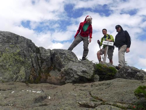
Goose Eye (3870') lived up to its reputation and delivered a more-than-cool experience to the three guys who ventured into the eastern Mahoosuc woods to visit its two peaks. The Mahoosucs have a reputation as a wild place, full of character, some challenge, and magnificent sights both along the way, and of course among its summits and ridges. We were not disappointed!
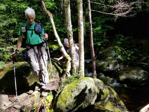
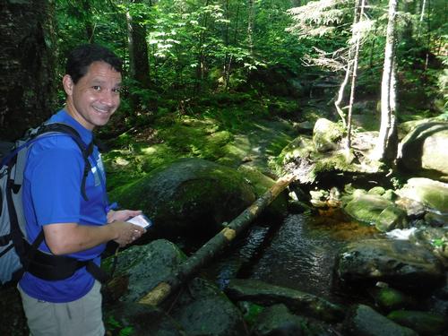
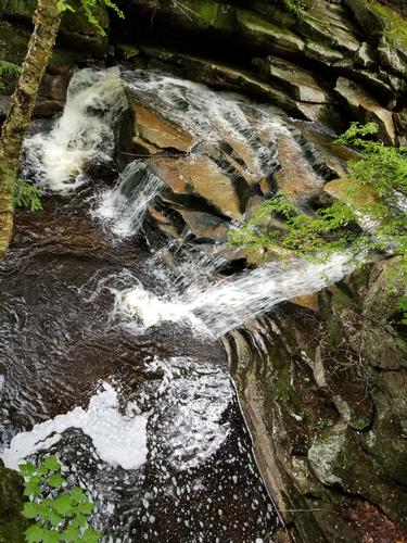
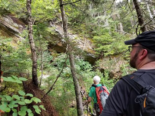
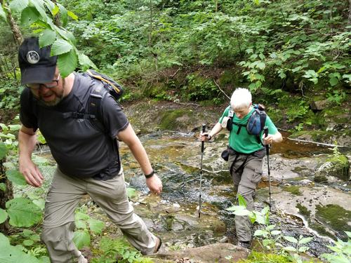
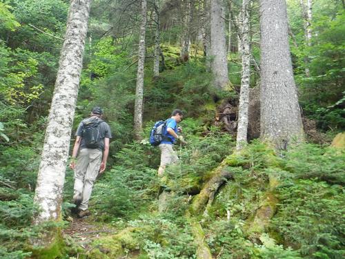
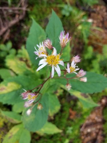
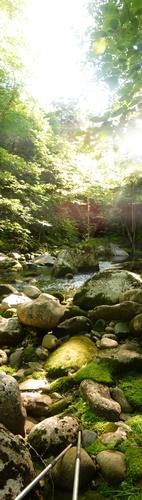
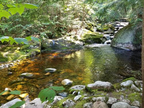
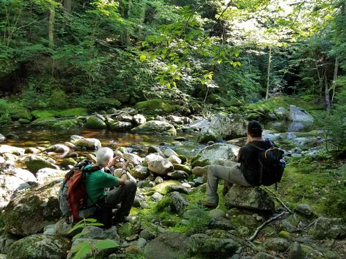
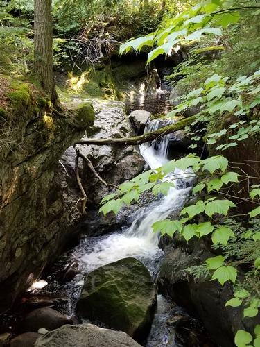
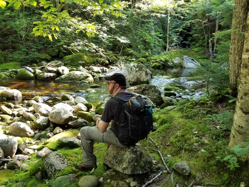
The group of us three: Alex and I as co-leaders, and Mike as intrepid traveler, headed up the eastern side of the ridge via the Wright Trail, which begins just up the road from Sunday River resort. It travels alongside or near Sunday River, a lush, gorgeous water way full of small- to medium-size waterfalls, and awesome swimming holes - more than any of us had seen anywhere else on one stretch, even in the Whites. These are the swimming holes the locals prefer, we learned from a guy and his friend who headed up ahead of us before we started. The swimming hole or two along the road leading to the trailhead were nice, too.
Before long, we were climbing away from the river and gaining more vertical, more aggressively. The mountain makes you work for it from this side, requiring an ascent of about 2,850 feet over the ~4.8 miles it takes to go from trailhead to summit.
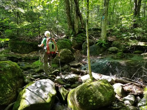
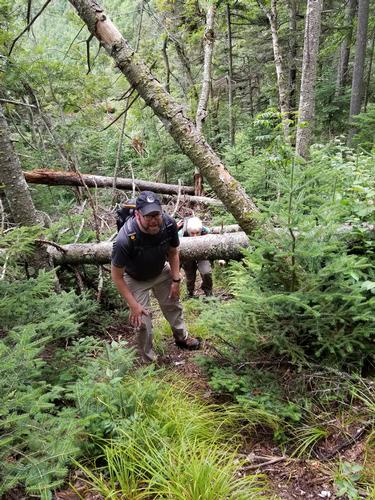
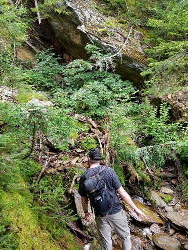
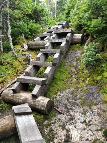
Alex and I were aware of an alternate section of trail that heads off at a junction a little over halfway up the mountain. This section, historically labeled the "north fork," was officially closed a few years ago, leaving only the south fork open to ascend and descend the mountain. We talked over the possibility of ascending the north fork anyway, knowing Alex and I both had relatively extensive experience bushwhacking varied degrees of routes (from no route at all, to established-yet-unofficial "herd path"). We decided to give it a try, and would turn around if things became dicey.
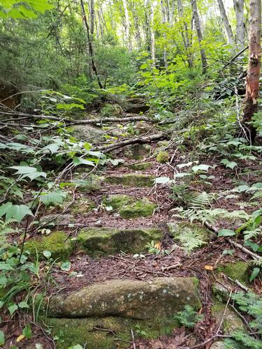
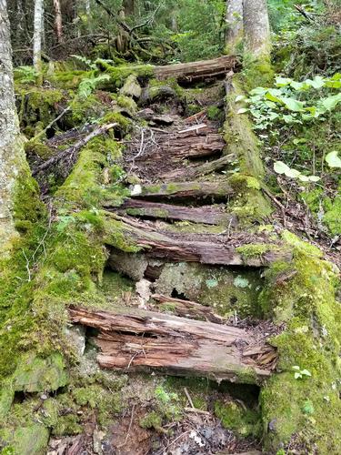
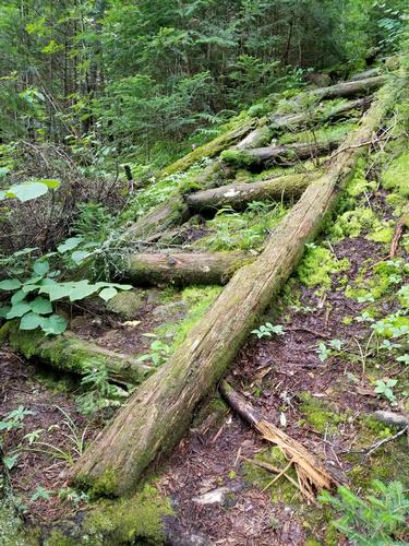
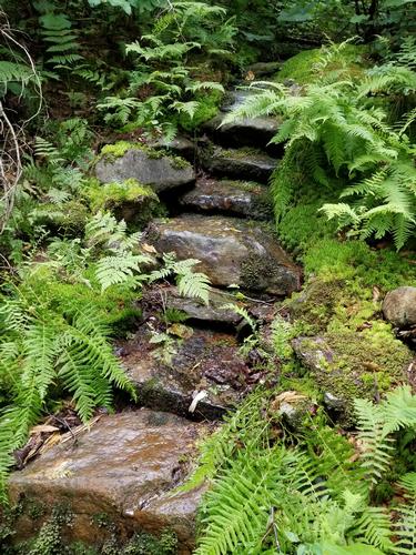
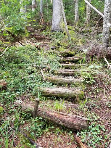
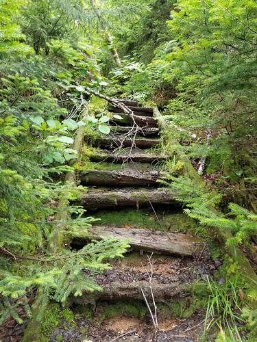
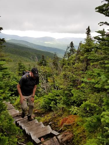
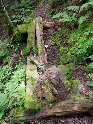
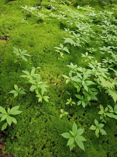
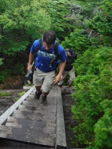
Thankfully, though, the trail was still quite clear all the way, even though we had to work around a fallen tree here or there. What made this closed trail the most fascinating, was the decaying trail features along the way: moss-covered and lightly-rotting ladders and bog bridges. We did not encounter any crossing we couldn't handle, though, and the ladders were still in good shape. Where the trail gained significant vertical, it featured some very well-planned switchbacks, providing some respite. You could tell, this section of the Wright Trail (and really the whole thing) was very well-maintained and kept up, until it was given back to Mother Nature. It was like walking back in time, perhaps akin to a ghost town, seeing what we're sure was a vibrant trail with many hiking features, in the long process of returning to fully natural state. We felt a true reverence for the trail, and indeed the mountain itself.
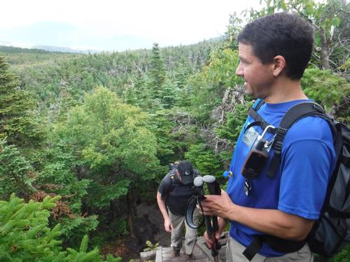
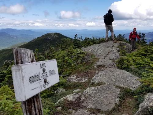
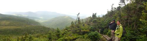
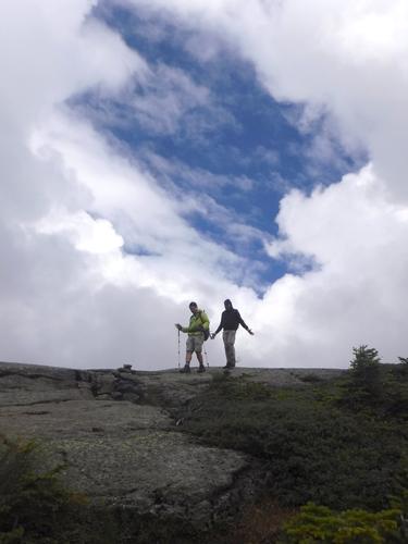
Soon enough, we found ourselves up on the ridge, at the col between the East and North summits of Goose Eye. We met a couple who were traveling the AT northbound, toward the final point a couple hundred miles north, Mount Katahdin. We wished them safe and happy travels, and started our way up onto the cone of the East peak.
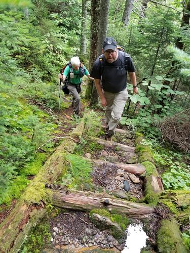
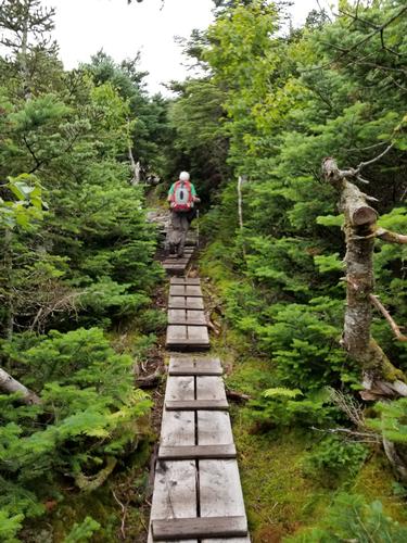
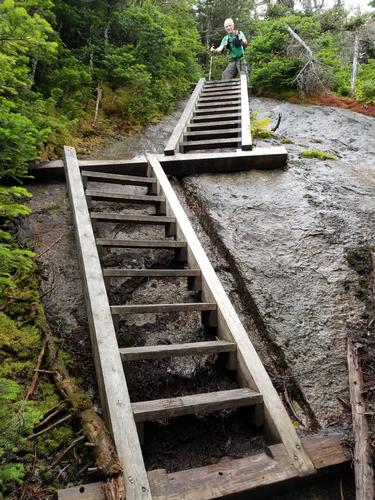
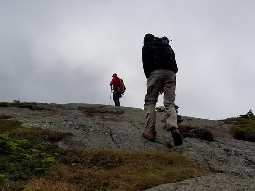
Heading up toward East peak, we encountered a numerous array of steps/ladders, nearly contiguous for at least a few hundred feet. I remarked it kind of seemed a little over-the-top, but it surely made the going easier in wet conditions, for what lay underneath was mostly smooth ledge.
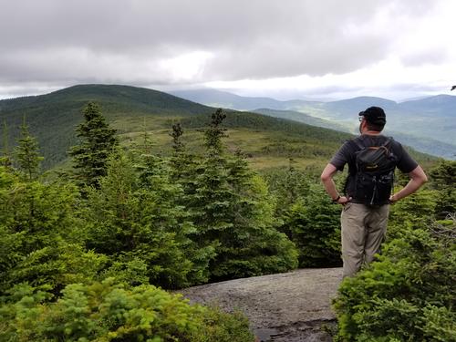
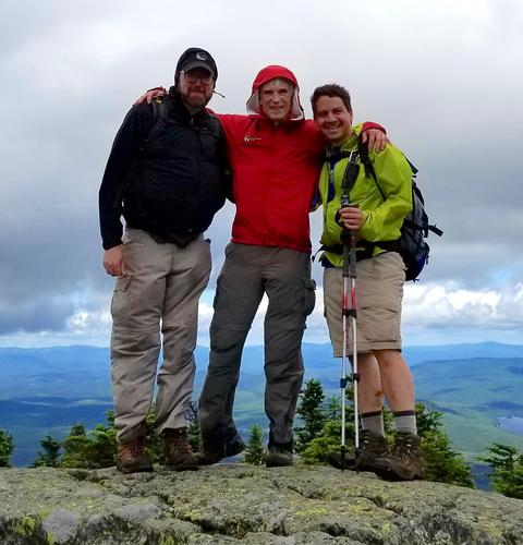
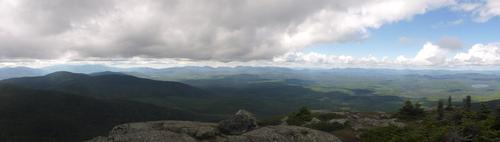
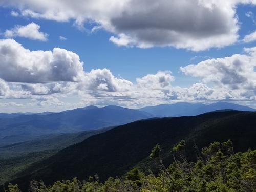
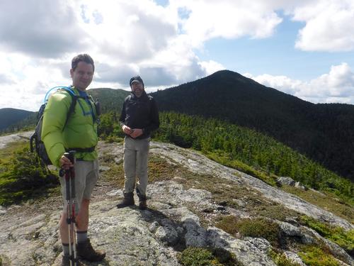
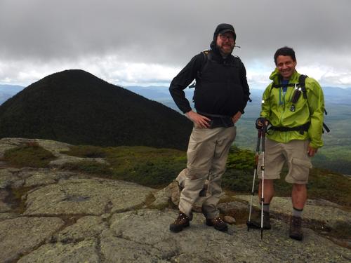
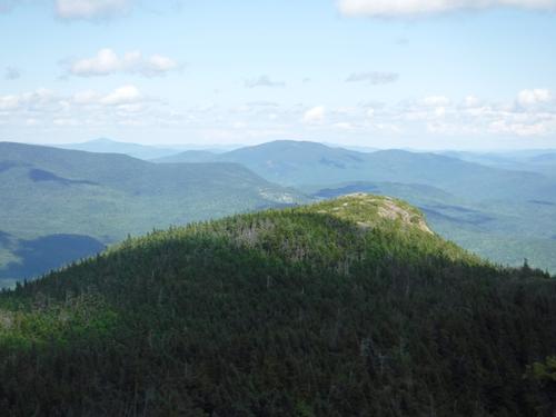
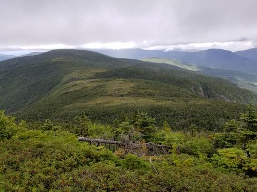
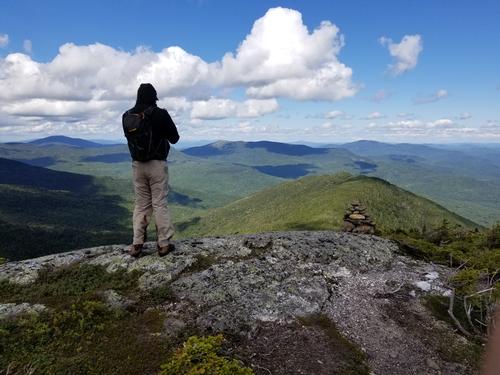
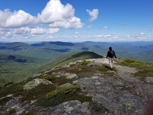
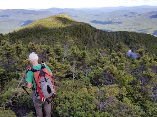
The East peak summit is bare and offers outstanding, 360-degree views, southeast toward Sunday River, southwest toward the slightly higher West peak, north toward the Great North Woods of NH and western Maine, and northeast along the rest of the Mahoosuc Range, to Old Speck (4170'), the Baldpates, and many others. While we didn't have bluebird skies, we had clear views all around, and found it difficult to keep moving. The wind was somewhat high, though - around 20-30mph gusts - so we continued on.
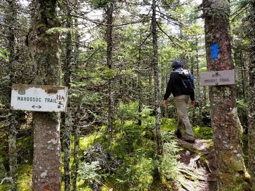
Along our way, at the trail junction that brings those coming up from the west onto the ridge, we came across an group of Outward Bound youth and their two leaders, having PB+J on wraps. They were making their way toward a tentsite east of the Goose Eye peaks for the night.
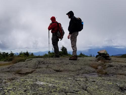
We soon summited the higher West peak, the high point of the mountain, and were greeted by more fantastic views in all directions. A grandmother and her grandson came up from the other side shortly after; they were on their way to camp overnight along a lower part of the ridge - pretty badass for the ~10-year old and his 77-year old grandma!
After a little more time on the summit taking in the incredible views, we headed back down the way we came, to the junction with the south side of the Wright Trail, at the col between Goose Eye's two peaks. We had a straightforward time descending this well-maintained section of the trail, to the same junction where the north (closed) side of the trail began. We decided to take a side trail down lower that led us closer along the river; this stretch was marked by dark red ribbon in a few places, and allowed us the opportunity to see more great swimming holes, waterfalls, and even a tiny gorge of sorts.
We cannot recommend this mountain enough, especially the Wright Trail loop, as a true gem and a great alternative to the Whites. It's not only one of the best and most interesting peaks on the New England 100 Highest list, but with all the rich features - and the swimming holes, too - it is an ideal reason to explore a little off the beaten path, and cool off on a warm summer day.
-Erik
There are 58 photos in Album (Note: Move mouse pointer over larger pic and click on NEXT for better viewing)


|
|
||