Trip report
Mt. Adams via King's Ravine
Hiking/Walk DATE: 08/13/2017 - 08/13/2017
Trip/Event Location: Gorham, NH
US
Trip Leader(s): Gandalf
Max # People: 15
Trip Guiding / Event Fee: No, I will not be asking participants for money
Difficulty Level: Very Strenuous
FUN hike on this 5,000 footer in the Presidential Range followed by a swim/BBQ at the Mad River Lodge!
Mt. Adams, [5,799'] is the second highest mountain in Northeast but there is also nothing
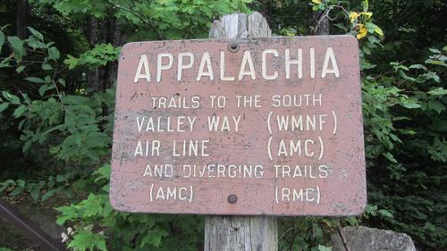
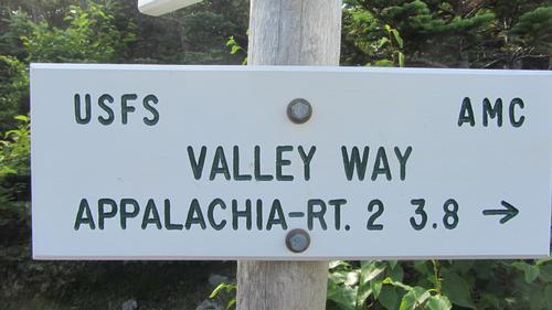
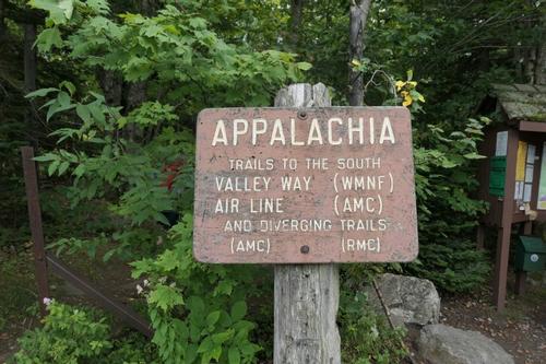
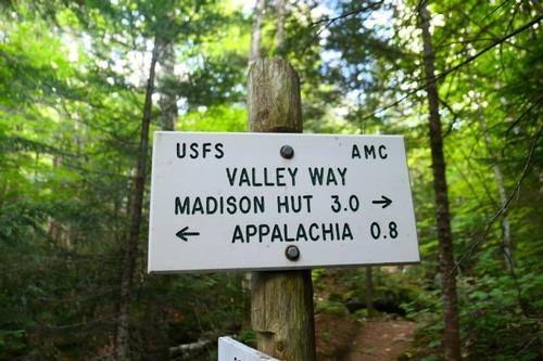
...We will meet at the large parking area at Appalachia, one of the major trailheads in the Whites. It’s located on the south side of US 2, 5.5 miles west of NH 16 in Gorham and 2 miles east of Lowe’s Store in Randolph. We are driving a blue Toyota Tacoma truck.
Trip Report/Photos

******************************************
Here is a video I quickly threw together of this great hike: https://youtu.be/WUCAMaXe_b0 - Walkabout Brian
*******************************************
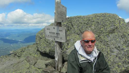
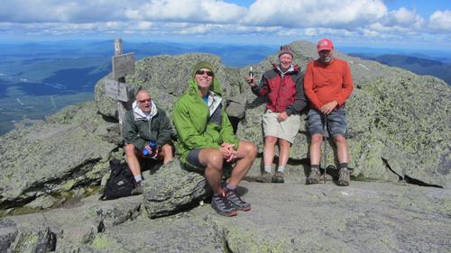
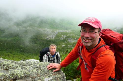
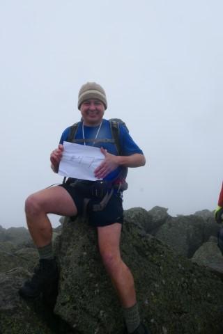
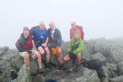
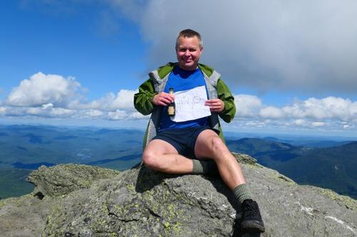
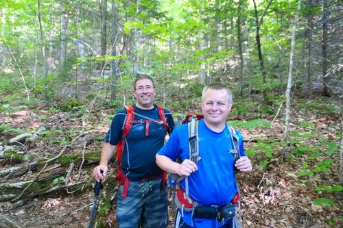
Congratulations to Brian Lamarsh for completing his last two NH 4,000 footers on Mt. Adams and Mt. Madison!
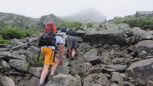
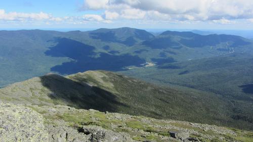
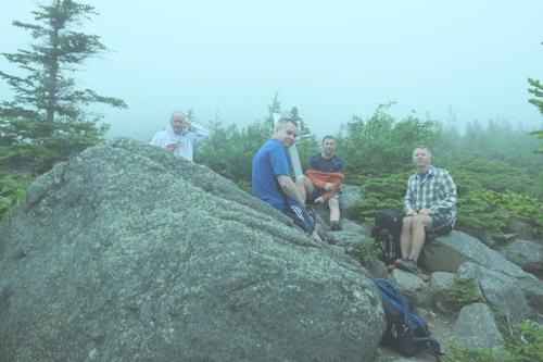
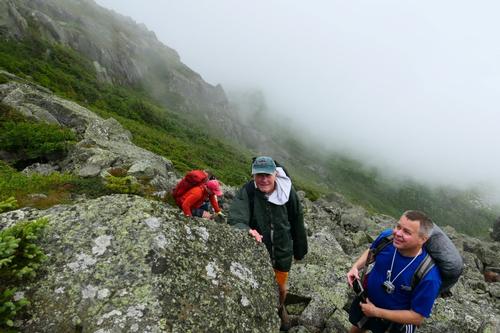
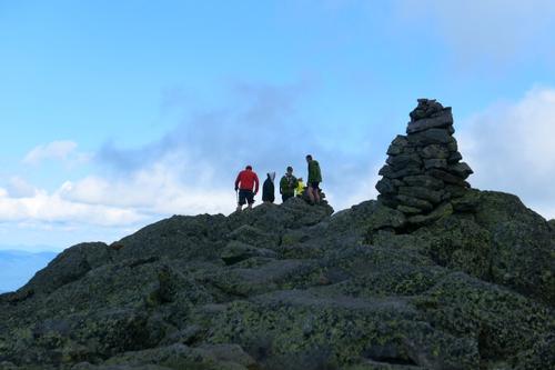
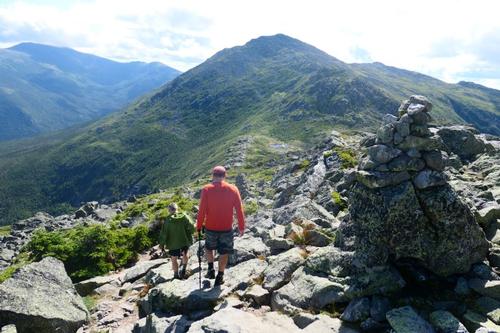
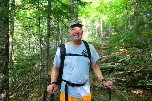
Jon and I, along with 3 other GOers: Brian, Randy and Bob, hiked through King Ravine to Mt. Adams [5774’] then over to Mt. Madison [5367’]. We were not originally planning to hike up Mt. Madison but once we found out Brian had only nearby Mt. Madison to finish the 48 NH 4,000 footers, we had to do it! The hike was a tough one [5,050’ elevation gain for the day] with some drizzle and fog on Mt. Adams but luckily it cleared with 100 mile views in every direction as we headed up Mt. Madison.
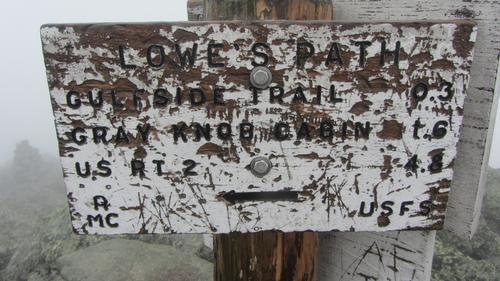
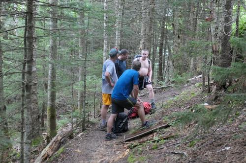
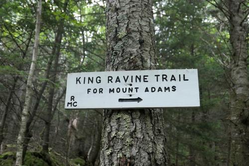
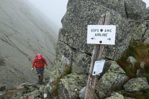
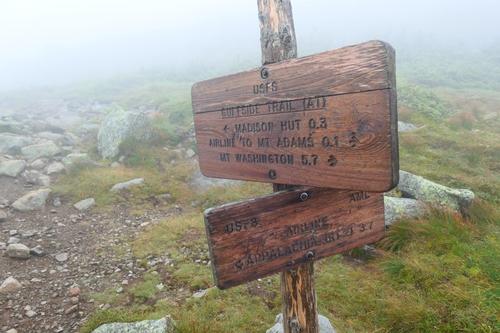
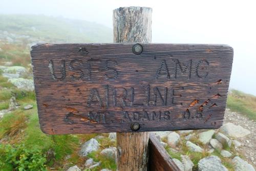
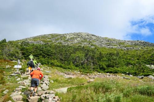
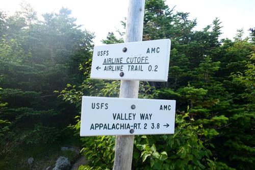
The plan was pretty simple, park at Appalachia, then hike up Airline to Shortline to King Ravine and then Airline to the summit of Adams. We then would take Gulfside to Madison Hut, climb Mt. Madison via the Osgood trail and descend back to our vehicles using Valley Way. We usually approach Adams ascending Valley Way so we wanted to change it up a bit. We were all excited about this adventure!
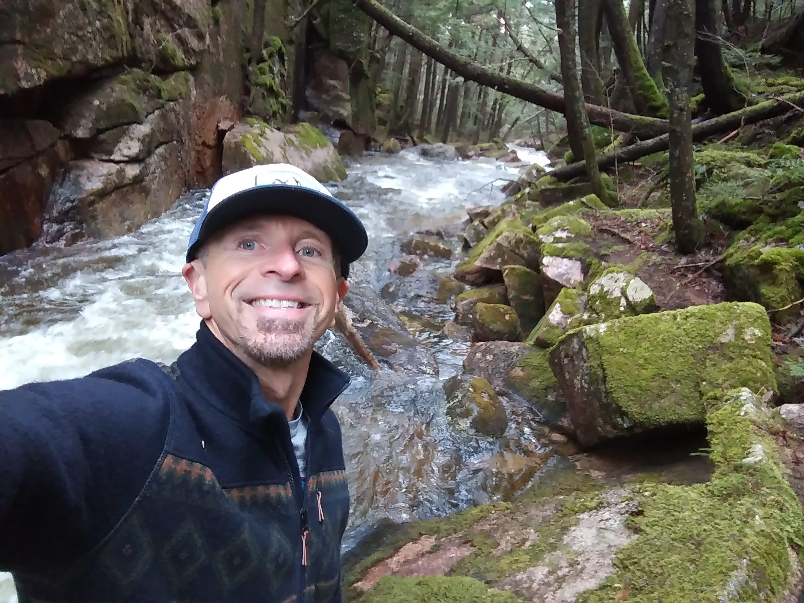
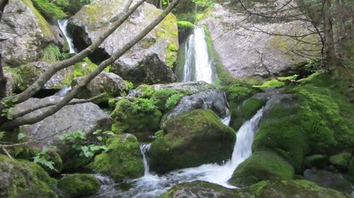
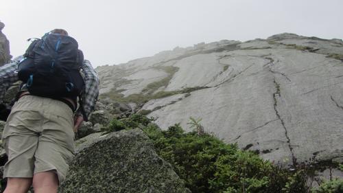
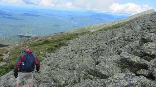
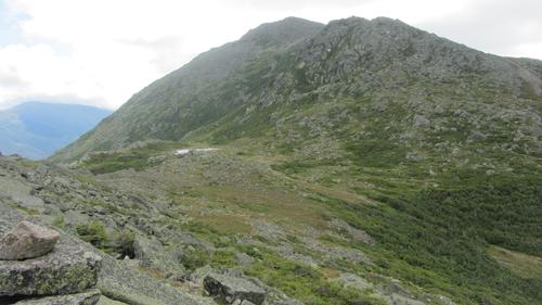
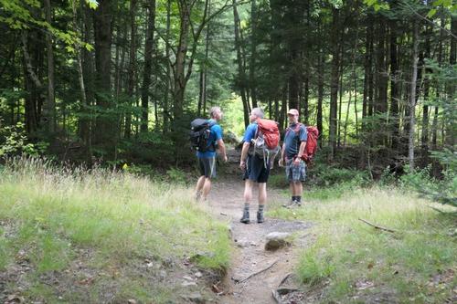
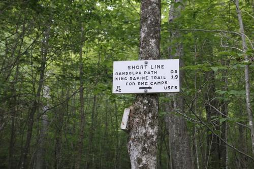
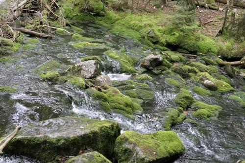
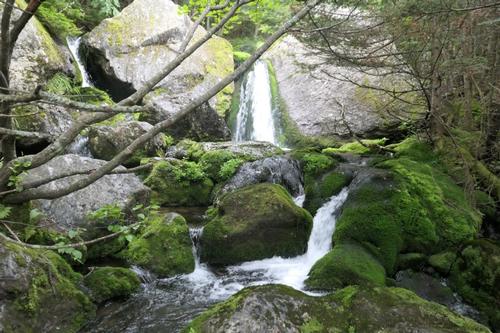
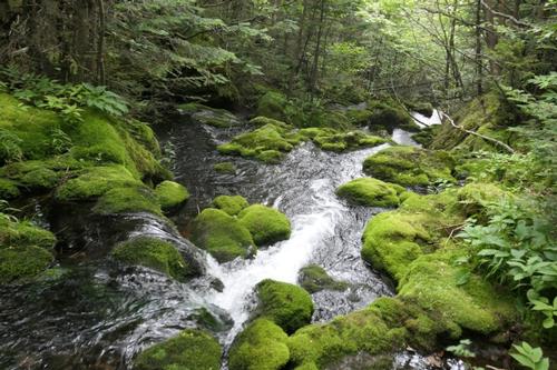
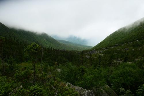
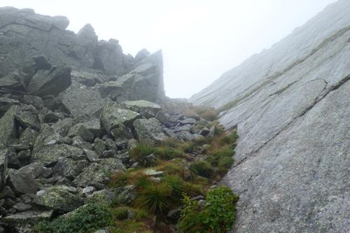
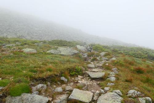
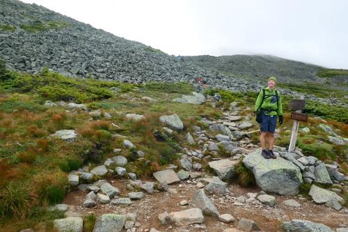
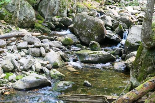
The first portion of the trip, the first 2.8 miles or so from Appalachia parking to the junction of the Shortline and King Ravine Trails was fairly quick and easy. The grade is easy to moderate and the footing for the most part was pretty nice. The forest was nice and quiet in the early morning, but the skies were dark above due to thick clouds overhead. In the upper portion of the Shortline, the brook is nearby on the right, providing the sound of rushing water and eventually by peeking through the trees, we could see cascades and falls. Mossy Fall is just a minute or two away on King Ravine Trail after the junction and is a pretty, small waterfall into a mossy pool.
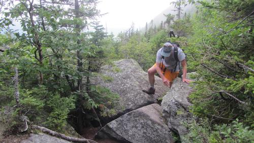
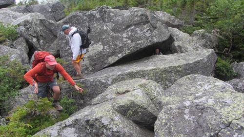
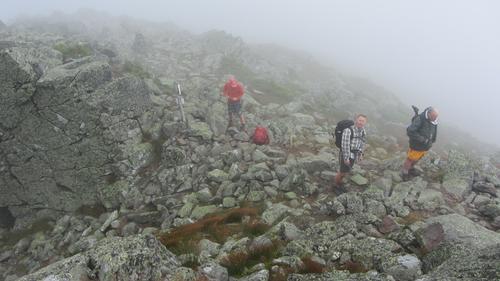
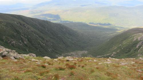
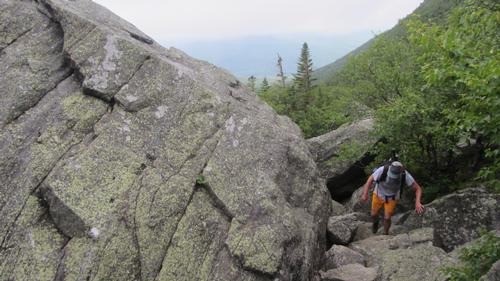
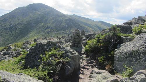
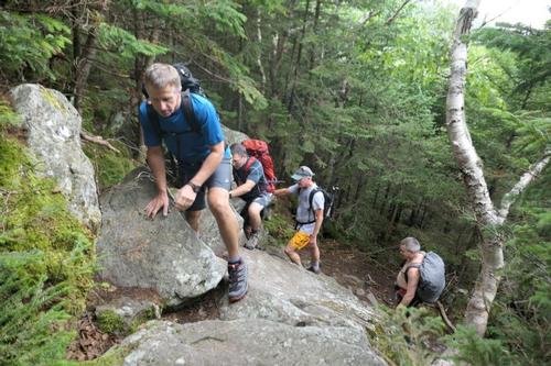
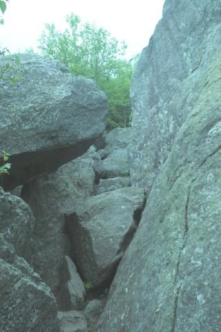
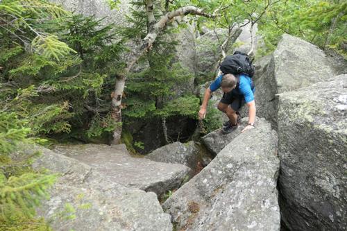
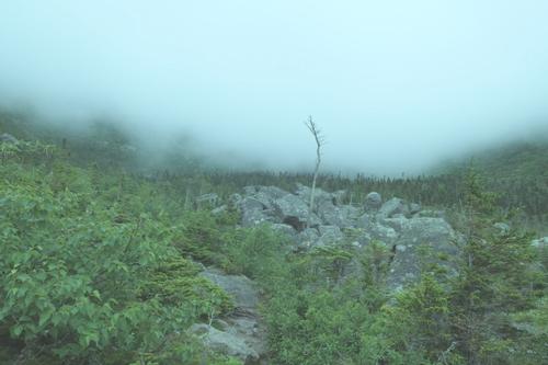
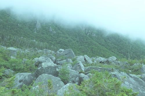
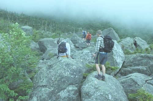
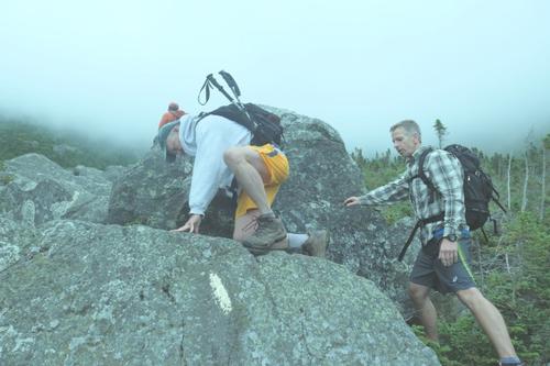
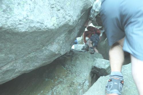
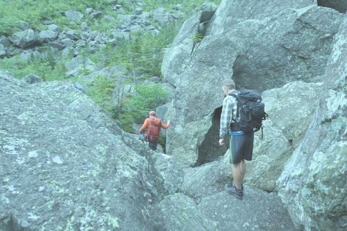
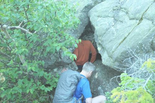
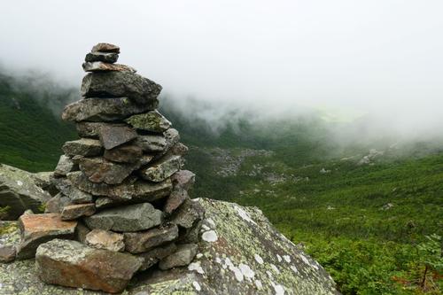
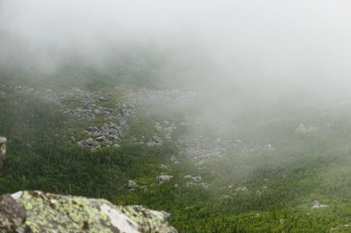
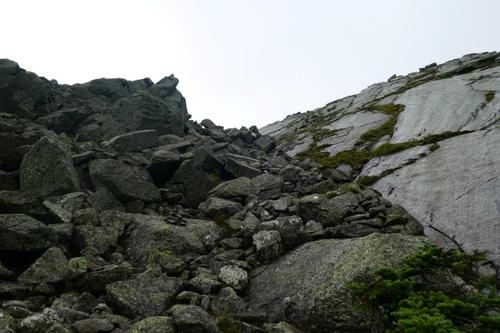
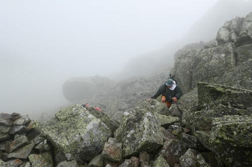
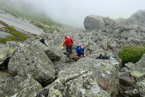
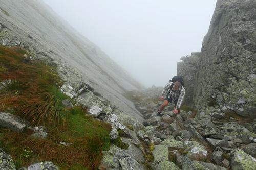
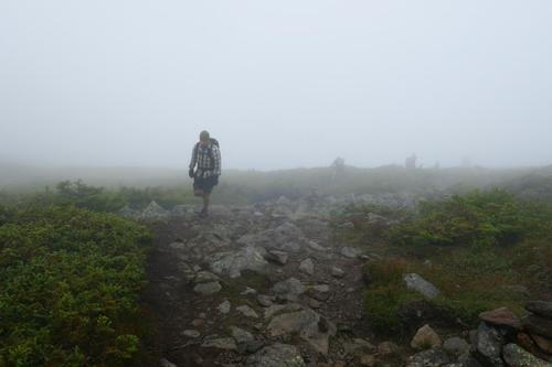
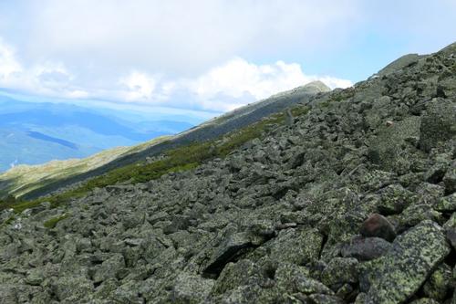
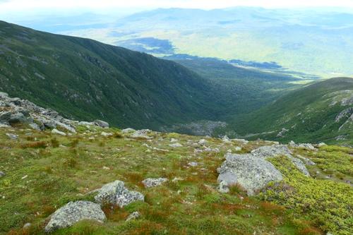
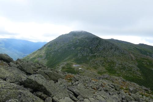
After Mossy Fall, the trail starts to change character, and quickly. The rocks start to grow in size and soon we were scrambling up, not just stepping up. Since we were closed in by clouds overhead we had no views but we were getting to the floor of the ravine, walking and hopping among boulders the size of and larger than SUV’s. King’s Ravine is a huge bowl like Tuckerman’s Ravine but without the crowds. At the Chemin De Dames junction, we were certainly among the boulders. We did not see anyone else in King’s Ravine.
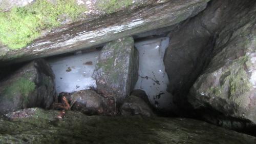
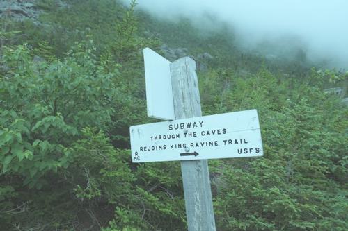
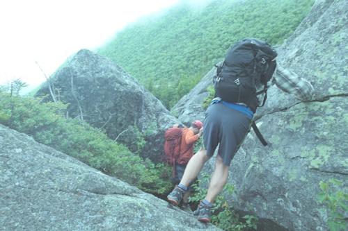
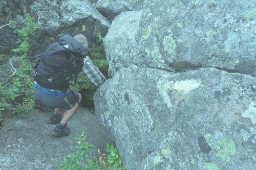
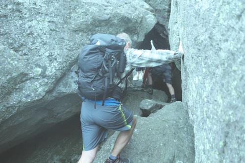
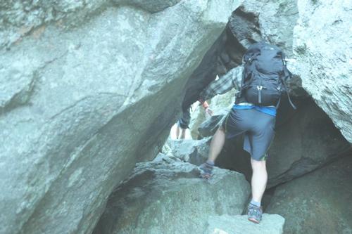
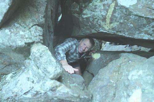
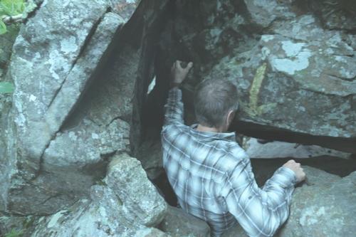
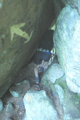
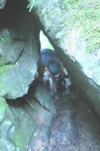
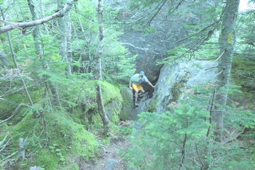
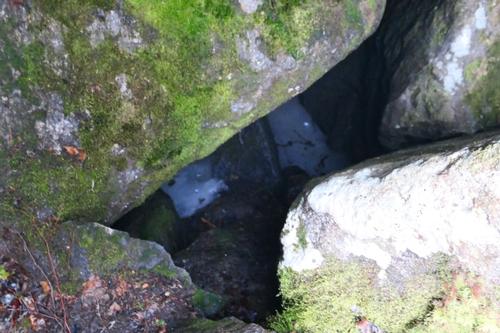
There was an option to take the ‘Elevated” route but we were excited and ready for the Subway! It starts off with some rock hopping and scrambling. We then navigated through a series of boulder caves; a lemon squeezer in spots where we had to take our packs off, push them through and crawl. Rough, rugged, 100% fun! Back on the trail, we got to the Ice Cave section, which again was interesting, and certainly cooler down in there. And yes…there was ice down there!
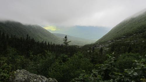
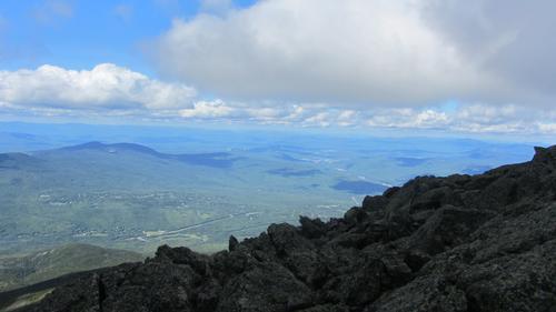
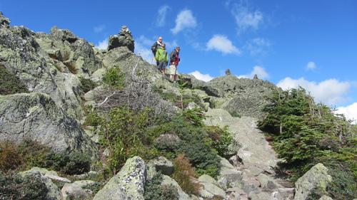
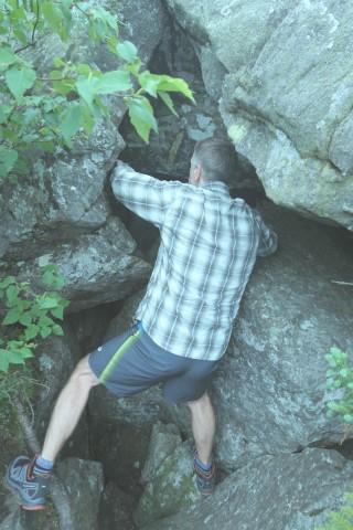
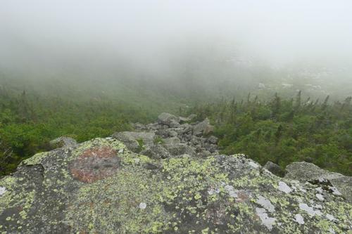
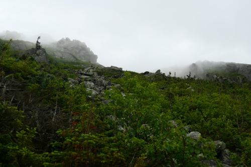
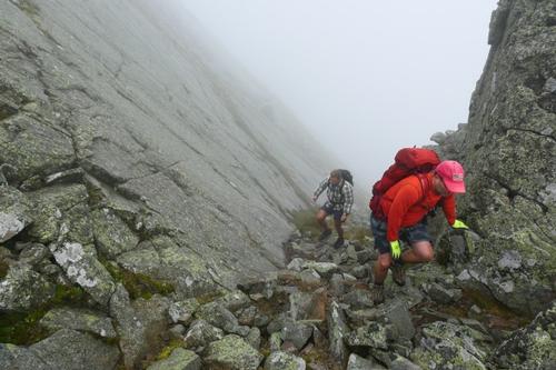
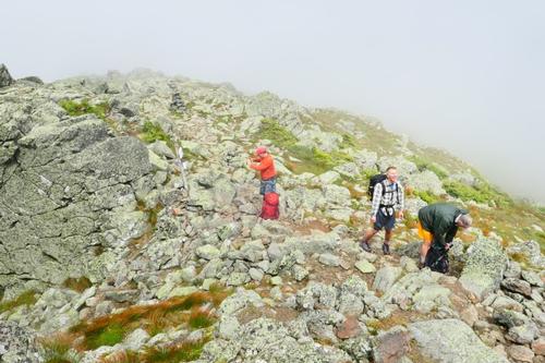
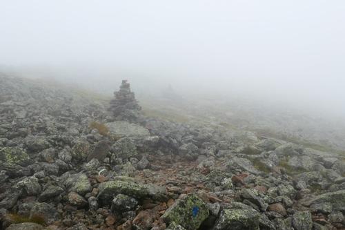
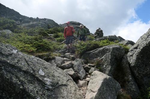
Then the real fun began, the hike or rather climb up the headwall. We had to use hands and feet in some places, as some sections had some rather larger boulders. This part is really steep, gaining 1100 feet in a half mile, but it was fun. When I wasn’t out of breath from the workout I was getting views as the clouds were lifting below. I was grinning and having a great time! It really is something to look up and barely be able to see the next cairn above your head and then to turn around and look back down the ravine. It was windy so about 2/3 of the way up we decided to break for lunch since it would be difficult to take a break higher up. After lunch, the steep ascent continued. As we climbed higher we could see The Gateway.
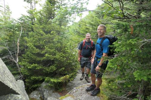
Once thru The Gateway we were on the Airline trail with only 0.6 miles to reach the summit of Mt. Adams. The sun appeared briefly that brought up our spirits being in the clouds all day.
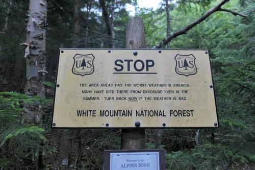
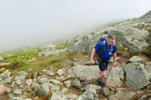
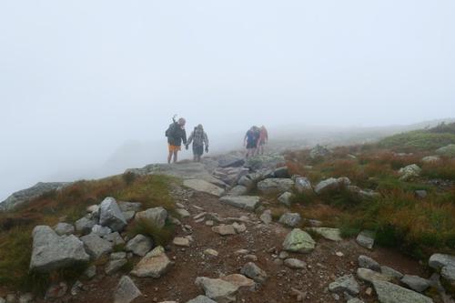
It was tough climbing in the fog with low visibility, small and wet rocks to hop on and very windy conditions. About 45 mph! Closer to the top, my legs started to really complain, my calves and quads had had enough. Although this hike to Mt. Adams has an elevation gain of 4,500 feet, it wasn’t just the hike itself. We also experienced a big, steep jungle gym with huge boulders. I knew within a few minutes I’d be at the summit and get chance to relax for a bit, so I pushed on and kept on going.
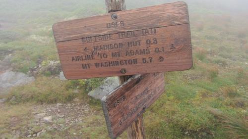
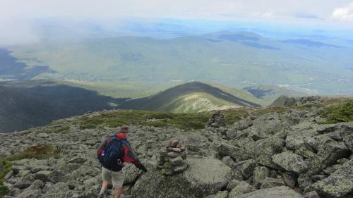
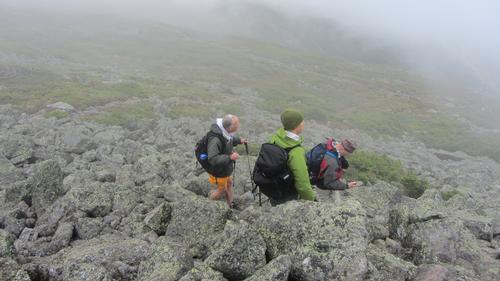
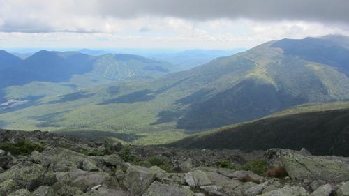
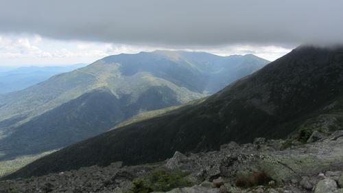
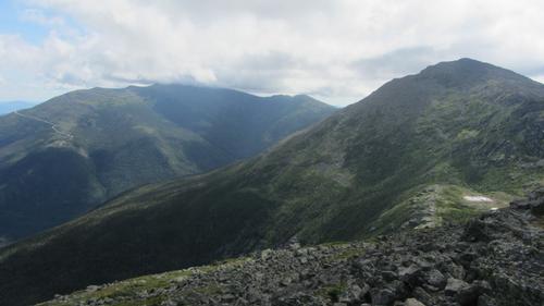
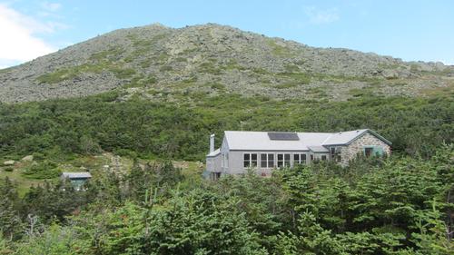
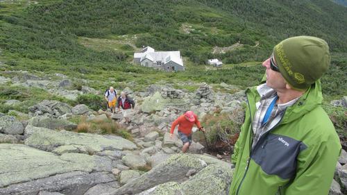
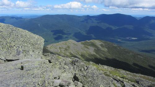
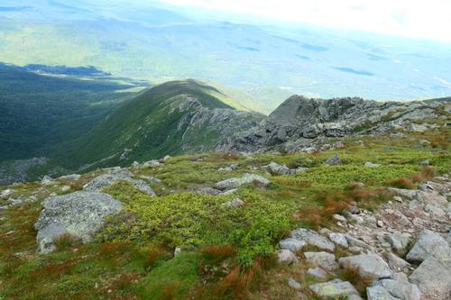
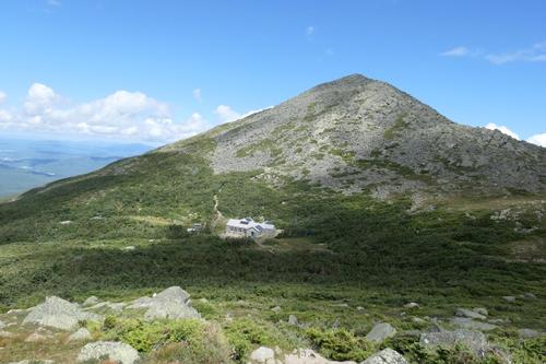
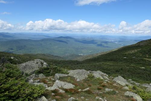
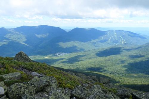
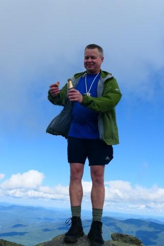
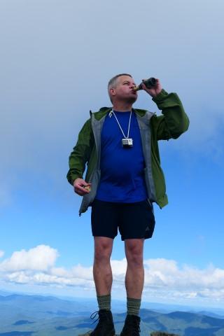
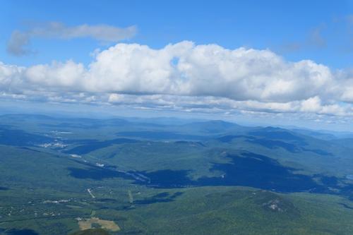
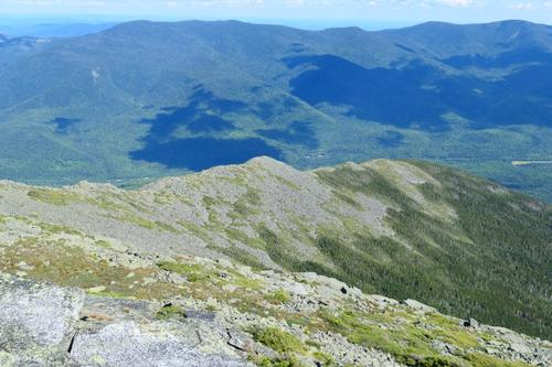
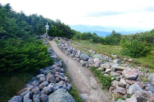
We took a short break and started back down the Airline. As we retraced our steps, the clouds suddenly disappeared, the sun appeared and wind died down. We could finally see the amazing views! We then hiked on the Gulfside and took a break at Madison Hut. We dropped our packs to make the 0.6 mile climb to Mt. Madison. As we climbed, we could see Mt. Adams that we had just climbed with Star Lake below. Further up, Mt. Washington and Wildcat ski area appeared. On the summit, we celebrated Brian’s last 4,000 footer by sharing champagne and gazing at views in all directions.
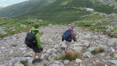
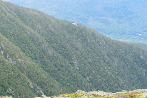
We retraced our steps, took another short break at Madison Hut and then made our 3.8 mile descent down the Valley Way back to our vehicles. The trail quickly goes back into the trees and we picked up the pace and moved quickly back. The start of the trail is steeper and rockier, but after that the footing improves to packed dirt with few rocks and the trail is easy walking back to Appalachia.
We had a fantastic day, with so many blessings, sunny skies for the ending (there’s no guarantee in the Presidentials), safety, and a little extra endurance. If you’re a rock scrambling, high-elevation gain junkie, the King Ravine the trail for you! You will love the experience. Even if this isn’t your sort of thing, a King Ravine hike to and from the Chemin De Dames junction for a little boulder experience and the great views of King Ravine is worth it. The day was more special being able to celebrate with Brian with his completing of hiking all 48 of New Hampshire’s 4,000 footers!
~ Mike Boisvert
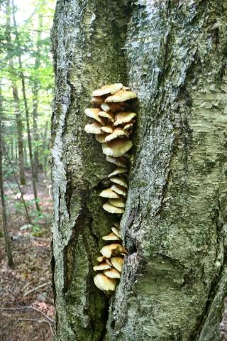
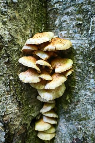
There are 160 photos in Album (Note: Move mouse pointer over larger pic and click on NEXT for better viewing)


What Members Are Saying About This Trip/Event
- This was an epic adventure - almost 11 hours of hiking over some seriously rough terrain! Love the video. It was great fun to be there for Brian's 48th finale' - yahoo! - JDNnh
- What an amazing day. Thanks Mike & John for leading us through King's Ravine, and to the summit of Adams. So nice that the skies opened up! Great video Brian, and congrats again on your 48th it was good to share that with you! - Dell
- Thank you Mike, John, Bob and Randy for you all giving me the opportunity to complete my NH 4K list. Deciding to go for Mount Madison on the way back was a great bonus! - WalkaboutBrian
|
|
||