Trip report
Mt. Jefferson via Castle Trail
Hiking/Walk DATE: 07/16/2017 - 07/16/2017
Trip/Event Location: Gorham, NH
US
Trip Leader(s): Gandalf
Max # People: 15
Trip Guiding / Event Fee: No, I will not be asking participants for money
Difficulty Level: Very Strenuous
FUN hike on this 5,000 footer in the Presidential Range followed by a swim/BBQ at the Mad River Lodge!
Mt. Jefferson, [5,716'], the third highest peak in the Whites grants a sweeping view,
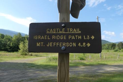
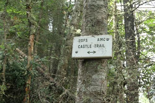
...The Castle Trail begins at Bowman on US 3, 3 miles west of the Appalachia parking area and 4.2 miles east of the junction of US 2 and NH 115. We are driving a blue Toyota Tacoma truck.
Trip Report/Photos

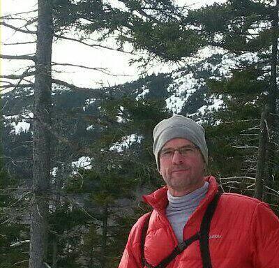
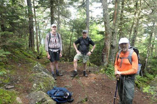
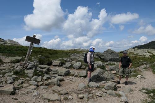
We decided to do a longer and very strenuous route from the Bowman trailhead on US 2 to the north – up the Castle Trail and down the Israel Ridge Path. This 11 ½ mile trek would take us along some of the most scenic trails in the Presidentials! Rob had yet to arrive when we left at 8:15AM on what promised to be a fine day to the above treeline.
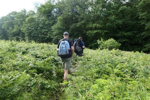
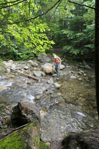
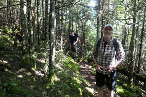
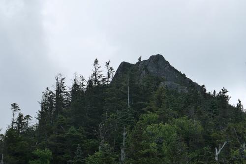
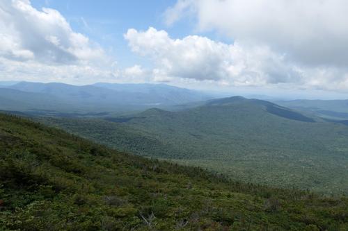
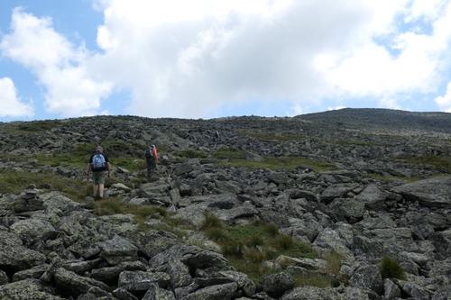
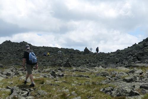
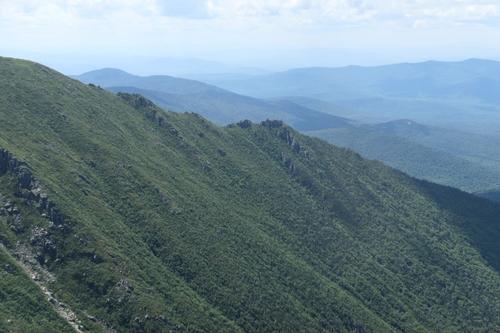
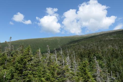
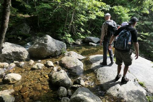
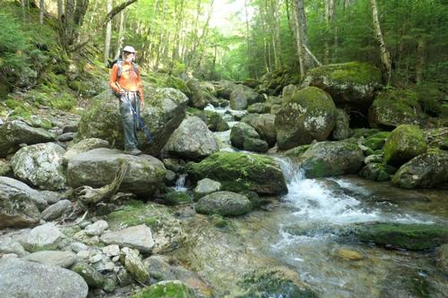
From the trailhead there is a classic view of Mt. Jefferson and the Castellated Ridge, in the venerable words of the AMC White Mountain Guide “sharpest and most salient of the White Mountain ridges.” The first part of the Castle Trail leads through a bushy area and across a powerline to a crossing of the Israel River. The water was higher than we expected. Phil rock hopped, Chuck tried the same approach and ended up slipping off the rock scraping his leg. Dave and I tried a different approach and were fine with getting our boots wet.
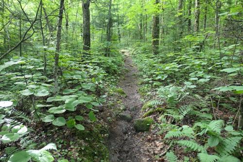
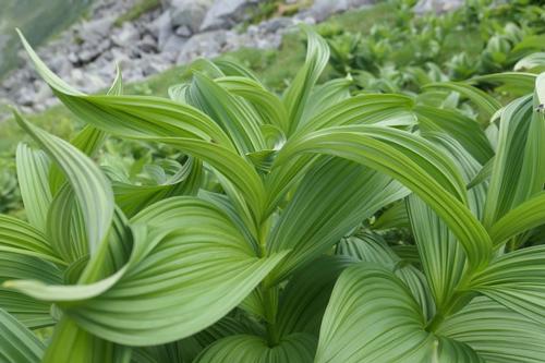
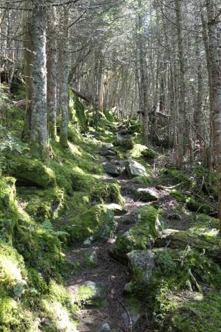
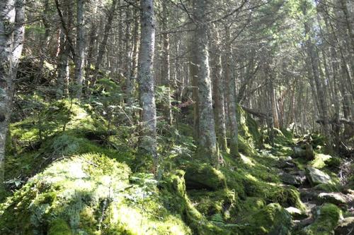
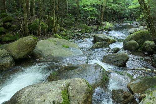
The next mile and half of the Castle Trail leads through a leafy hardwood forest, which is especially fine after the Israel Ridge Path splits L and Castle starts to ascend the flank of Mt. Bowman. The hardwoods extend up to about 2400 ft. and then the white birches take over and the trail becomes steeper and rockier. The grade is quite steep above 2700 ft. with many rock steps. Rob had caught up to us at this point. With temperatures in the lower 80’s, we all began to sweat.
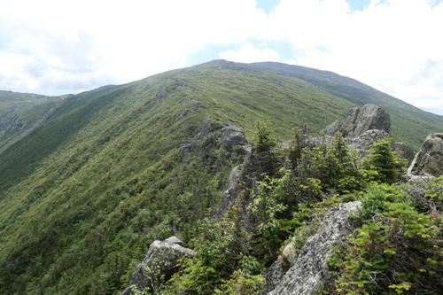
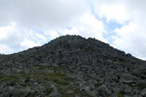
At the top of this long pitch, the trail abruptly levels out on the broad shoulder that connects the Castellated Ridge with Mt. Bowman. The next half mile or so is pleasant: easy grades, good footing, and ferns galore. This is some of the nicest walking on the Presidentials! The grade increases as you ease onto the main ridge, but the footing is decent.
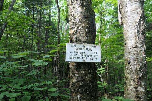
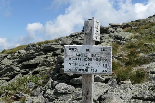
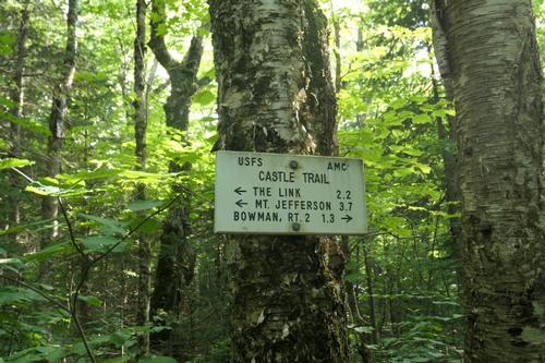
The ridge becomes much steeper and rougher once we reached the junction with The Link at 4025 ft. We encountered two backpackers wrapping up their weekend by circling back to their car via The Link. I hate The Link and vowed never to do it again whereas Rob loves it. I guess we have different tastes as to terrain; does that translate to men also? Hmmm
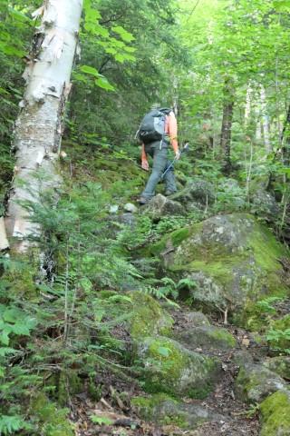
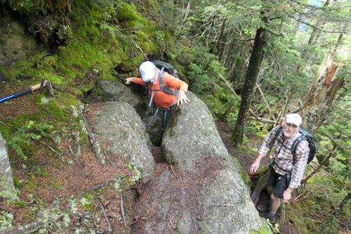
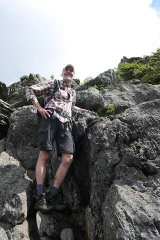
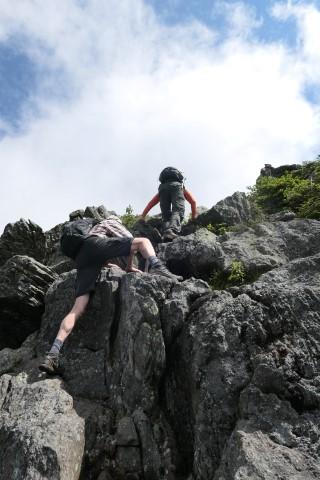
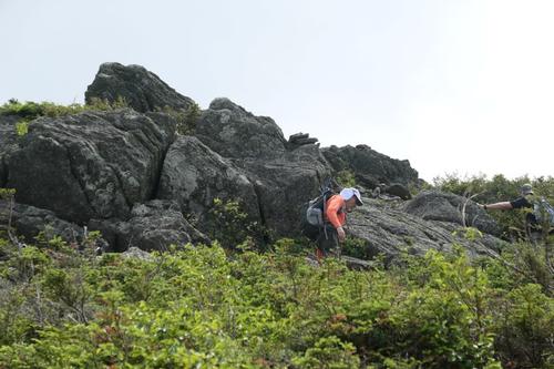
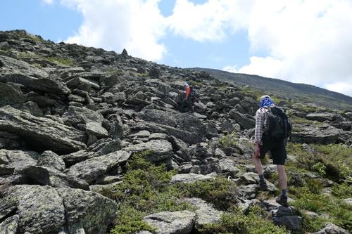
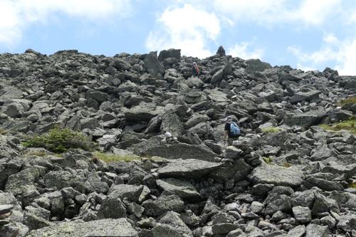
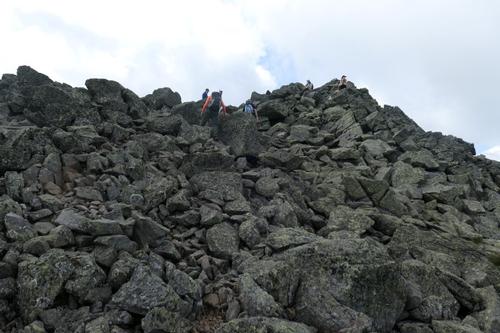
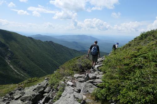
After The Link junction it was time to stash the trekking poles, lots of scrambling up ahead! I got a picture of us scrambling up a steep slab that is one of the more interesting spots as we worked our way up the Castles. And we were just getting started.
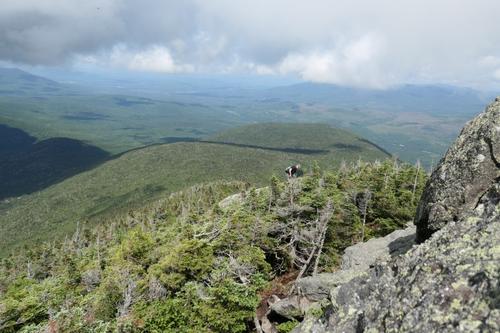
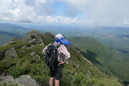
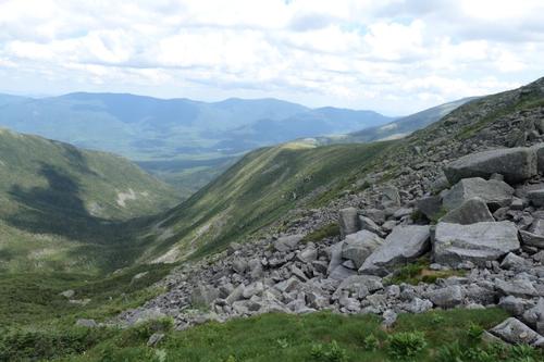
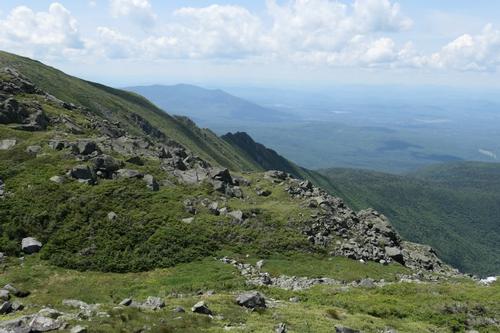
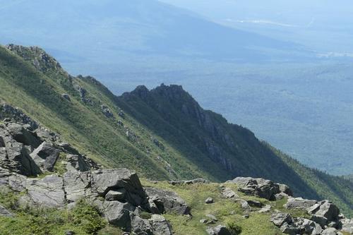
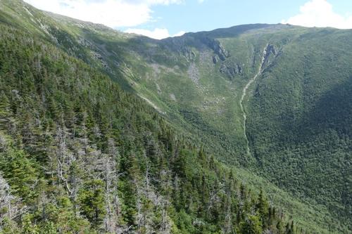
From the first outlook ledge, the First Castle is in sight above. I got a picture of us scrambling one of the most difficult as the trail lifted up to the top of the First Castle [4450 ft.]. This crag is one of the great below-summit viewpoints in the range! Whether you look down the valley of Castle Brook…up the ridge to the higher Castles…across to the scree-scarred headwall of Castle Ravine…or out to the western Whites.
Standing on the edge, we got a dramatic look down at the floor of the ravine. We were clearly impressed with the views evidenced by all the comments everyone was making.
Phil had not been feeling well all day and after reaching the First Castle, decided to turn back. It was a good decision as we had another 1300 feet of elevation to climb in 1.5 miles. He was going to take it slow on the descent and we did back with him at the trailhead once we finished.
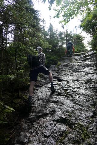
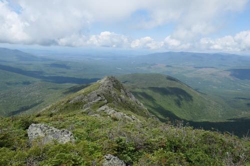
We continued up the trail, weaving around the upper Castles and other assorted crags. I took may pictures of us navigating this section include photos of the Castles looking back.
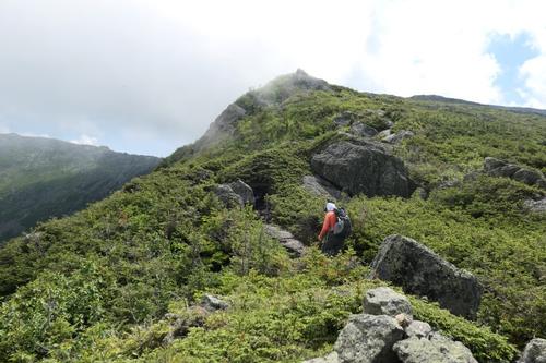
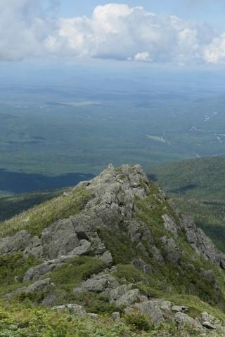
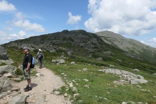
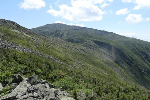
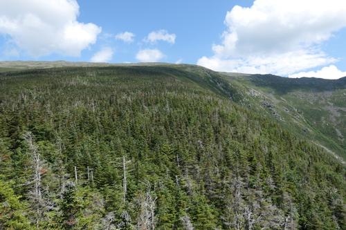
As we climbed higher, the shark-fin nature of the ridge became more apparent. Higher up, the “Adams family” comes into view to the NE. It’s a steady climb, all in the open, leading up through rough talus as the summit of Jefferson rises ahead. We worked our way up the mountain enjoying the passing breezes to cool us off.
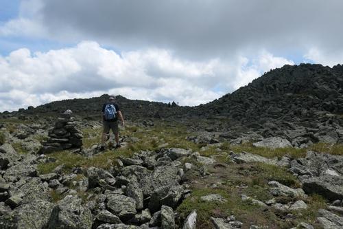
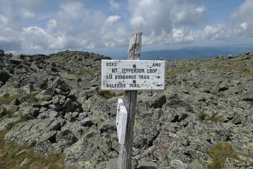
The Cornice junction is reached at 4.5 miles and 5100 ft. Only a half mile to the to the Jefferson summit. This last segment offers more of the same in the rock scramble department, often following cairns white-capped with quartz. We were happy to finally see the pile of rocks that represents the actual summit!
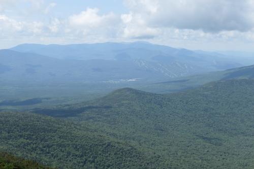
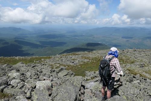
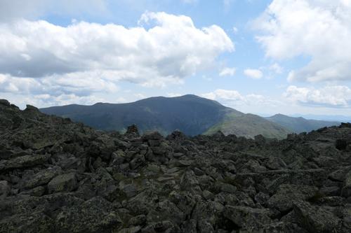
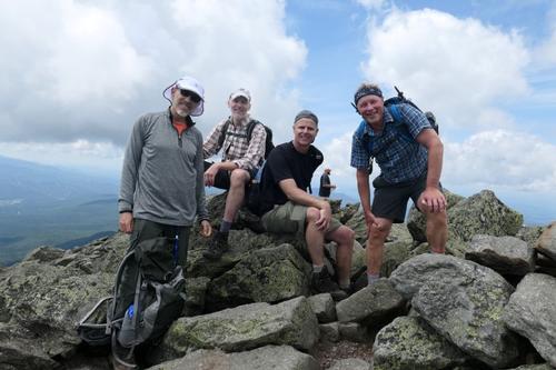
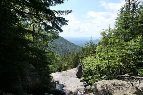
A massive cairn marks the four-way trail junction just below the summit of Jefferson. The true summit is reached by a short rocky scramble up from the high point of the Caps Ridge Trail. Although it is not often ranked among the top several viewpoints in the Whites, there are plenty of interesting vistas to be found on Jefferson. From here, the summits of 40 other NH 4,000 footers can be spotted! Most notable are the two highest peaks in the Northeast, both near neighbors to Jefferson, the third highest at 5716ft. Mt Adams [5799 ft] is to the NE…and Mt. Washington [6288 ft] to the south. The Carter Range is seen to the east, beyond a lesser summit knob. The southwestern panorama reveals wave after wave of blue ridges. It was a hot, hazy, and humid day so the mountains off in the distance had this bluish hue to them. We had a couple women from Quebec City take our group summit picture.
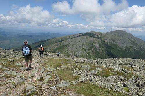
After a relaxing summit stay, we headed north down the Jefferson Loop. It was around 1:30pm. We started to meet a number of hikers on this section of trail. We met one handsome dude who was friendly and shared his proud achievement of summiting Mt. Adams and Mt. Madison; returning back to Mt. Jefferson to use the Caps Ridge Trail to get back to their vehicles.
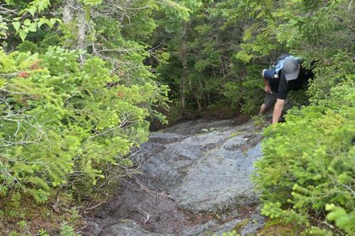
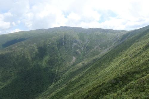
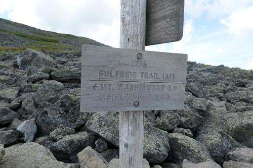
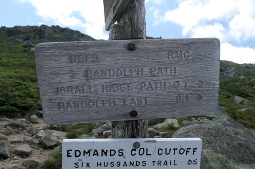
As we descended, the view of Adams rising from the depths of Jefferson Ravine is dramatic – one of the outstanding views in the Whites! After a steep, rough descent, we eased down to Edmands Col. I think we were looking forward to less rocky terrain but in fact, that did not materialize until the end of the hike when we looped back to the Castle Trail.
Next up was an open 0.7 mile traverse on the Randolph Path, leading across the rim of the Castle Ravine to the Israel Ridge Path. Although the lower few miles of Randolph Path are nice and graded with pretty good footing, this upper section is often rocky and rough. Still fairly slow going for a nearly level route.
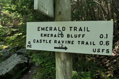
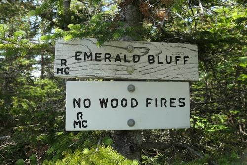
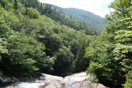
Nevertheless, we had continuous views through here, looking down into Castle Ravine…across at the Castellated Ridge…and back at the summit of Jefferson. We turned L for the descent on the wild, rough and scenic Israel Ridge Path, soon descending into the scrub. Rob and I took the time for the short side trip to Emerald Bluff, a remarkable outlook on the Emerald Trail while Dave and Chuck continued to descend. We peered down into the Castle Ravine and had a great vantage point of the Castle Ravine headwall!
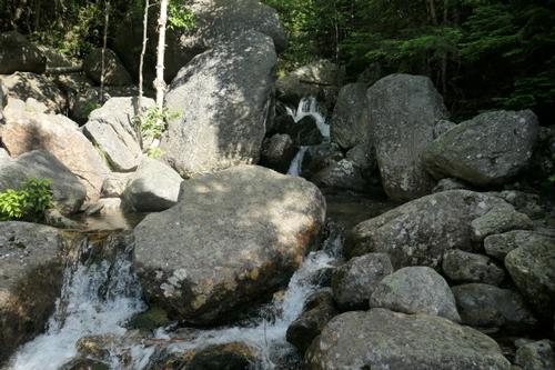
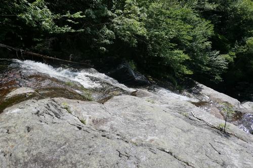
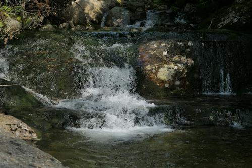
The RMC crew has constructed several ladders to span steep ledges. The descent off the lower end of Israel Ridge is very steep. This minor ridge was originally called the Emerald Tongue; apparently the great path-maker J. Rayner Edmands applied the new name when he constructed the Israel Ridge Path in the 1890s. We stopped beside the Second Cascade on Cascade Brook and gazed off the ledges, with Mt. Bowman rising nearby. This is a great spot for relaxing and sunbathing. The Second Cascade is a great destination for a moderate hike of 5 ½ to 6 ½ miles round trip, depending on the route chosen. The trail is rather rough in the vicinity of the Second Cascade, and also by the First Cascade a short distance downstream.
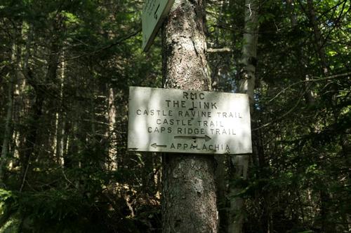
We reached the junction of The Link without any signage of the Israel Ridge Path. The Link sign indicated to take a left to the Castle Trail so that we did. I discovered 5-10 minutes that we were on the wrong trail once I looked at my map and realized we were going up the Castle Ravine. We turned around and realized that The Link and Israel Ridge Path share the same trail for about 50 yards…there should be a sign indicating where to continue if you wish to follow the Israel Ridge Path.
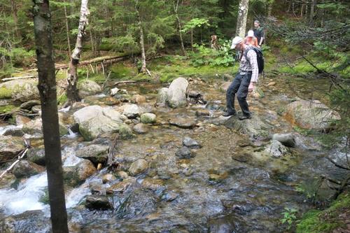
Back on the Israel Ridge Path, we crossed the Israel River, and reached the Castle Trail to return back to our vehicles. This was a marvelous, inspiring hike and I heartily recommend a climb up Mt Jefferson on the Castle Trail if you have good weather window!
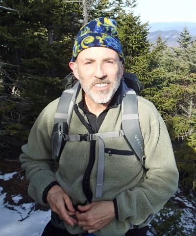
Trip report and pictures by Mike Boisvert
There are 92 photos in Album (Note: Move mouse pointer over larger pic and click on NEXT for better viewing)


What Members Are Saying About This Trip/Event
- It's always great being on the trail... trails that are rugged... hard edged... steeply pitched... Thanks Mike for leading a brilliant day and glad we switched to Sunday!! - Robert.L
|
|
||