Trip report
Mt. Tecumseh Traverse
Backpacking DATE: 08/20/2016 - 08/20/2016
Trip/Event Location: Waterville Valley, NH
US
Trip Leader(s): Robert.L , wildcat
Max # People: 12
Trip Guiding / Event Fee: No, I will not be asking participants for money
Difficulty Level: Moderate
Join Martin and me on Saturday August 20 for a traverse over Mt. Tecumseh starting from Tripoli Road and ending at Waterville Valley Ski Area. At 4,003', Mt. Tecumseh ranks 48th in height,
...If you are part of the GO gathering Friday night we’ll carpool from the campground Saturday morning to Waterville Valley to spot the necessary car(s) then make our way to the trail head on Tripoli Road. I may be over estimating the needed time but we’ll assemble at the campground for an 8:30am departure.
If you join us on Saturday, meet us at the Tripoli Road parking area for Mt. Tecumseh at 9:15 (the group may be late, depending on how quickly we can leave the camp ground and spot cars. I’ll be driving a dark gray Honda CRV). Take exit 31 of I-93. Follow Tripoli Road for 5.7 miles, the parking lot will be on the right.
Trip Report/Photos
Morning came early at the GO Gathering…. or perhaps a little too early as the festivities went well into the evening… I arrived a little later than anticipated on Friday but quickly settled in and caught up with many GO members, old and new, and immersed myself in the moment of FUN. I’ve had lots of great experiences in GO this past year and I was happy to lead a trip and give back a bit of what’s been given to me!!
I got up around 6:30am… made my way to the local Dunkin Donuts to grab a ‘Box of Joe’ knowing full well many might appreciate the hot coffee when they awoke whether or not folks were prepped to make their own. Slowly… bit by bit… people came out of their tents… shook off the evening before… and life started humming again. I didn’t get the chance to connect with all the folks who signed up for Tecumseh the night before so Saturday was a wait and see approach to who’d be ready for an 8:30 am departure… not so many, lol.
Sometime between 8:30 and 9:00 I connected with Howard, Phil, Ed, Carl and Kerry…. Rick had signed up but decided to sleep in a bit later. He went on his day to hike the Drakes Brook Trail just down the road from the campground. Martin unexpectedly had to leave so I was leading this hike solo!!
With no last minute sign ups we piled into three cars… spotted one vehicle at the trail head by the ski area and carried on to Tripoli Road where we soon found ourselves at the foot of Mt. Tecumseh Trail head. The traverse was a modest 5.6 miles but not to be discounted. At 4,003 feet we were to ascend approximately 2,000 feet over 3.1 miles with the gift of a sharp descent into a col before the final push to the summit – always a little taxing when unexpected. The descent was even steeper at a short 2.5 miles.
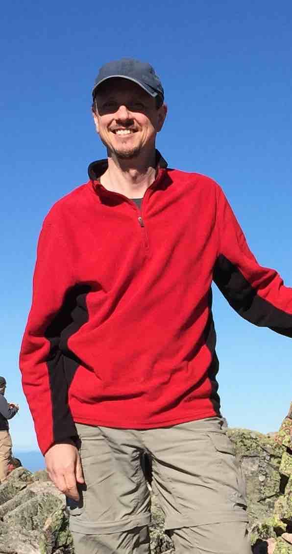
The sky was bright blue mixed with puffy white clouds, great temps, light breeze and very little humidity – a perfect day for hiking. Around 10am we made our way into the tree line and the trail quickly began the upward climb. This trail represents the best of what I love about hiking … the forest starts under a leafy canopy but quickly turns to pine with various degrees of density. Most of the way up we had the scent of pine – intoxicating – with beautiful mosses and ferns. It was green, lush and quite stunning. As we climbed higher and higher I really loved how the trail narrowed, the pine trees became denser all the while rubbing shoulders with these trees – love it! Sadly I forgot my camera at home – total bummer – so let your imagination run wild in creating the visual that we experienced first-hand. We took lots of breaks on the way up and hiked at a moderate pace.
Shortly before we began the descent into the col we tagged a view point that had us asking if this was the summit… I hadn’t hiked this trail before so I was a bit unsure. Based on the view – looking westward I believe we were capturing Mt. Moosilauke… it was a small view point and confirmed by hikers who came up behind us that this wasn’t the summit. As we continued our Journey we soon realized the summit loomed large right before our eyes, Ed wondering, just how he would manage the final push up as we continued to descend into the col.
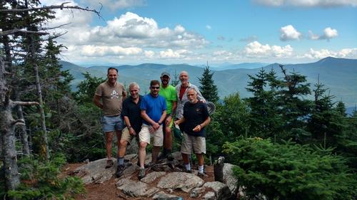
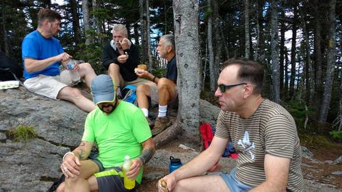
Around Noon we reached the summit. We broke for lunch and hung around for about an hour. There were a handful of folks on the summit with us – and many a good canine friend too! We lunched chatted and appreciated the views. From the summit you can take in the Sandwich Range Wilderness area and see clear north all the way to Mt. Washington.
Around 1pm we began our descent, again following a moderate pace and taking rest breaks along the way. This side of the traverse was quite different than what we came up. This trail is steep, quite direct and had us constantly going down in addition to being largely deciduous, very dry with little to no mosses or ferns. Much of the trail at the higher elevation is a series of steps clearly laid by caretakers. In fact – we chatted up one such gentleman who was digging out rocks and using his iron pole to maneuver them in place – hard work for sure! He was constructing a new set of stairs to mitigate erosion at a particular section of the trail.
At this time Phil decided to pick up his pace and hike ahead. Ed took the lead and set the pace for me and Howard with Carl and Kerry not far behind us. Along the way we took a side detour to catch a view via the ski trail. By 3:15pm we were at the trail head where we spotted the car from earlier. We all squeezed into the car for the trip back to Tripoli Road to connect Phil and Kerry to their vehicles. Just before we reached the trail parking a downed tree was blocking the road. We got out of the car to assist the sole gentlemen doing his best to get the tree removed. We hoisted and tossed the tree aside – job well done!
I did manage to get a group shot and lunch photo while at the summit – enjoy. By 4:30pm we were back at the campsite enjoying a refreshing swim to wash off the day’s sweat from our journey up Tecumseh.
Thank You Phil, Howard, Ed, Carl and Kerry for sharing your day with me. You guys were great company, hearty hikers and fun to be with – hope to see you on the trails on upcoming treks. I had lots of fun and I hope you did too. Cheers Gents!!
There are 2 photos in Album (Note: Move mouse pointer over larger pic and click on NEXT for better viewing)

|
|
||