Trip report
Mt. Chocorua Loop Hike
Hiking/Walk DATE: 04/30/2016 - 04/30/2016
Trip/Event Location: Albany, NH
US
Trip Leader(s): shep5
Max # People: 15
Trip Guiding / Event Fee: No, I will not be asking participants for money
Difficulty Level: Moderate to Strenuous
Join me for this 9.3 mile loop hike, which will encompass the the steep Carter Ledges, the Three Sisters and the summit of Mount Chocorua. While not a 4000-footer, Mount Chocorua has the feel of
...FROM POINTS SOUTH CONVENIENT TO ROUTE 93: Take Route 93 to Exit 23. Take Route 104 East for 8.2 miles. Turn onto Route 3 and follow for 0.9 miles to the intersection with Route 25. Take Route 25 for 19 miles and then turn onto Route 113 East. Follow NH 113 for 2.9 miles. Just after the village of Tamworth, turn right onto Page Hill Road. Follow this for 3 miles to Route 16 in Chocorua (NOTE: If you stay on NH 113, you'll get to the same point.). Take Route 16 North for 6 miles to the Davies Campground and General Store (on your left just before Moulton Drive).
FROM POINTS SOUTH CONVENIENT TO ROUTE 16: From Portsmouth, NH, drive Route 16 North for roughly 70.8 miles to the Davies Campground and General Store (see above).
The trailhead parking area is accessed by a dirt road off NH Rt 16 behind Davies Campground and General Store, 6.1 miles south of the juntion with the Kancamagus Hwy (Rt 112) in Conway. Look for a gray Hyundai Elantra.
For GPS Users: 43.939451, -71.225266 (approximate address 2509 NH Route 16; Albany, NH – at the intersection of Moulton Drive). Meeting Time: 9:00 AM.
Trip Report/Photos
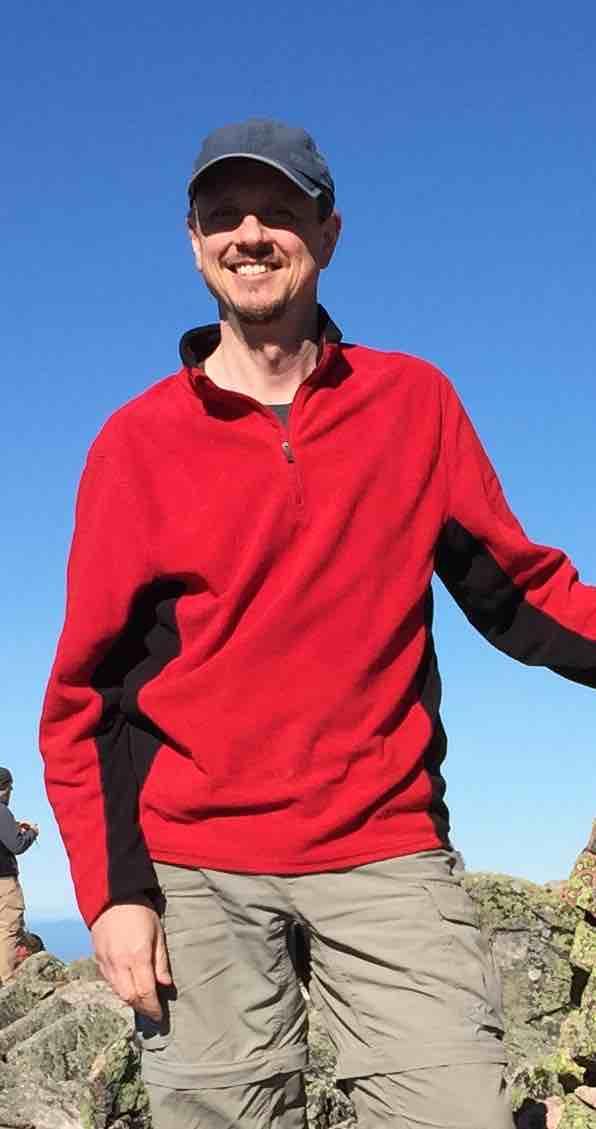
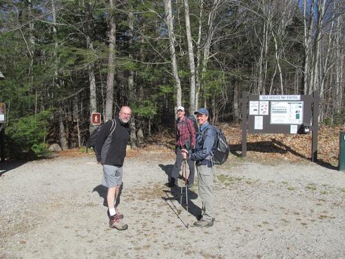
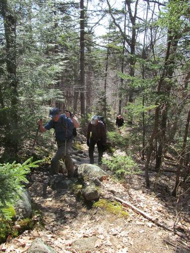
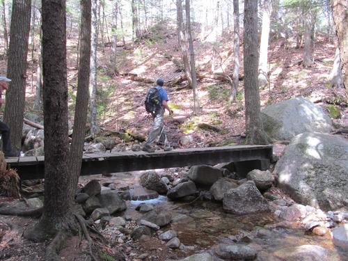
On Saturday, April 30th, four of us met up at the Piper Trailhead parking lot behind the Davis Campground at 8:45AM. We were Jim, Martin, Robert and myself. By just before 9AM we were ready and we started up the Piper Trail. It was a bit chilly to start the day, but skies were clear and blue with nearly no wind.
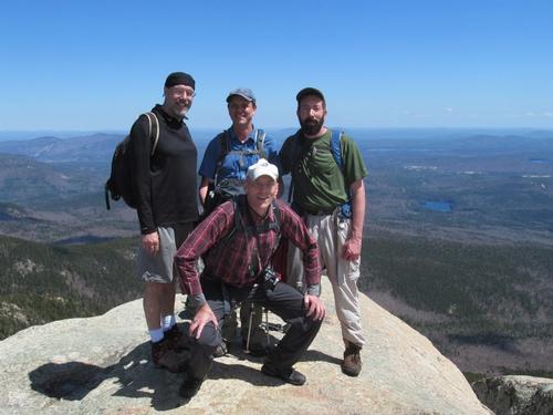
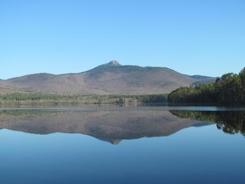
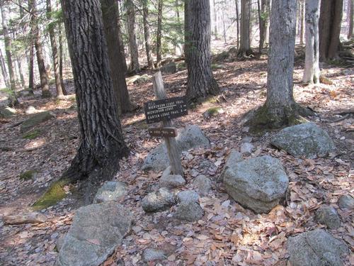
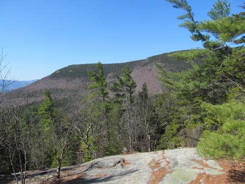
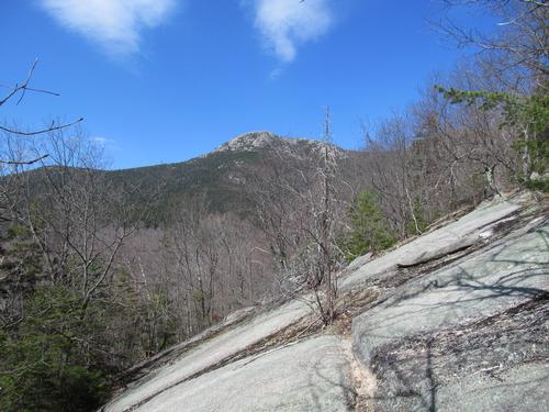
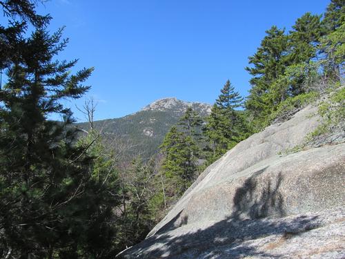
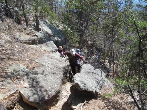
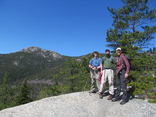
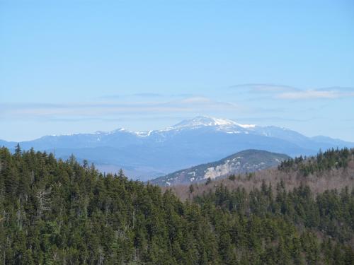
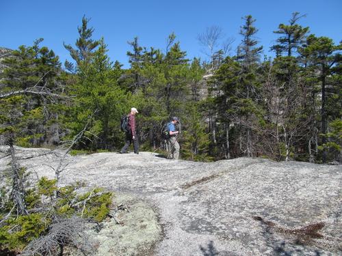
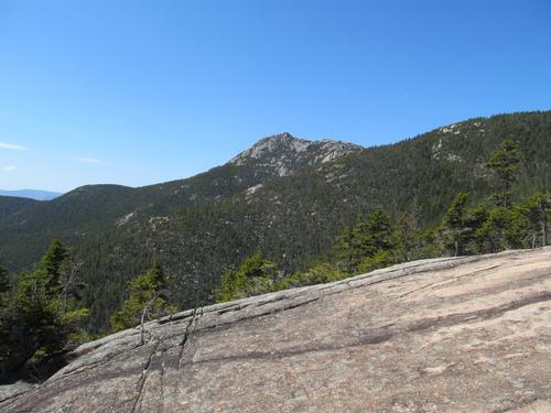
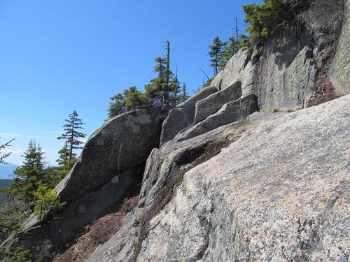
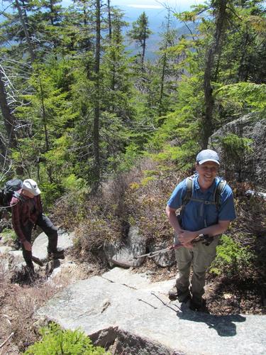
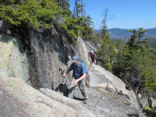
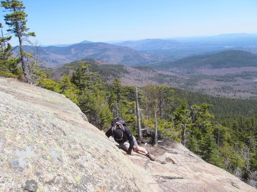
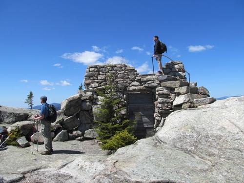
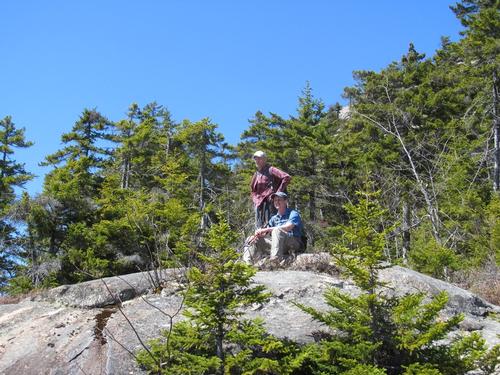
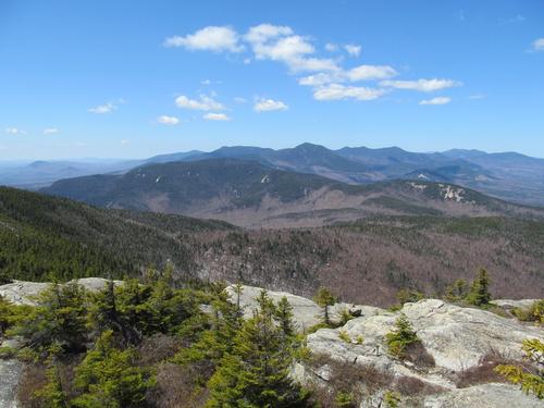
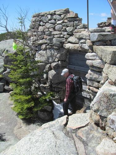
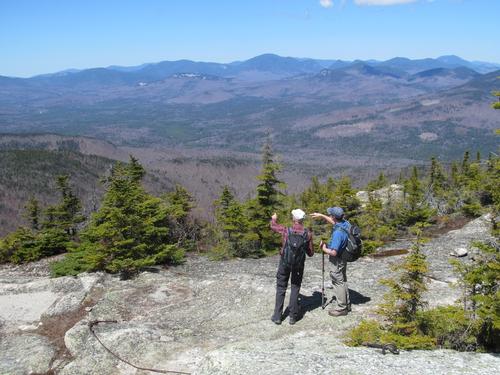
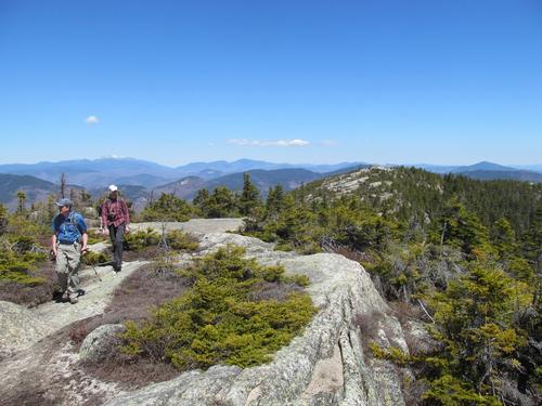
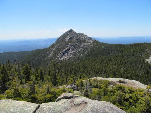
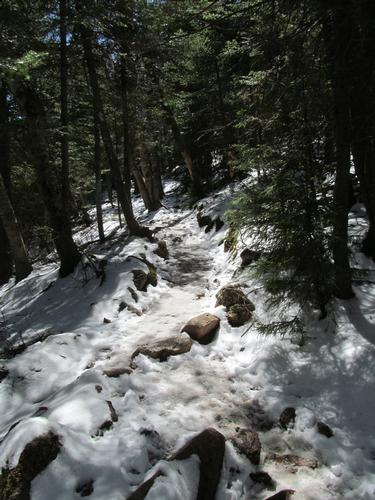
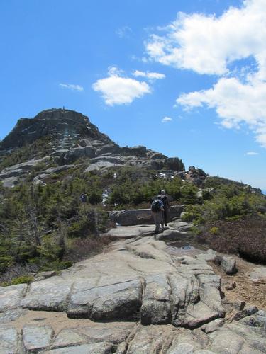
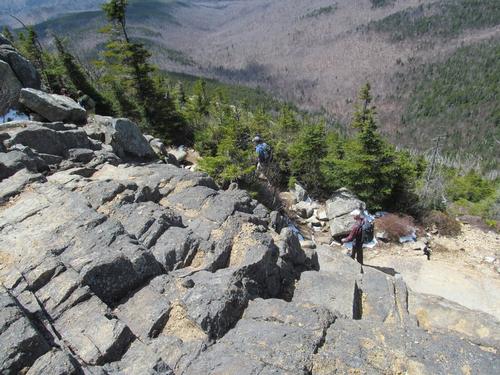
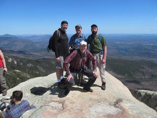
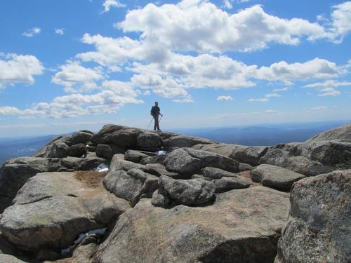
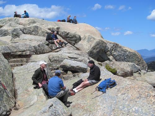
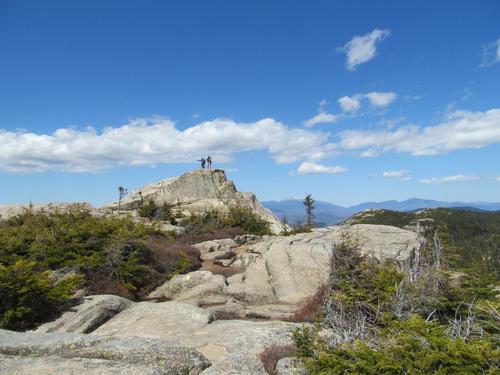
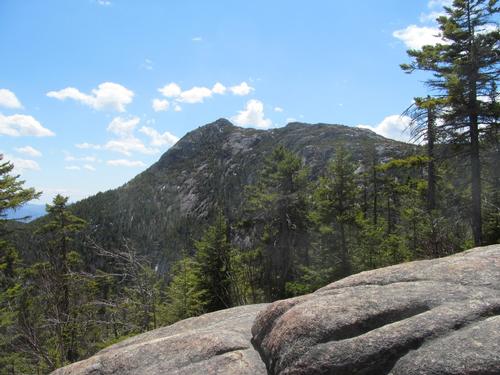
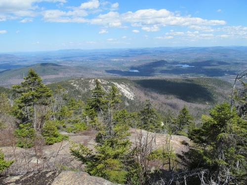
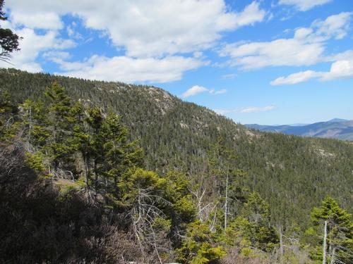
The Piper Trail was initially fairly wide and ascended at a moderate grade. By 9:30 we had reached the junction with the Nickerson Ledge Trail. We turned onto this trail and it immediately began to climb more aggresively. The trail leveled out after about 10 minutes and there was a view of Bald Mountain from the first ledge. At just before 10AM we turned onto the Carter Ledge Trail. This trail ascended more aggresively, but offered lots of views towards Mt. Chocorua in the process. After another half-an-hour we were treated to a view of Mt. Washington to the north. The trail then descended briefly before beginning its climb up to the Carter Ledge. We reached the ledge by 11:15. It consisted of a narrow ledge, which then transitioned to a small area of smooth, sloped granite, which had to be carefully maneuvered (there was a good drop-off). None of us had too much difficulty with it, but I could understand, why it might bother some. After another 15 minutes of climbing we reached the Middle Sister Trail and we took this up. By 11:40 we were on an open ledge of the first "sister". We took a snack break, while we chatted with some other hikers here. From here we descended again briefly before climbing up to the more open Middle Sister with is shell of a old fire tower foundation. The views from here were fantastic in all directions. It was just before noon and we pressed on. We were up on the open summit of the third "sister" in only another 15 minutes. After this we descended and reached the trail junction with the Champney Falls Trail by 12:20PM. As we headed to the summit of Mt. Chocorua, there was finally a good amount of snow and ice on the trail as the trail progressed through the small wooded col. After emerging from the woods, we just had the final open, rocky summit to ascend. This was fairly quick and we summited Mt. Chocorua (3475') at 12:45PM. After taking a group photo, we found a nice area just below the summit to enjoy our lunches.
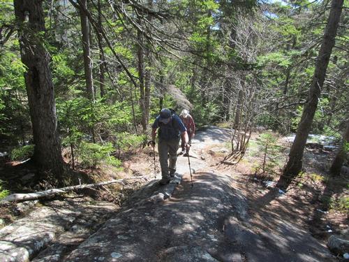
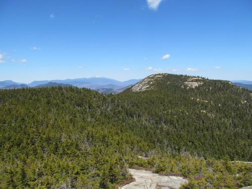
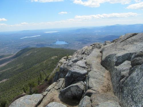
After a decent lunch break, we started back down by 1:30PM. We re-traced our steps off of the summit back to woods and this time turning onto the Piper Trail. As we descended this trail, we once again encountered open ledges again by a little after 2PM. There were great views back towards the summit and over to the ridgeline that we had ascended. We took another short snack break on the second of these ledges. It was shortly after these ledges that the trail descended back into the woods and in short time we passed the spur for Camp Penacook. The rest of the trail back was a modest descent through the woods and we again reached the trailhead parking lot by 4PM.
Jim had a long drive home and the rest of us had decided to spend the night in the area, so we dispersed. Later in the evening after cleaning up, Martin, Robert and myself drove into North Conway and had a nice meal at Chef’s Bistro.
What a fantastic day! Perfect weather, a beautiful hike with lots of spectacular views, and great conversation and camaraderie among everyone throughout the day. Who could ask for more! I had only ever done Mt. Chocorua from the Champney Falls Trail and this route blew that away with near constant open ledges and ridgeline that the Three Sisters provides. The Carter Ledge was not as scary as some forums made it sound, but I could see why some wouldn't like it. Overall, this hike was a huge thumbs up! Thanks to Jim, Martin and Robert for joining me on the adventure.
There are 41 photos in Album (Note: Move mouse pointer over larger pic and click on NEXT for better viewing)


What Members Are Saying About This Trip/Event
- One of the most inspirational hikes ever, from the spectacular views, to the gorgeous weather to the great group and conversations. Thanks Steve for making it happen! - wildcat
- What a spectacular day. A true gift from nature, brilliant blue skies, awesome hiking mates, a rugged mountain, good exercise - simply the best. Thanks gentleman for a generous and spirited day on the trail. - Robert.L
|
|
||