

Trip report
Mt. Washington Forest, Berkshires, MA
Hiking/Walk DATE: 02/13/2016 - 02/13/2016
Trip/Event Location: Mt. Washinton, MA
US
Trip Leader(s): Robert.L
Max # People: 10
Trip Guiding / Event Fee: Yes, but only to cover shared expenses, and I too am paying
Difficulty Level: Easy to Moderate
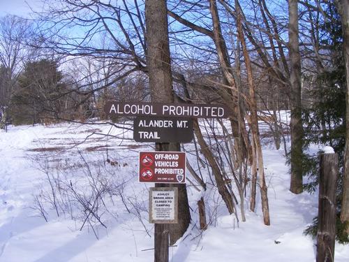
Join me Saturday, February 13th, for a day of exploration along the Alander Mountain Trail, a moderate hike, at the other Mt. Washington, The Berkshires, MA.
Mt. Washington State Forest is located
...Directions: From East or West/Mass Pike (I-90): Take Exit 2 in Lee. Follow MA Rte. 102 west for 4.7 miles to Stockbridge. Turn left and follow U.S. Rte. 7 south for 7.7 miles through Great Barrington. Turn right and follow MA Rte. 23 west for 4.9 miles to South Egremont. Turn left onto MA Rte. 41 south, then take immediate right, Mount Washington Road; continue for 8.8 miles (becomes East St.) to park entrance and headquarters.
From West, North and South/NY Rte. 22: From NY Rte. 22 in Copake Falls, NY take NY Rte. 344 east into Massachusetts (becomes Falls Rd.) for 3.3 miles. Turn right onto West Street and continue for 2 miles, bearing right onto East Street. Parking and trailhead are on right
Trip Report/Photos

Wind chills, cold temps and record low’s might have kept some indoors today, not me. I watched the forecast, listened intently, checked the weather websites and decided I could brave the elements and make a day of it. I had three participants signed up for this short hike but in the end it was just me. This marked a milestone of sorts – my first solo hike – and it was on the coldest day of the year!
I got to the trailhead a little early, I checked the temperature – a balmy 10 degrees – and finished suiting up – it was going to be a brisk but rewarding hike. I hit the trail at 9:30am. After taking my first photo, I realized I left the memory card at home – my camera’s internal memory is rather short – so each picture had to count – sorry there are not many.
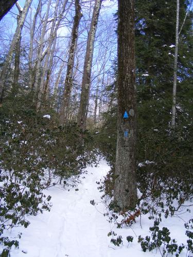
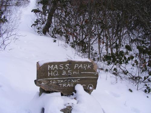
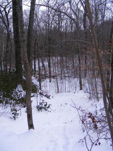
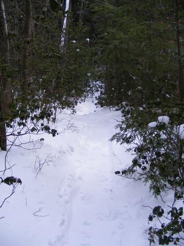
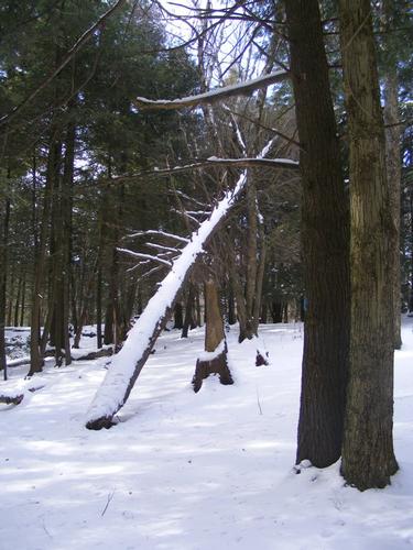
Snow cover was light – 5 inches at best. Recent snows of central Massachusetts which blanketed my neck of the woods with 20 inches didn’t reach that far west. I still used my microspikes and headed up the Mt. Alander Trail, a short 2.5 miles and 790 foot ascent. This trail and forest was beautiful. Lots of evergreens, some open space and an amazing field of mountain laurel shrubs – in every direction – I can only imagine how beautiful that must be when they are in bloom. I was struck by the vast number and size of hemlocks – one of my more favorite evergreens. The climb was easy, gradual and I never felt like I was exerting myself. A handful of places might be considered “steep” but they were short lived. I sported my heaviest winter gear, never broke a sweat and was as warm as a baby cuddled in flannel sheets. Was it cold outside – you bet, but where was the wind-chill? I didn’t care, I seemed to be nestled and protected by the trees.
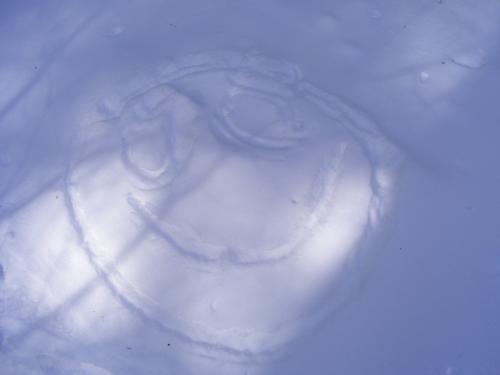
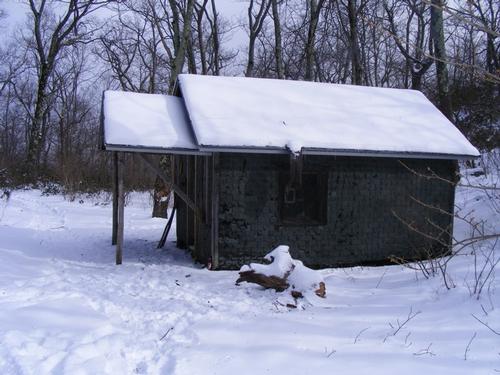
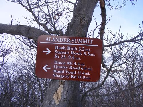
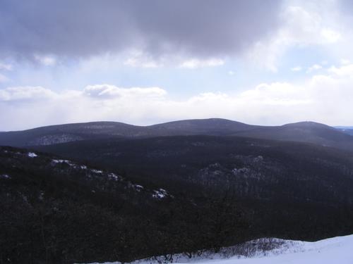
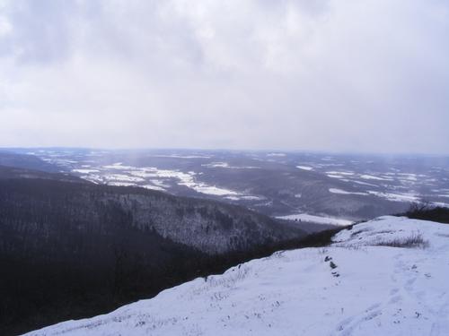
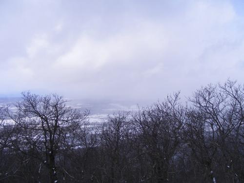
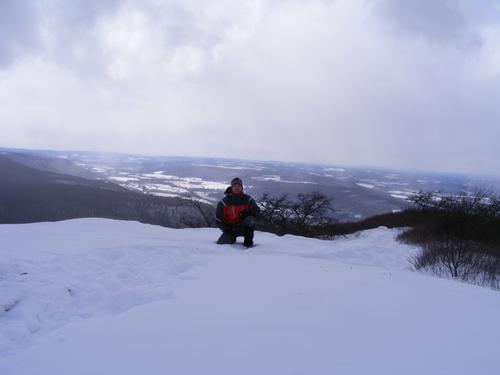
Along the way up someone drew a smiley face - made me smile! As promised, I found “The Cabin” which was occupied by some overnight guests. I did not disturb them and continued on my way. I arrived at the summit of Mt. Alander at approximately 11am. I took a few photos and took in the views. Off in the distance I thought I saw clouds – indeed the views disappeared shortly after arrival as a snow squall came down – quite beautiful – nothing intense. I decided to have an early lunch at the summit and drink my hot apple cider.
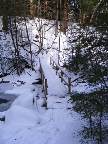
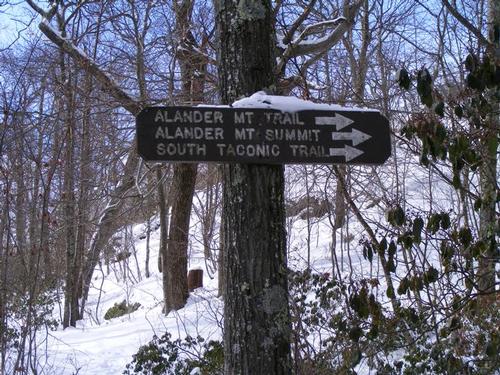
It was still early, I was energized and it was time to turn back. Continuing on the South Taconic Trail was not the plan and that detour seemed longer than I was prepared for. On my way down I decided to cut over on the Campground Trail to Ashley Hill Brook Trail, it gave me an little more trail time – but more importantly – the trail had not been walked so it was mine to make. It was very easy to follow – quite beautiful and serene. Aside from the cabin occupants, I was the only one on the trail.
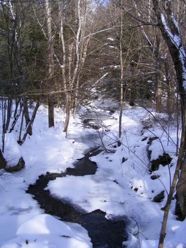
At the junction of Campground & Ashley is a tricky water crossing – the ice formations were quite amazing but because of them, the rocks were well hidden – was it snow, rock, or ice – I didn’t know. I didn’t trust the ice bridges so I cut upstream a short distance and found a nice crossing – better to skip over rocks I think.
My short excursion in Mt. Washington Forest gives me reason to return. There are longer hikes and points of view to visit and experience. I arrived back at the car at 1:30pm after having hiked roughly 5.5 miles. Not the longest of hikes, four hours, but I enjoyed the stroll through the forest and the peace and serenity that comes with it. I passed two couples making their way up as I was exiting. The temperature had fallen to 6 degrees, yeah it was cold but I could have walked on for many more miles.
We work hard during the week – and we all need a break. It is important to escape the daily grind and just let go…. In these moments I feel so very much alive… today was no exception. Until next time…
There are 17 photos in Album (Note: Move mouse pointer over larger pic and click on NEXT for better viewing)

|
|
||

