

HIKES & EVENTS
Cannon & the Kinsmans Loop Hike
Hiking/Walk
DATE: May 05, 2018
END DATE: May 05, 2018
Hike/Event Location: Lincoln NH
Trip Leader(s)
shep5
Jaffrey, NH United States
Meeting Time: 8:30 AM
Max # People: 6
Hike Guiding / Event Fee: No, I will not be asking participants for money
Hike Difficulty Level:
Very Strenuous
(Do you qualify to attend with this hike difficulty rating? Click Here.)
Sign Up To This Trip/Event
You must be a least a guest member to participate. Comments such as "+1" or "bringing a friend" are NOT permitted. All participants must sign-up for the event individually.
Select your mode of transportation, make any comments and then click on button.
You are not logged in.
Please, Log In
Summary
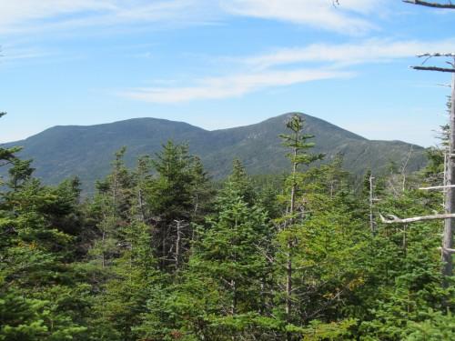
Join me for a loop hike from Franconia Notch encircling over Cannon Mountain (4100'), the Cannon Balls and North and South Kinsman (4293'/4358'). We will utilize the Hi-Cannon Trail from Franconia Notch Campground, where there are ledge views over the notch and Lonesome Lake on the way to the summit of Cannon Mountain. We will continue along the Kinsman Ridge Trail traversing the Cannon Balls over to North and South Kinsmans, with a number of spectacular views. We will return via the Fishin' Jimmy Trail, passing Lonesome Lake and its shoreline AMC hut on the descent.
Total Distance and Elevation Gain: 12.9 miles with approximately 4500 feet in cumulative elevation gain.
Total Time: 9 - 10 hours depending on breaks and group's speed.
Rain or harsh weather may postpone to another date or cancel, as appropriate.
What to Bring: Typical early-spring hiking gear should be appropriate: convertible hiking pants, good sturdy hiking boots with thick socks, a windbreaker/raingear and extra layers (e.g. fleece)...or winter jacket/parka depending on forecasted conditions. You should also carry along microspikes, just in case. Also bring along lunch, snacks and plenty of water (at least 2-L). Optionally, pack sunscreen and anything else that you may require for a day hike.
Carpooling: Contact other participants or the trip leader to arrange for a rideshare to the trailhead.
Afterwards: If there is sufficient interest, we will have drinks and/or dinner in the North Woodstock area.
Directions To Trailhead Parking Lot

From the Lincoln (Exit 32) continue following Route 93 North for another 9.6 miles to Exit 34B. Cross under the highway and reverse direction by taking Route 93 South for 2.1 miles to the Lafayette Place Campground. Immediately take the left into the parking lot...additional parking is just past the ranger cabin. Look for a gray Hyundai Elantra.
For GPS Users: Layfayette Place Campground parking lot (44.142243,-71.683647). To obtain custom directions, copy and paste the GPS coordinates directly into Google Maps.
Trip Leader

 Invite To Be Your Buddy
 Send Email
- Online Status: OFFLINE
- Last Login: 04/04/2020 12:45 PM
- Member Since: 10/30/2001
- Approved By: TrailGuyEric


